Forecast for the Skyline Area Mountains

Craig Gordon
Issued by Craig Gordon for
Saturday, November 17, 2012

Terrain to avoid- steep, rocky, upper elevation terrain where you could trigger an avalanche that breaks to the ground. While isolated and limited to a small portion of the terrain, the consequences could be season ending.

In general you'll find a LOW avalanche danger in a vast majority of the terrain along the Skyline this weekend.

Low
Moderate
Considerable
High
Extreme
Learn how to read the forecast here
Special Announcements

The Manti-Skyline advisory program continues to function because of the very generous contributions you've made at our annual fundraisers along with the support from our non-profit Friends of the Utah Avalanche Center. Thanks to all of you for helping keep this vital resource up and running! We will be updating this weekend advisory by 7:0 AM each Saturday morning.

Welcome to the new look of the avalanche advisory. This past summer we had a series of meetings and negotiated a unified look-and-feel of the avalanche advisories and web pages for other avalanche centers in this region including Jackson, Wyoming, Sun Valley and the Sierra Avalanche Center. Eventually all these sites should look very similar and the plan is for Colorado to join the look next winter. In another week or two we expect to have two viewing choices for the advisory page--this basic view and the "advanced" view most are familiar with from last season with colored danger ratings in the aspect-elevation diagram.

We are still in the process of transferring the pages and content from our old website to the new site, so be patient. We are also tweaking the look and design so you may notice some changes. When everything is finished, it should all be pretty cool.

Weather and Snow

Skies are mostly cloudy, temperatures in the upper 20's and low 30's and winds are blowing west and southwest 10-20 mph along the high ridges. It's really thin out there still and riding and turning will be limited to rock free, low angle, grassy meadows.

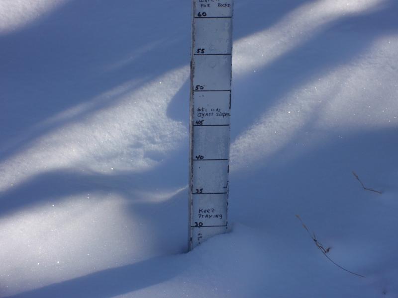
The snowstake at Miller Flats pretty much sums up our current state of affairs... yes we need more snow!

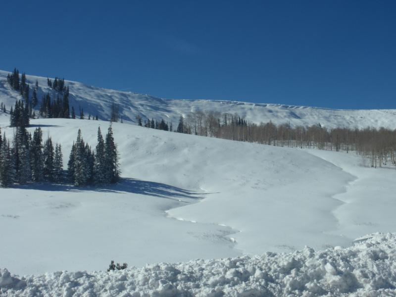
Looking at the Skyline from just below the summit. Coverage is still quite thin.

Recent Avalanches

No avalanche activity to report.

Ad
Avalanche Problem #1
New Snow
Type
Location
Likelihood
Size
Description

The shallow snowpack is growing weak overtime and there's an isolated possibility of triggering a slide that breaks to the ground. While not widespread, if you went hunting for an avalanche I bet you could find one in the steep upper elevation terrain surrounding the Skyline.

Here's a great observation and snowpack tutorial by our ace observers by Darce Trotter and Steve Cote-

http://utahavalanchecenter.org/observations/observation-ge-hill/skyline-summit

Avalanche Problem #2
Persistent Weak Layer
Type
Location
Likelihood
Size
Description

Light snow and strong winds along the ridges will form fresh drifts sensitive to the weight of a rider. Best to avoid any fat, rounded, hollow sounding snow.

Additional Information

A moist southwest flow camps out over the region through the weekend bringing a slight chance of snow through early Monday. High temperatures hover near freezing and southwest winds increase into the 40’s late this afternoon. Partly cloudy skies and mild temperatures move into the area early in the week.

General Announcements

Remember your information can save lives. If you see anything we should know about, please participate in the creation of our own community avalanche advisory by submitting snow and avalanche conditions. You can call me directly at 801-231-2170, email [email protected], or email by clicking HERE

This is a great time of year to schedule a free avalanche awareness presentation for your group or club. You can contact me at 801-231-2170 or email [email protected]

Donate to your favorite non-profit –The Friends of the Utah Avalanche Center. The UAC depends on contributions from users like you to support our work.

The information in this advisory expires 24 hours after the date and time posted, but will be updated by 7:00 AM Saturday November 24th.