Forecast for the Uintas Area Mountains

Nikki Champion
Issued by Nikki Champion for
Monday, April 17, 2023
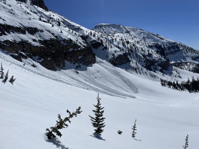
With a solid overnight refreeze, and cool temperatures there is a LOW avalanche danger for wet avalanches on almost all aspects and elevations this morning.
As temperatures rise, avalanches will begin to happen naturally today, and the wet-loose debris can stack up very deep, especially in terrain traps like gullies. It's possible with enough sunshine today; the avalanche danger may rise to MODERATE for wet snow avalanches on slopes facing SW-S-SE

Outside of wet snow, additional hazards include traveling on firm icy slopes and large cornice fall.
Low
Moderate
Considerable
High
Extreme
Learn how to read the forecast here
Weather and Snow
Yesterday, trailhead temperatures in the Western Uintas climbed into the mid-40s and low 50s F by the later afternoon hours. Mountain temperatures climbed into the upper 30s F.
This morning, temperatures are hovering in the mid-20s F under clear skies. Winds are calm at low elevations and gusting below 10 mph from the northeast along the high peaks.
Today will have sunny skies, calm winds, and high temperatures climbing into the upper 30s, mid-40s, and even low 50s at trailheads F.
There have now been multiple days of below-freezing temperatures and clear skies last night which have helped the snowpack get a solid refreeze following three days of hot weather in the middle of last week. With a few more warm days and cold clear nights, the riding conditions may begin to improve on solar aspects.
Recent Avalanches
Yesterday, widespread wet activity was reported on the solar aspects.
The wet activity below rock bands on the steep southwest-facing terrain of Hayden Peak. (C. Brackelsberg)

Reports of a cornice-triggered hard slab off of Hayden Peak from last week also came in, a good reminder to give the cornices a wide berth.
Ad
Avalanche Problem #1
Wet Snow
Type
Location
Likelihood
Size
Description
As the temperatures increase today, wet-loose avalanches will become likely on aspects facing southwest to south to southeast. Yesterday, observers found the solar aspects becoming very wet in the afternoon. Today is a repeat performance with sunny skies and temperatures above freezing. If you see roller balls or notice saturated, slushy snow, it is time to change aspects.
Avalanche Problem #2
Normal Caution
Type
Location
Likelihood
Size
Description
Keep in mind:
  • With the snow surface frozen solid this morning, slide-for-life conditions do exist. Falling on a long sustained steep slope could be very dangerous. An ice axe, crampons, whippet, and the ability to self-arrest - are great tools if traveling on these firm surfaces.
  • As always, stay away from massive cornices. As temperatures continue to increase, we will continue to see more cornices breaking naturally. Give cornices, and the edges of cornices a wide berth as they often break farther back than expected. Limit your exposure to slopes below cornices.
General Announcements
This forecast is from the U.S.D.A. Forest Service, which is solely responsible for its content. This forecast describes general avalanche conditions and local variations always occur.