March Kicks Off Our Spring Campaign- Donate Now to Support Forecasting

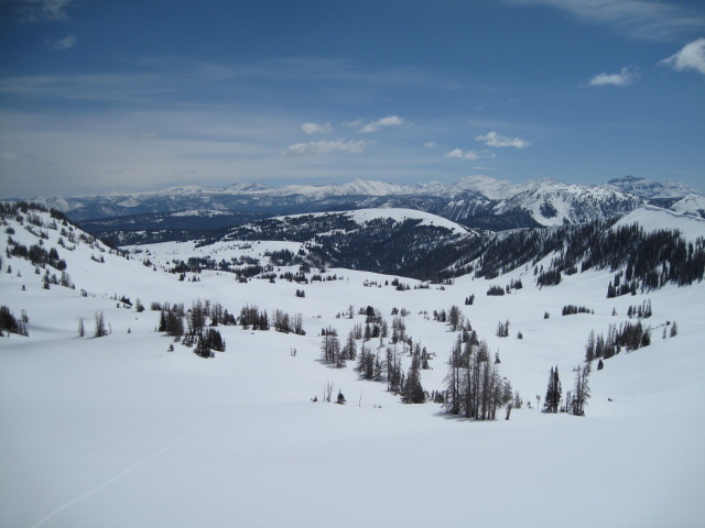
Forecast for the Uintas Area Mountains

Craig Gordon
Issued by Craig Gordon on
Thursday morning, April 16, 2020
Heads up... the avy danger bumped up overnight-
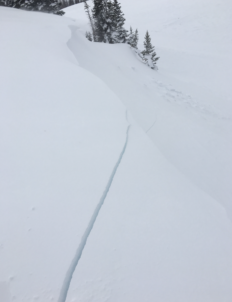
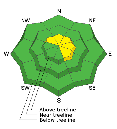
In the wind zone at and above treeline, you'll find MODERATE avalanche danger. Human triggered avalanches are POSSIBLE on steep wind drifted slopes, especially those with an easterly component to its aspect. Any avalanche initiated has the possibility to break deeper and wider than you might expect and once triggered, can easy boss you around.
Lose some elevation, lose the wind, and you also lose much of the avalanche danger. Wind sheltered mid and low elevation terrain offers generally LOW avalanche danger and great riding.... pretty easy choice... right?
Low
Moderate
Considerable
High
Extreme
Learn how to read the forecast here
Special Announcements
From all of us... to all of you... HUGE THANKS!
The Avalanche Research Program at Simon Fraser University is conducting an online survey to examine how people use avalanche safety information. They want to hear from all backcountry users to understand how they process information provided in public avalanche forecasts. Anyone who completes the survey before May 15th will be entered to win cash prizes.

Uncertainty, Risk, & Decision Making: before, during, and after COVID-19 - Read this thought-provoking blog post about how we take risks by guest author Tom Diegel.
Weather and Snow
Currently-
April showers bring... spring powder! Last nights storm quickly blossomed over the Uinta zone, instantly dumping nearly a foot of fresh, medium density snow across the high country. Westerly winds peaked into the 50's right around midnight, but since subsided somewhat and currently blow in the 20's and 30's along the high peaks. Under mostly cloudy skies, snow continues stacking up and current temperatures register in the teens and low 20's. Riding and turning conditions are about as good as they get and you can expect epic, in-yer-face, over-the-hood, April conditions.
For today-
Look for mostly cloudy skies with snow continuing through the morning. We can expect a few more inches before conditions turn showery and snow tapers off. West and northwest winds blow in the 30's along the high peaks. High temperatures don't vary much from where we're at this morning and as skies clear overnight, temperatures dive into the teens and single digits.
Futurecast-
Sunny skies with highs climbing into the 40's on Friday... slightly warmer and dry weather is slated for Saturday.
You came for the views, but...
Ted was in Upper Moffit Basin Tuesday and reports a fat, white snowpack, on a go-anywhere base. More on his travels found here.
Recent Avalanches
No significant avalanche activity to report.
To view additional trip reports and recent avalanche activity, simply click here.
Ad
Avalanche Problem #1
Wind Drifted Snow
Type
Location
Likelihood
Size
Description
Shooting cracks like in the image above, are huge red flags and clues to unstable snow.
Yesterday's westerly winds whipped up a fresh batch of wind slabs along the leeward side of upper elevation ridges and around terrain features like chutes and gullies. Problem is... as winds died down, snow continued stacking up, helping to hide and camouflage recently formed drifts under a fresh coat of white paint. Today's avalanche hazard is easy to detect and easy to avoid. Simply look for and steer clear of fat, rounded slopes, especially if they feel or sound hollow like a drum. In addition, use all the tools available to help you make solid decisions on your terrain choices. Tweak little test slopes and road cuts similar in aspect, elevation, and slope angle to what you wanna ride and see how they're reacting before setting your sights on big terrain.
Additional Information
Sunday April 19th will be the last of the regularly scheduled Uinta forecasts.
Information on outdoor recreation - The State of Utah created this webpage with information about recreating on both state and federal public lands during the current health crisis.

Skiing and riding at closed ski resorts - Some resorts allow access now, and some do not. Please check HERE for the latest info on ski area access.

New to the backcountry (including riding at closed resorts) - Watch the award-winning, 15 minute Know Before You Go video, or take the 5-part, free online-learning series.
General Announcements
The information in this forecast expires in 24 hours, but will be updated by 7:00 AM Friday Apr. 17th.
This forecast is updated daily by 7:00 AM.
In the mean-time, if you see or trigger an avalanche or just wanna let me know what you're seeing you can reach me directly at 801-231-2170
The information in this forecast is from the US Forest Service which is solely responsible for its content.