Forecast for the Uintas Area Mountains

Craig Gordon
Issued by Craig Gordon on
Monday morning, April 14, 2025
Although it was a bit quirky, the winter did finally come around and I wanna say ginormous thanks to all of you for your trust, your support, and for helping us spread the avalanche gospel. 'Cause without you.... there is no us!
Yeah, it's Spring... (the fight between summer and winter :) which generally offers a trifecta of avalanche problems:
1. Wet Snow: Wet loose avalanches, wet slab avalanches, and lastly glide avalanches.
2. New Snow: New storm snow instability as soft, storm slab avalanches and dry, loose avalanches.
3. Wind Drifted Snow: Wind slabs - soft or hard wind drifts.
Low
Moderate
Considerable
High
Extreme
Learn how to read the forecast here
Special Announcements
We've wrapped up avalanche forecasting for the winter, and soon, the only thing separating my skin from warm, blue-ish, Sea of Cortez salt water will be an evenly distributed layer of Hawaiian Tropic Tanning Oil. However, I couldn't leave without thanking a truly awesome cast of characters. First and foremost... huge thanks go out to my partner in crime, though we are not criminals, Andrew Nasetta, for all the hard work, determination, and devotion to the avy forecasting art form. Andy not only made it through his freshman year of forecasting without any speed bumps, he breezed through the winter with a 4.0 GPA. ( By comparison it took me nearly four years to complete my freshman year of High School and I clawed my way through every minute of it :)
In addition, we are super stoked to have Joey Manship contributing avy forecasts, fieldwork, outreach, and avy education to the eastern front. We're looking forward to having him play an important role in the future of the western Uinta program.
And finally, I would be remiss if I didn't include the incredible information we get from Ted Scroggin. He came out of retirement to get on the snow this winter and submit snow and weather observations that help the accuracy of this program. Ted knows the Uinta's like no other and we are grateful to have such a high caliber forecaster on our team.
Thanks men... well played. You truly are the glue that holds this program together and your dedication and commitment ultimately saves lives!
We know partnerships are huge to the western Uinta advisory program and both the Heber-Kamas and Evanston Ranger Districts are instrumental in supplying field partners and in-kind support.
In addition, many thanks to the Park City Powder Cats (PCPC), not only for all the snow and avalanche information and for the great professional dialog during times of heightened avalanche danger (much respect to Dave, Bo, Andy... wearing his other beenie, Trevor, and Jason), but also for your very generous contirbutions to the UAC. The Powdercats donated one day of cat skiing with proceeds going to the avalanche center. Wow... a rockin' PCPC crew and a first class operation for sure!
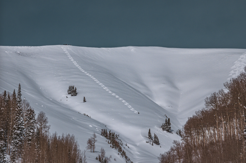
Regular Uinta avalanche forecasts have ended. But don't let your heart be troubled, we will continue posting observations and avalanches, so please keep those letters and cards coming, and please submit your observations as you get out and about in the mountains.
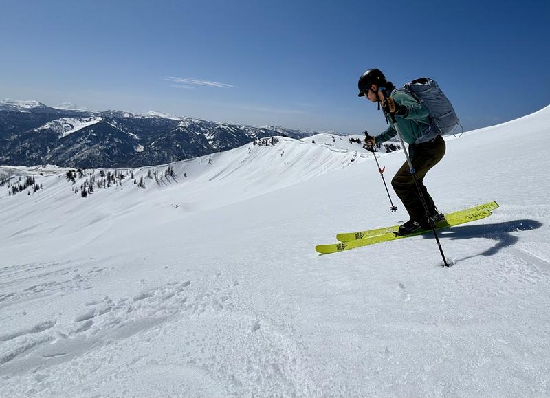
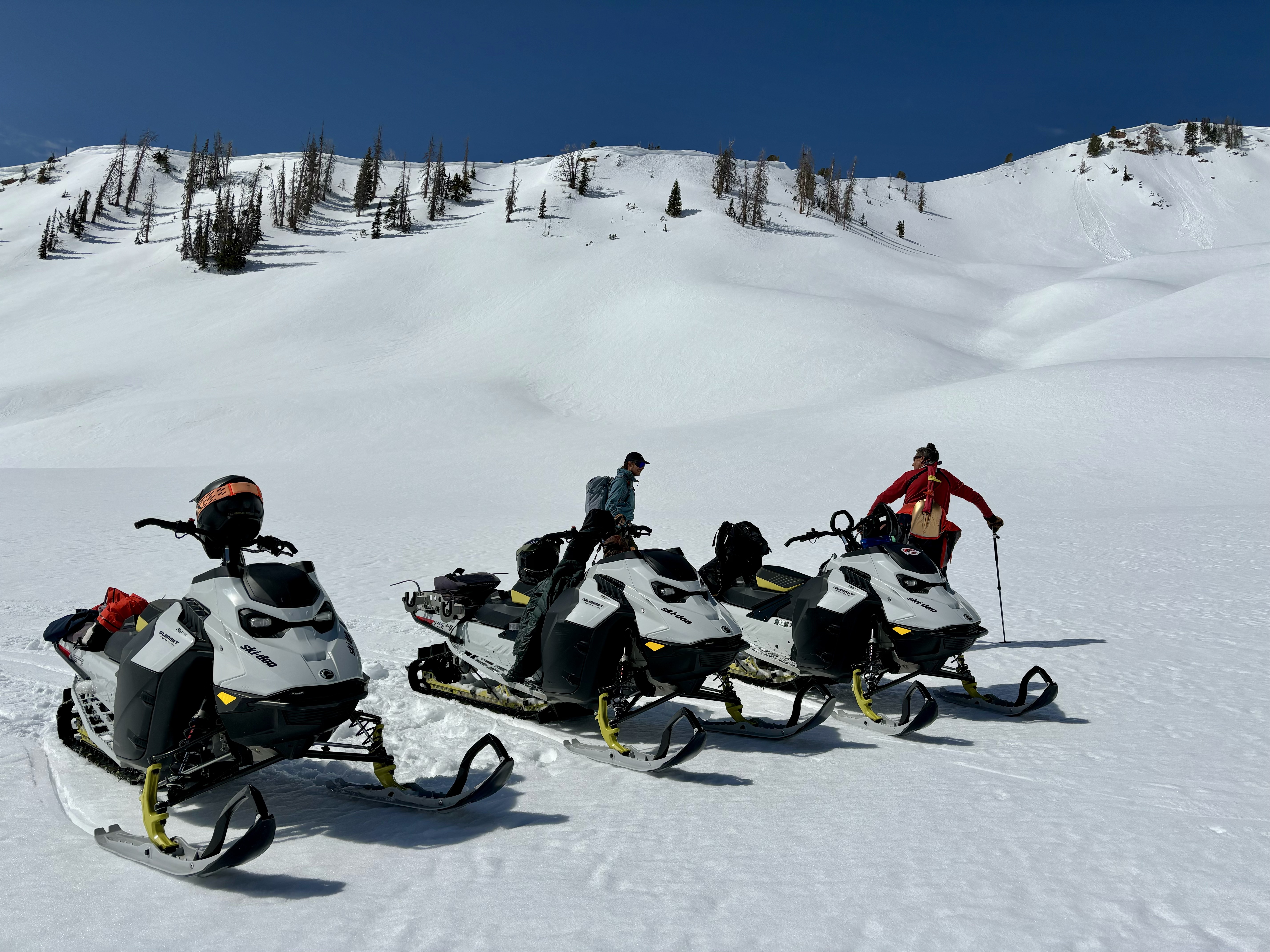
Top to bottom product testing, the next generation of avy forecasters Andy Nassetta and Joey Manship are truly first rate snow craftsman! I'm grateful for their conversations and deep dives, which make me a better forecaster, helping me understand the art of snow and this amazing white paint world we work in.
Weather and Snow
Salt Lake's National Weather Service is a great source for weather updates.
Uinta weather station network info is found HERE. Simply click on "western Uinta" tab and then "weather stations" tab.
Recent Avalanches
Check out all travel obs, avalanches, and more from the eastern front and across the state, HERE!
Ad
Avalanche Problem #1
Normal Caution
Type
Location
Likelihood
Size
Description
In general you can count on several types of avalanche conditions in the spring-
Whenever we get a storm the avalanche danger will rise, as the new snow might not bond well to the existing hard, slick crust it falls on. As always, recent avalanche activity as well as cracking and collapsing of the snowpack are dead giveaways the snow is unstable. Even if these clues don’t present themselves, be sure to do some tests on smaller slopes that are similar in aspect, elevation and slope angle to what you want to ride on. Choose test slopes that have minimal consequences, especially after a significant snowfall. If there's wind associated with the storm or if there's snow available to blow round before it gets cooked into place, expect to find wind drifts, reactive to our additional weight, on leeward slopes.
Wet slides and sluffs are pretty easy to manage. As the day wares on and the snow heats up, like clockwork, wet avalanches become more widespread on steep, sunny slopes. If you're feeling like an ant under a magnifying glass... so is the snow. During the heat of the day, simply get off of and out from under steep, sun-baked slopes and steer clear of terrain traps like gullies and road cuts, where even a small slide can pile up cement-like debris very deeply.
Here's some considerations-
  • Wet snow avalanches can get out of hand quickly -- Even small avalanches in consequential terrain can be fatal, and typically involve lots of trauma. Think about what you're riding on, and what's below you if you get swept off your skis, board or sled, or even have a simple slip and fall... or what we call a slide for life!
  • Large cornices can trigger large avalanches -- At the peak of the days heat, watch for cornices falling and avoid being underneath, as they could trigger a larger chunk of snow crashing onto the slope below.
  • Chose the right partners and bring the right tools for the job -- From what's in your pack to your objectives and mindset, don't forget it's a team sport out there.
    • Practice good travel protocol and techniques -- It's an easy way to increase your margins for error, especially in the spring. Start early and end early, space out, ride one at a time, regroup in areas of reduced exposure, and communicate everything throughout your day!
A school bus sized cornice that failed and created a large void and huge divot between the ridge and the slope below. Look for more cornice failure as we get deep into spring and give these boxcar mammoths plenty of room and respect.
Additional Information
Under the rock solid direction and guidance of Paige Pagnucco and Caroline Miller, whilst surrounded by an amazing cast of characters, I'm truly blessed to work with such an amazing team!
A huge shout out to Ski-Doo for getting us out into the hills to help us complete our work, and do a little product testing on the way! The Uinta's are a remote range, and snow machine is nearly the only way to get around. We could not do it without their support, machines, and stoke in our work and mission at the UAC -- You rock, Ski-Doo!
General Announcements
We are always looking for snow and avalanche observations or just general riding conditions. In the meantime reach out to us with questions, concerns, or if you see anything in your travels! Contact us directly through the info below:
This forecast is from the U.S.D.A. Forest Service, which is solely responsible for its content. This forecast describes general avalanche conditions and local variations always occur. Issued on Monday, April 14th this forecast will be updated when the snow begins flying again!