March Kicks Off Our Spring Campaign- Donate Now to Support Forecasting

Forecast for the Uintas Area Mountains

Craig Gordon
Issued by Craig Gordon on
Sunday morning, April 12, 2020
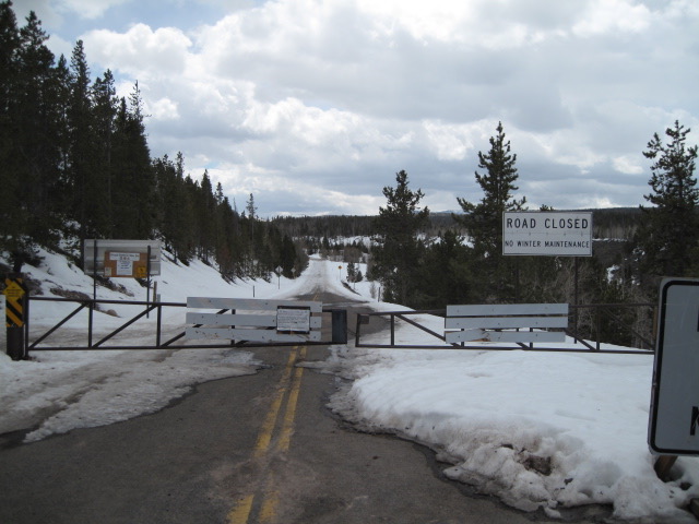
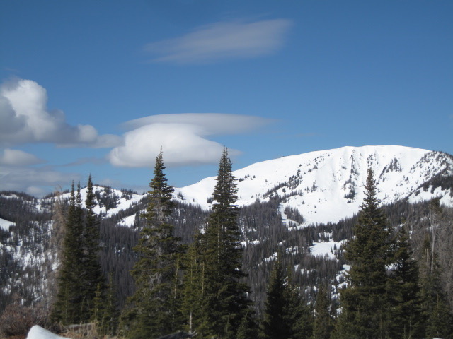
In the wind zone, at and above treeline, you'll find MODERATE avalanche danger. Human triggered avalanches are POSSIBLE, especially in steep, wind drifted terrain at and above treeline in the wind zone. And heads up... strong winds formed fresh drifts around terrain features like chutes and gullies and lower downslope than we usually expect. In addition, here's something to consider... if you're getting into steep, technical terrain, even a small slide can knock you off your ride, slam you into a tree, and throw a curve ball at your day.
Lose some elevation, get out of the wind, and seek out mid and low elevation, wind sheltered terrain, where the avalanche danger is generally LOW.
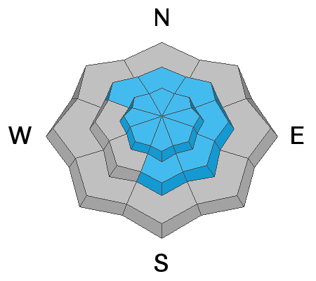
Low
Moderate
Considerable
High
Extreme
Learn how to read the forecast here
Special Announcements
The Avalanche Research Program at Simon Fraser University is conducting an online survey to examine how people use avalanche safety information. They want to hear from all backcountry users to understand how they process information provided in public avalanche forecasts. Anyone who completes the survey before May 15th will be entered to win cash prizes.
Uncertainty, Risk, & Decision Making: before, during, and after COVID-19 - Read this thought-provoking blog post about how we take risks by guest author Tom Diegel.
Weather and Snow
Currently-
And just like that, winter comes out of hiatus, delivers 3" of light density snow, and temperatures crater into the teens in just a matter of hours. Along the high peaks, west-northwest winds ramped up late Saturday, and this morning... they blowin' like a hurricane with hourly averages in the 50's and gusts in the 70's and 80's. It's gonna be a bit rugged out there this morning and if you're looking for soft snow, mid elevation, wind sheltered terrain is your ticket.
Uinta weather network info is found here. Simply click on the Western Uinta tab.
For today-
Look for partly cloudy skies with high temperatures barely cracking out of the upper 20's. Northwest winds are gonna be an issue early this morning, but should diminish as the day progresses.
Futurecast-
A cool northwest flow persists over the region for the early portion of the week. Expect partly cloudy skies and continued cool temperatures. A passing snow shower or two isn't out of the question until midweek when we begin to dry out and warm up.
Don't let a little trailhead asphalt discourage your riding objectives...
Gain a little elevation and you're rewarded with a fat, white snowpack and plenty of riding options.
Recent Avalanches
No significant avalanche activity to report.
To view additional trip reports and recent avalanche activity, simply click here.
Ad
Avalanche Problem #1
Wind Drifted Snow
Type
Location
Likelihood
Size
Description
It's remarkable how a few inches of snow and nuking winds can change the landscape and bump up the avy hazard overnight. No... it's not a big storm and today's avalanche problem is pretty straight-forward and isolated to steep, leeward terrain in the wind zone. And here's the good news... today's avalanche dragon is easy to identify and easy to avoid. Simply look for and steer clear of any fat, rounded piece of snow, especially if it sounds hollow like a drum. In addition, look for clues to unstable snow like shooting cracks or recent avalanches on the same type of slopes you wanna ride. And remember... if you're tagging steep, technical terrain, be aware that even a small slide could knock you off your feet and boss you around.
Additional Information
Information on outdoor recreation - The State of Utah created this webpage with information about recreating on both state and federal public lands during the current health crisis.

Skiing and riding at closed ski resorts - Some resorts allow access now, and some do not. Please check HERE for the latest info on ski area access.

New to the backcountry (including riding at closed resorts) - Watch the award-winning, 15 minute Know Before You Go video, or take the 5-part, free online-learning series.
General Announcements
The information in this forecast expires in 24 hours, but will be updated by 7:00 AM Monday Apr. 13th.
This forecast is updated daily by 7:00 AM.
In the mean-time, if you see or trigger an avalanche or just wanna let me know what you're seeing you can reach me directly at 801-231-2170
The information in this forecast is from the US Forest Service which is solely responsible for its content.