March Kicks Off Our Spring Campaign- Donate Now to Support Forecasting

Forecast for the Uintas Area Mountains

Craig Gordon
Issued by Craig Gordon on
Saturday morning, March 7, 2020
Today's avalanche hazard is pretty straightforward and easily managed with terrain choices, including aspect and elevation-
While the avalanche danger is generally LOW across the range, there are isolated places where you could trigger an old wind drift, especially in steep, rocky terrain above treeline in the wind zone. And here's something to consider... if you're getting into steep, technical terrain, even a small slide can knock you off your ride, slam you into a tree, and throw a curve ball at your day.
In addition, should the sun poke out for any length of time, low elevation sunny slopes may take on some heat today and become damp. So you'll want to get off steep sun-baked snow as the day heats up.
Low
Moderate
Considerable
High
Extreme
Learn how to read the forecast here
Special Announcements
The UAC's Avy Awareness Auction is currently underway with tons of great gear, jewelry, artwork and experiences available. Visit the auction page here to help support the UAC's spring avalanche awareness and outreach efforts.
Click here for more details.
And... a new version of the UAC IOS application is now available on the Apple App Store. This version fixes many of the issues that occur when running IOS 13.
Click here for more details.
Weather and Snow
Currently-
A few high clouds drifting into the area along with a strengthening southerly flow, helped keep overnight temperatures rather balmy. Currently it's in the mid to upper 20's, with a few lower elevation remote weather sites registering near freezing. Meanwhile, back along the high peaks, southerly winds blow 30-50 mph. Riding and turning conditions are a bit hit or miss and there's no lack of hard old tracks, slick crusts, and scratchy snow. But wait... there's more! If cool, shallow snow is your thang... you'll find it on wind sheltered, upper elevation, northerly facing slopes.
More Uinta weather network info is found here. Simply click on the Western Uinta tab.
For today-
A mild southerly flow strengthens today, clouds thicken, temperatures climb into the mid 40's, and southerly winds crank into the 50's as the day progresses. A rather weak storm system crosses the region tonight through Sunday, delivering a few inches of high density snow.
Futurecast-
Snow showers linger into Sunday with a break slated for early Monday. Looks like the next storm on tap for midweek dives to the south and it's a roll of the dice for us if we see any significant storminess. Clearing weather rounds out the work week. However, a glimmer of hope for snow appears in the long range, perhaps beginning mid month.
Recent Avalanches
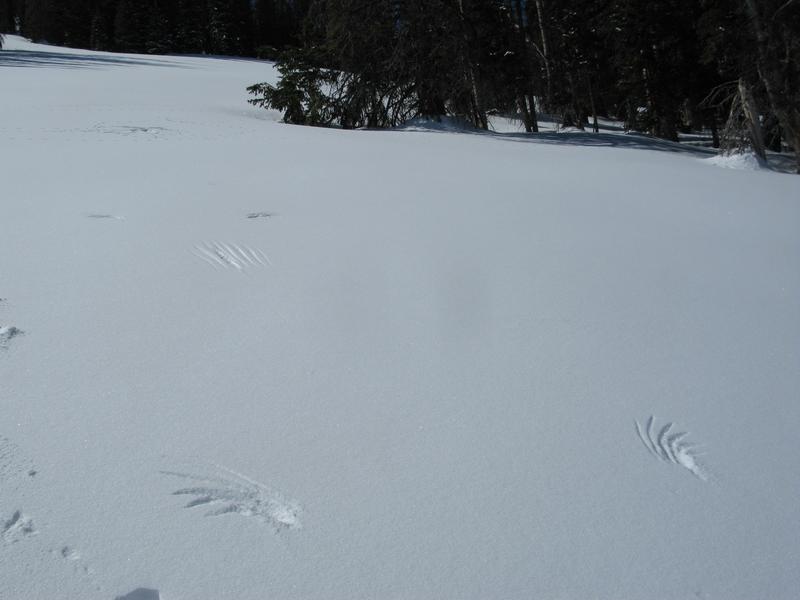
Whilst traveling in Upper Chalk Creek midweek, I spotted a few shallow sluffs on very steep slopes facing the north half of the compass. Otherwise no earth-shattering avalanche activity to report.
Ted was in Whitney Basin Thursday and noted... "No red flags where I traveled, but I would imagine with the warm weather, some lower elevation sunny slopes are getting soft and unsupportable".
To view additional trip reports and recent avalanche activity, simply click here.
Ad
Avalanche Problem #1
Normal Caution
Type
Location
Likelihood
Size
Description
Here are a few considerations...
Dry snow-
Isolated to steep, leeward terrain in the wind zone, there might be a lingering wind drift or two, or shallow loose snow sluff that'll react to your additional weight. Not particularly widespread, but remember... if you're tagging steep, technical terrain, be aware that even a small slide could surprise you and possibly knock you off your feet and boss you around. So, the ticket to riding safely today is simply look for and avoid any fat, rounded piece of snow, especially if it sounds hollow like a drum.
Damp snow-
If the snow you're riding on becomes damp, manky, and unsupportable, simply change aspect and elevation and set your sights on terrain facing the north half of the compass.
Additional Information
Sometimes you're the windshield.... sometimes you're the bug. Stumbled onto this remarkable display of a Golden Eagles hunting skills. Looks like a subtle touchdown, tail drag, and not so pleasant outcome for whatever was on the menu.
General Announcements
The information in this forecast expires in 24 hours, but will be updated by 7:00 AM Sunday Mar. 8th.
This forecast is updated daily by 7:00 AM.
In the mean-time, if you see or trigger an avalanche or just wanna let me know what you're seeing you can reach me directly at 801-231-2170
This is a great time of year to schedule one of our free avy awareness presentations.
You can email me directly [email protected]
The information in this forecast is from the US Forest Service which is solely responsible for its content.