March Kicks Off Our Spring Campaign- Donate Now to Support Forecasting

Forecast for the Uintas Area Mountains

Craig Gordon
Issued by Craig Gordon on
Saturday morning, March 28, 2020
In the wind zone, at and above treeline, pockets of MODERATE avalanche danger exist in wind drifted terrain facing the north half of the compass. Human triggered avalanches are POSSIBLE, especially on steep leeward slopes, particularly those with an easterly component to its aspect. And remember.... any slide triggered may break deeper and wider than you might expect.
Lose some elevation, you lose the problem, have a great day of riding, and high fives await when you roll home safely to your family. Wind sheltered mid and low elevation terrain offers generally LOW avalanche danger.
Low
Moderate
Considerable
High
Extreme
Learn how to read the forecast here
Special Announcements
If you rely on the UAC forecasts each day you get out, consider making a donation during our Spring Awareness Campaign to help us continue providing the avalanche forecasts and education you rely on.
The UAC encourages everyone to follow direction from federal, state, city and county officicals. The following is from Joe Dougherty, spokesman for the Utah Division of Emergency Management:
Though outdoor recreation is still permitted under the governor’s Stay Safe/Stay Home directive, we recommend that people maintain a distance of at least 6 feet.
Be extra cautious to avoid injuries outdoors. We are working with our hospital systems to conserve as much personal protective equipment as possible in case of hospitalizations.
Most outdoor injuries can be prevented. Know the conditions and know your limits so you don’t end up in a hospital.
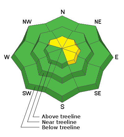
Weather and Snow
Currently-
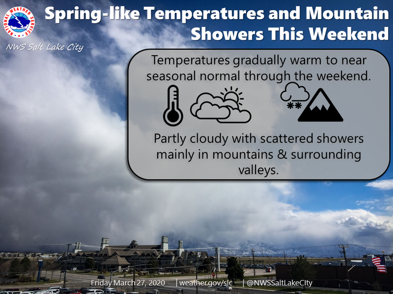
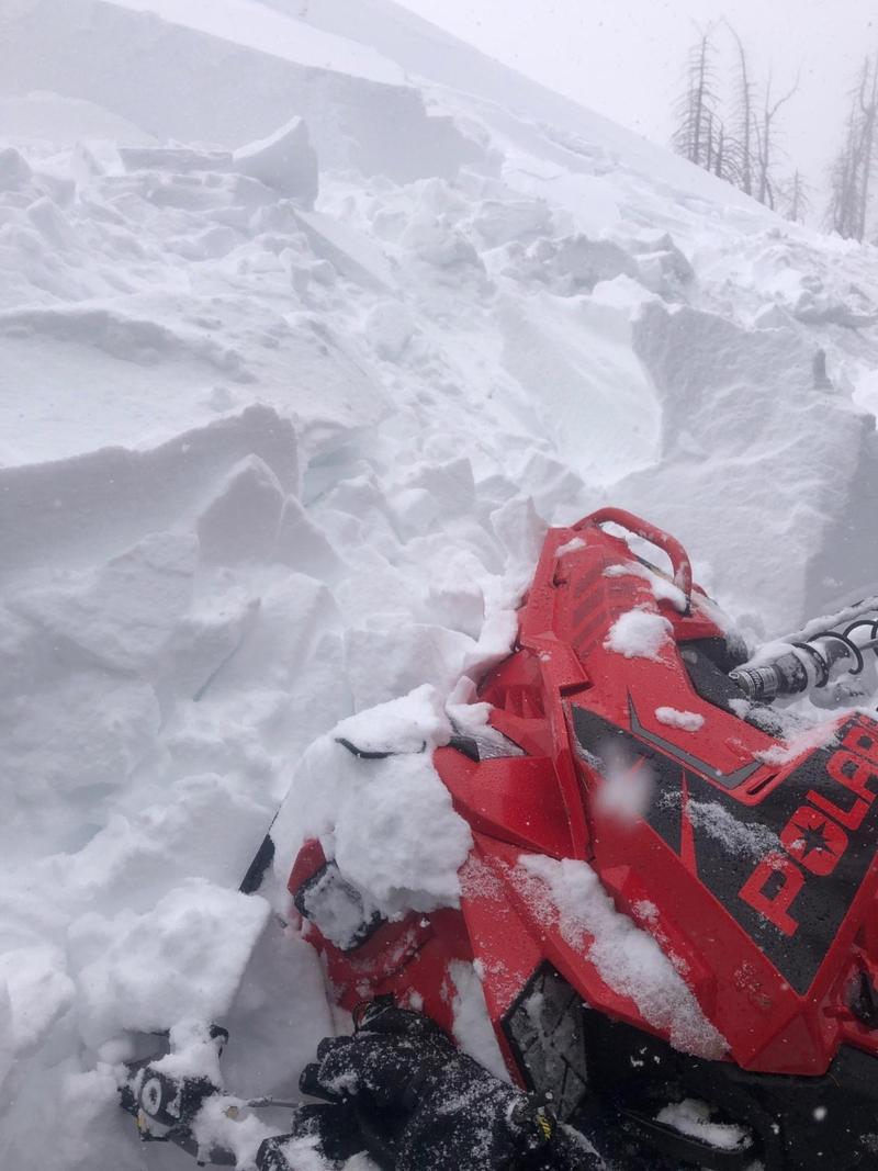
A weak storm slides through the region early this morning and light snow falls under mostly cloudy skies. Winter-like temperatures abound, currently registering in the single digits and low teens. After a rather tranquil night, west and northwest winds bumped in the 20's and 30's along the high peaks right around midnight. This weeks series of storms was good to the eastern front, stacking up nearly two feet of snow. Late March riding and turning conditions are about as good as they get, especially on mid elevation, wind sheltered slopes.
More Uinta weather network info is found here. Simply click on the Western Uinta tab.
For today-
Expect partly cloudy skies with high temperatures climbing into the 20's and low 30's. Northwesterly winds blowing in the 30's along the high ridges, peak this morning, but should diminish as the day wares on. With afternoon heating, clouds drift through the region and a snow shower or two slides by.
Futurecast-
Another weak wave moves overhead for Sunday, delivering scattered snow showers with highs climbing into the mid 30's.
Recent Avalanches
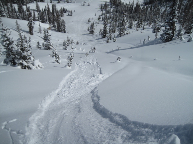
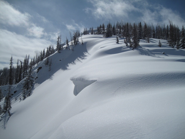
Ted stomped around Moffit Basin yesterday and found a well-behaved snowpack with the only avalanche issue involving long running new snow sluffs. More on Ted's travels and insight found here.
To view additional trip reports and recent avalanche activity, simply click here.
Ad
Avalanche Problem #1
Wind Drifted Snow
Type
Location
Likelihood
Size
Description
Triggered Thursday in the wind zone, on a steep slope near the ridgeline just south of Tower Mountain, the slide above broke a bit deeper and wider than expected. This image illustrates the kind of terrain and of course, avalanche dragon we'll want to continue avoiding again today.
It's amazing how rapidly snow changes with a kiss of strong springtime sun and just a bit of heating. As a matter of fact, most of our midweek storm snow instabilities have settled, are happy in their own skin, and you can get on plenty of steep slopes without incident. It doesn't take long to realize, the range is about as white and fat as it gets and we've got a supportable, go-anywhere kinda base. Now, here's the good news.... most of our terrain offers "green-light" avy danger. Now the heads up... if you're getting into steep, technical terrain today, don't let your guard down because there are isolated areas where recent wind drifts are camouflaged under light, fluffy snow, making them hard to detect. Once triggered, they'll have no problem bossing you around and will easily throw a curve ball at you, potentially ruining a great day of riding.
The key to riding safely today is... look for and avoid fat, rounded slopes like in the image above, especially if they feel or sound hollow like a drum. In addition, be flexible with your travels plans and adjust objectives if you're starting to see or feel obvious clues to unstable snow like shooting cracks, sudden collapses, or the biggest clue to avalanches and of course, that's avalanches!
Additional Information
Excellent riding conditions begin right out of the gates... but the deep, cold goods are found with a little elevation gain.
Skiing and riding at closed ski resorts - Some resorts allow access now, and some do not. Please check HERE for the latest info on ski area access.

New to the backcountry (including riding at closed resorts) - Watch the award-winning, 15 minute Know Before You Go video, or take the 5-part, free online-learning series.
General Announcements
The information in this forecast expires in 24 hours, but will be updated by 7:00 AM Sunday Mar. 29th.
This forecast is updated daily by 7:00 AM.
In the mean-time, if you see or trigger an avalanche or just wanna let me know what you're seeing you can reach me directly at 801-231-2170
The information in this forecast is from the US Forest Service which is solely responsible for its content.