

Forecast for the Uintas Area Mountains

Wednesday morning, March 14, 2018
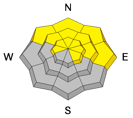
On steep slopes facing northwest through southeast, particularly at mid and upper elevations, the avalanche danger is MODERATE and human triggered, dry snow avalanches are POSSIBLE. Any avalanche breaking into weak layers of snow, now buried deeper in our snowpack will quickly ruin your day.
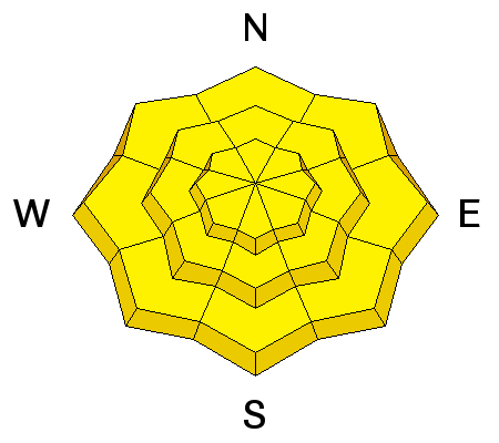
The danger for wet avalanches is MODERATE and human triggered damp slides and sluffs are possible on all steep slopes, especially if the sun comes out for longer than expected .
 Weather and Snow
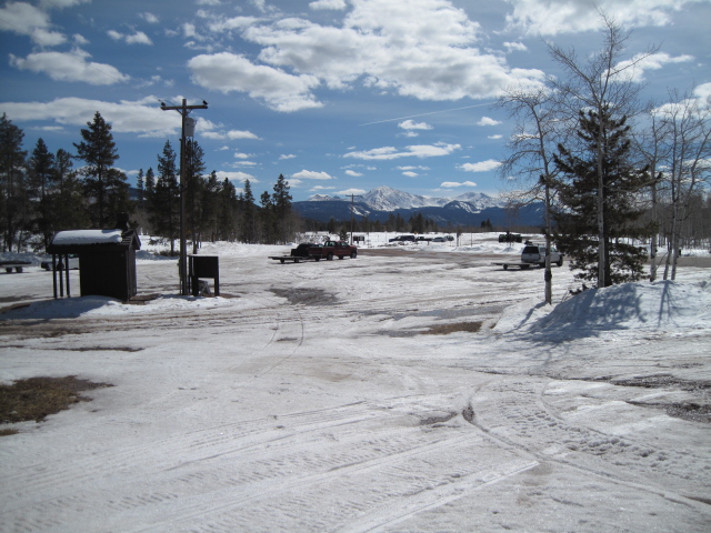
Clouds streamed into the region overnight keeping low temperatures hovering right around freezing. Southerly winds crank into the 30's along the high ridges, ahead of a large low pressure system slated to pump moisture into the region through the weekend. Riding and turning conditions are a bit underwhelming. Sunny slopes are crusted and old tracks feel like curb and gutter. While on the other side of the compass, soft settled snow is a dwindling commodity, but still found on wind sheltered, shady slopes.
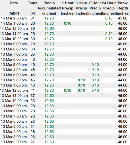
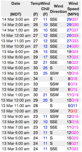
Above are 24 hour temperatures and snow depth near Trial Lake along with winds and temperatures from Windy Peak. More remote Uinta weather stations are found here
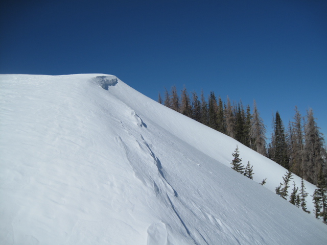
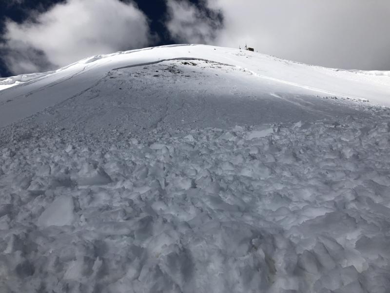
It might be a chore getting there, but upper elevation terrain still harbors soft snow. (Scroggin images)
Ted was in Whitnety Basin yesterday and found a mixed bag of riding condtions and mostly stable snow.
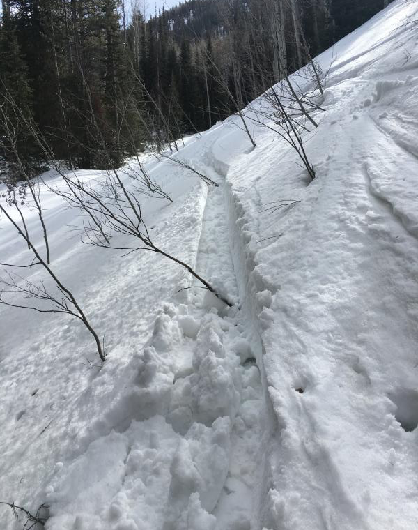
Weston D was in Weber Canyon and found damp, manky snow on all but the highest north facing terrain. (Deutschlander image)
More on their travels along with a great body of recent trip reports, observations, and snow data here.
 Recent Avalanches
Heads up.... until the snowpack cools off, this is the type of avalanche we're dealing with today.
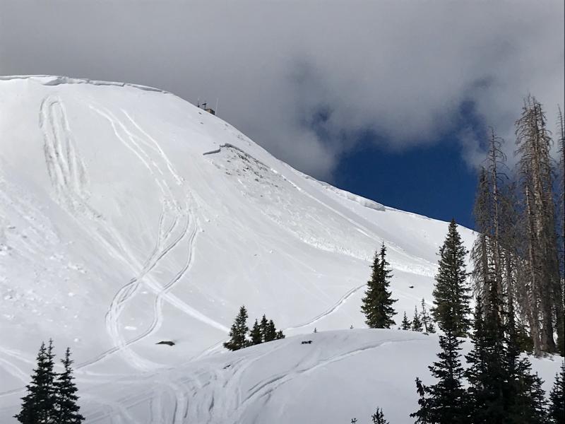
Two recent sled triggered avalanches on the south half of the range. Upper image is a northeast facing slope at about 8,200' near the Mill Hollow Trailhead. Bottom Image is a southeast facing slope near Currant Creek Peak at 10,400' in elevation. Common theme is both slides were a couple feet deep and broke close to the ground on weak, faceted snow.
A list of recent avalanches is found here.

Persistent Weak Layer
Description
Our recent string of warm weather is about to end, but until the snowpack locks up, the dormant weak layers of snow buried near the ground may still be a bit touchy. Making the pattern more complicated and giving us a false sense of stable snow is... not every slope is gonna be reactive to our additional weight. However, those that are, have the possibility to break deeper and wider than you might expect. So, just when you're feeling good about stability... bam, you collapse the slope and now you're staring down the barrel of a scary slide. These are the classic characteristics of an unpredictable, presistent slab. And the way we manage unpredictable avalanche dragons in the mountains is to simply avoid where they live. If you're looking for soft snow and safe riding, simply tone down your slope angles and avoid terrian with steep slopes hanging above you.
Wet Snow
Description
Until the snowpack cools off the possibilty of wet activity still prevails, especially if the sun peeks out for any length of time. If the snow you're traveling on is punchy, damp and manky you'll want to get off of and out from under steep sun-exposed slopes. Starting out as just a point release, an avalanche can easily gouge into weaker layers of snow as it crashes down onto the slope below, stacking up deep piles of bone twisting debris.
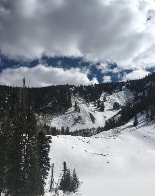
Weston D caught this image of a wet avalanche fanning out on a steep slope in Weber Canyon yesterday.
Additional Information
Warm and windy with snow showers developing later today. Highs climb into the 40's and southerly winds blow into 40's and 50's along the high ridges. Snow continues on Thursday with a couple inches stacking up and cooler temperatures expected. A slight break for Friday and then a better shot of snow slated for the weekend.
General Announcements
The information in this advisory expires 24 hours after the date and time posted, but will be updated by 7:00 AM Thursday March 15th, 2018.
If you're getting out and about, please let me know what you're seeing especially if you see or trigger and avalanche. I can be reached at [email protected] or 801-231-2170
It's also a good time to set up one of our very popular avalanche awareness classes. Reach out to me and I'll make it happen.
This information does not apply to developed ski areas or highways where avalanche control is normally done. This advisory is from the U.S.D.A. Forest Service, which is solely responsible for its content. This advisory describes general avalanche conditions and local variations always occur.