Forecast for the Uintas Area Mountains

Andrew Nassetta
Issued by Andrew Nassetta on
Monday morning, February 17, 2025
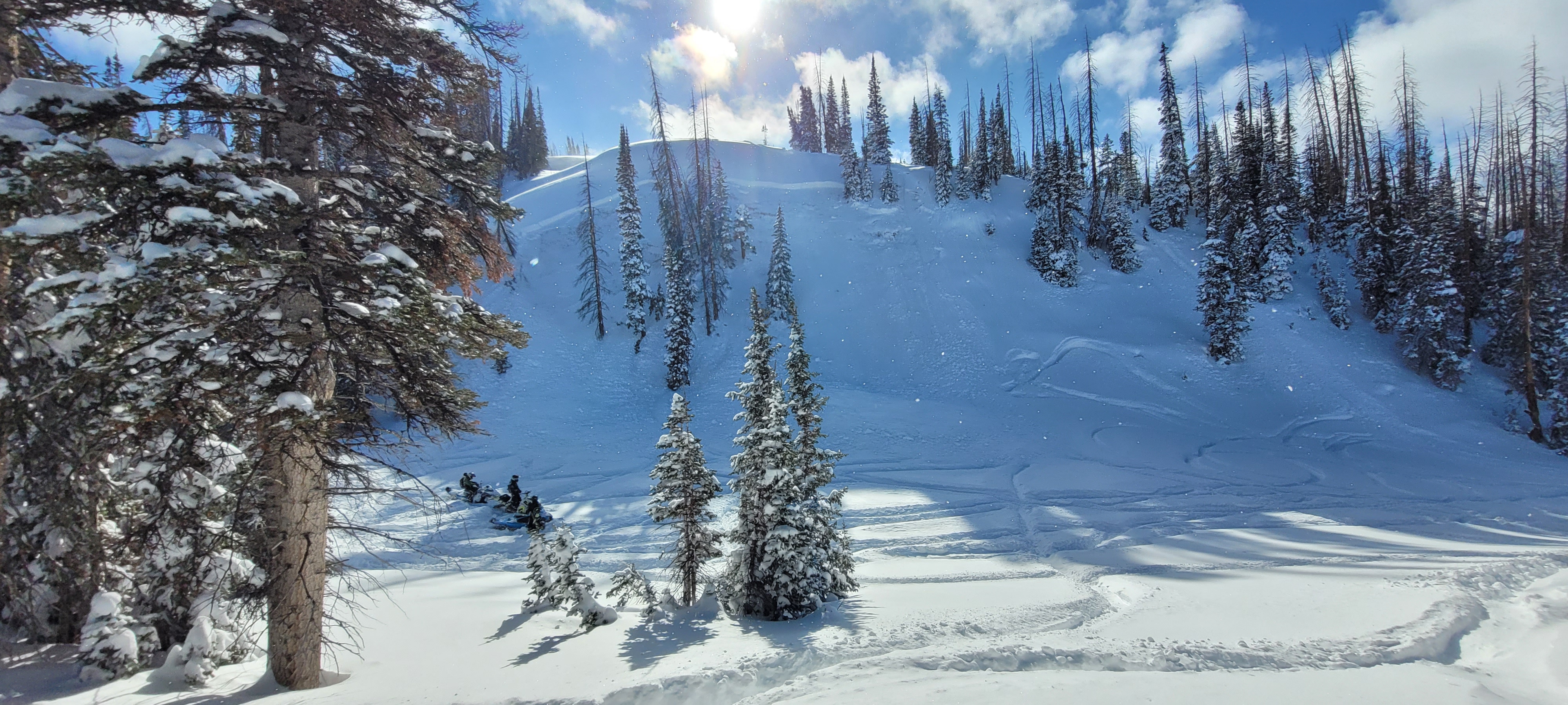
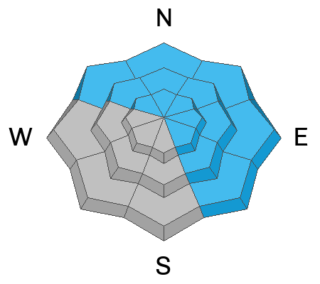
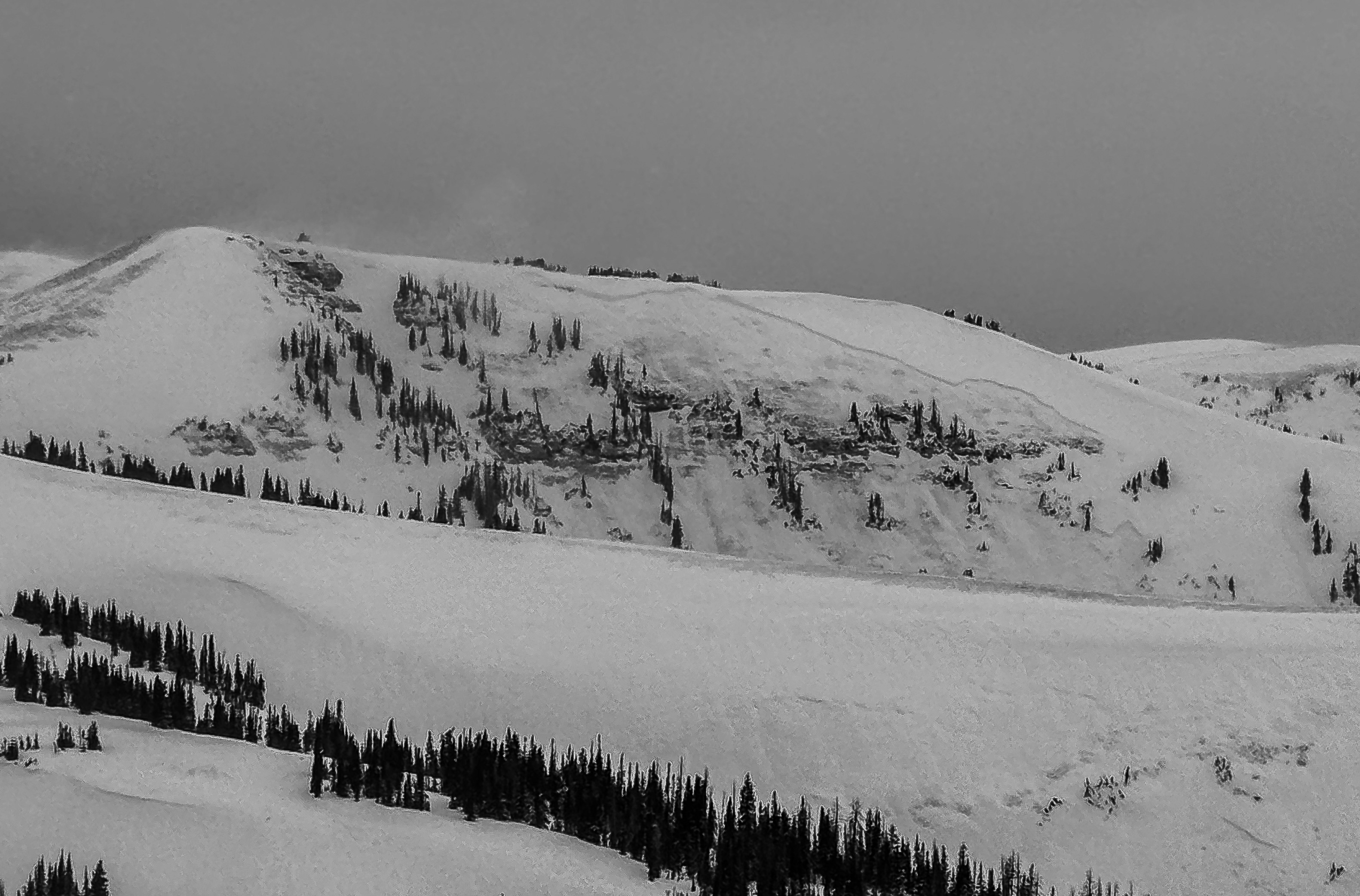
At upper-elevations on aspects facing northwest through north through east the avalanche danger is HIGH and it is VERY LIKELY that we can trigger avalanches remotely failing 2-6' deep and breaking hundreds of feet wide. With heightened avalanche danger, remember to pay attention leaving the trailhead to smaller steep slopes that we like to ride like road cuts, creek beds, and gully walls. This weekends storm snow stacked up dangerously, and even a small slide could catch us off guard burying us deeply in a nasty terrain trap.
It is tricky and straight-up dangerous out there right now. I'm meadow skipping, wiggling mellow south facing slopes and avoiding avalanche terrain to keep my risk to avalanches down and the stoke high.
Low
Moderate
Considerable
High
Extreme
Learn how to read the forecast here
Weather and Snow
Nowcast
We received 1-3" of medium density snow throughout the day yesterday topping off an already impressive weekend storm that stacked up 36” of snow and added nearly 3" of water to the pack -- Huge totals for the eastern front! As of 0500 AM, light snowfall is accompanied by temperatures in the teens at 9,000' and moderate winds from the WSW, between 15-25 MPH gusting into the 30's.
Forecast
Snowfall continues throughout the day with periods of higher accumulation this morning and later this afternoon. Expect to pick up anywhere between 2-4" depending on where you are in the hills. Winds stay tempered around 20 MPH from the west while temperatures climb to the 20's.
Futurecast
Things continue to look promising, and the pattern stays active through the week with some high pressure developing later next weekend.
Recent Avalanches
Below, a crew was in the process of building a jump near currant creek peak and triggered their LZ from the bottom. Not a huge slope, but a stellar example of terrain that could sneak up on us and get out of hand quick -- Thanks for the photo, Gents! Don't forget to get up to speed by checking out obs, avalanches and trip reports from across the range and beyond, here!
A northeast slope at 9,800' near Currant Creek where the crew intended on having their landing zone.
Ad
Avalanche Problem #1
Persistent Weak Layer
Type
Location
Likelihood
Size
Description
Since Thursday, 3' of snow with nearly 3" of water has piled on our complex and fragile snowpack reactivating layers buried in the upper portion, the mid-pack and near the ground. Recently, on slopes facing north through east at upper-elevations riders remotely triggered slides low on the slope and from a distance. Failing 2-6' deep and breaking wide, these are unsurvivable avalanches and the conditions are ripe for triggering one of these monsters.
There is no threading the needle. Persistent slab avalanches are not manageable no matter who you are, and the only trick to the trade is avoidance.
A large destructive avalanche at 10,400' on a northeast slope that occurred naturally, and gouged to the ground near Chalk Creek.
Avalanche Problem #2
Wind Drifted Snow
Type
Location
Likelihood
Size
Description
Over the past few days, steady west and southwest winds blowing 20-30 mph have created sensitive drifts at mid and upper elevations. With an ample amount of snow available for transport keep your eyes peeled for fat rounded pillows, cornices, and places where the snow looks affected and textured. Today's drifts will break 2-4' deep and could pack a bigger punch than you might expect.
Remember, any avalanche triggered today could step-down or fail into weak, faceted snow buried deeper in the pack.
Above, shows a wind run from Windy Peak near the north slope, where 20-30 MPH winds accompanied by 40-50 MPH gusts aided in the formation of todays wind slabs.
General Announcements
We are always looking for snow and avalanche observations or just general riding conditions. In the meantime reach out to us with questions, concerns, or if you see anything in your travels! Contact us directly through the info below:
This forecast is from the U.S.D.A. Forest Service, which is solely responsible for its content. This forecast describes general avalanche conditions and local variations always occur. This forecast was issued on Monday, February 17th at 05:00 AM and expires 24 hours after it was issued.