Forecast for the Uintas Area Mountains

Issued by Craig Gordon on
Monday morning, February 17, 2020
Monday morning, February 17, 2020
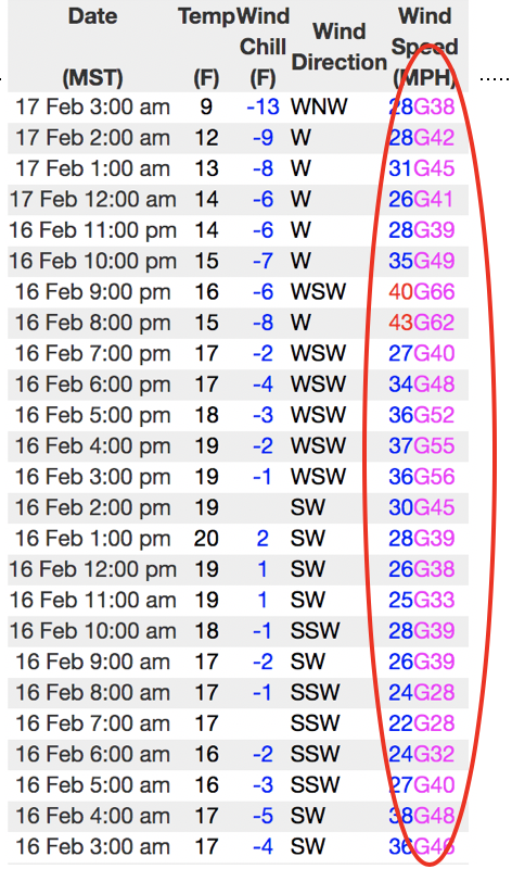
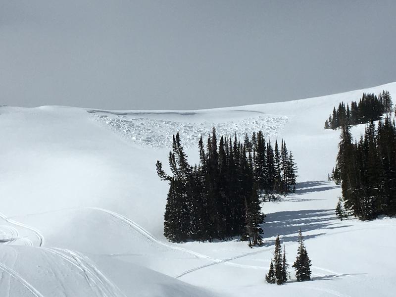
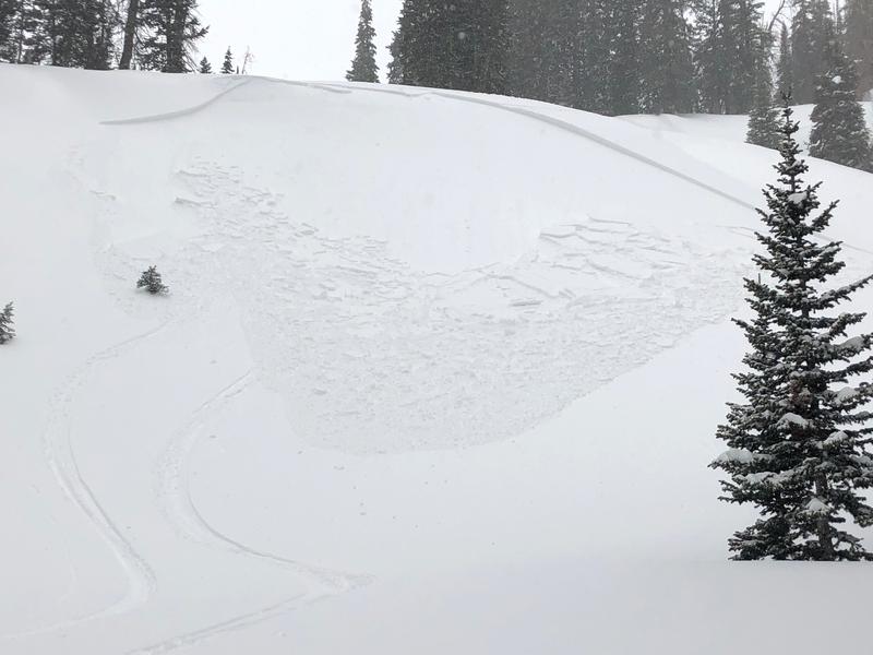
Heads up... the storm delivered and the avalanche danger ramped up overnight. Once triggered, todays avalanches will run faster and further than you might expect and they'll be packing a punch!
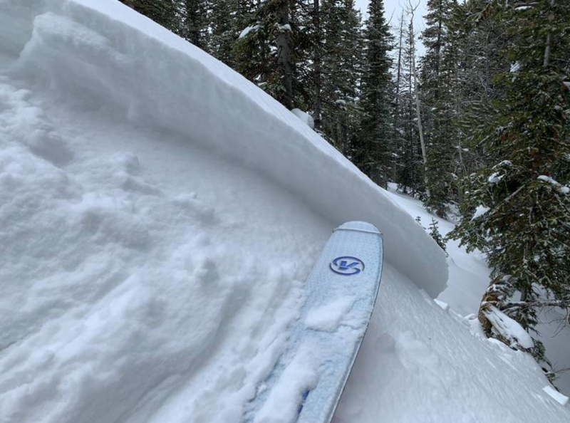
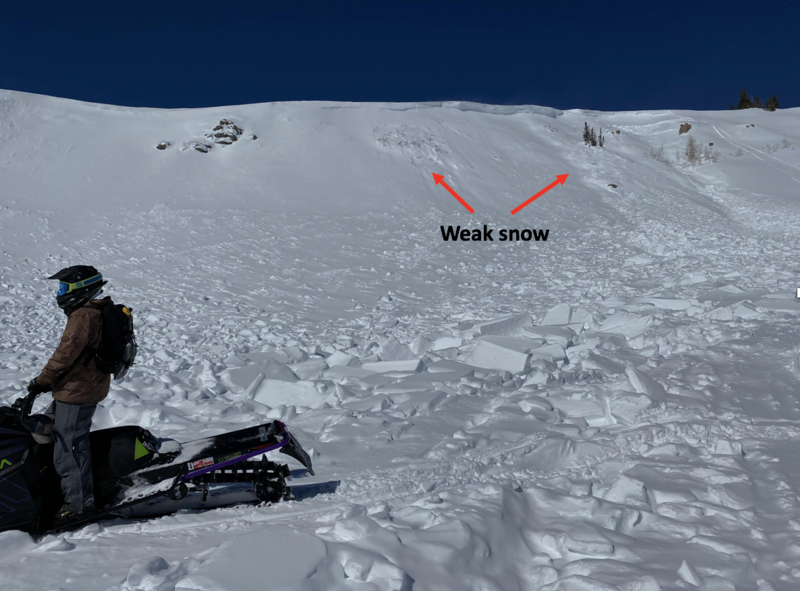
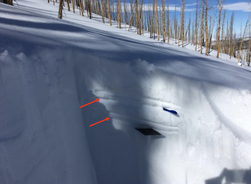
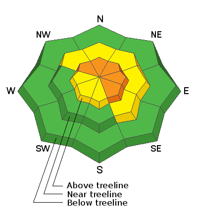
In the wind zone, at and above treeline, fresh wind drifts will react to our additional weight and a CONSIDERABLE avalanche danger exists. Human triggered avalanches are LIKELY on steep, wind drifted slopes. Avalanches breaking into deeper, buried weak layers remains a distinct possibility. Usual suspects include- steep, rocky, upper elevation terrain, especially slopes exhibiting a thin, shallow snowpack. Remember- any slide that breaks to old snow, instantly throws a curve ball at your day.
Mid elevation terrain got in on the act as well where strong winds whipped up a fresh batch of drifts on leeward slopes. While not nearly as widespread, a MODERATE avalanche danger is found on steep, wind drifted slopes and human triggered avalanches are POSSIBLE.
Lose the wind and you lose much of the problem. Wind sheltered mid and low elevation terrain offers generally LOW avalanche danger.
Low
Moderate
Considerable
High
Extreme
Learn how to read the forecast here