March Kicks Off Our Spring Campaign- Donate Now to Support Forecasting

Forecast for the Uintas Area Mountains

Craig Gordon
Issued by Craig Gordon on
Sunday morning, November 15, 2020
In the wind zone, at and above treeline, you'll find MODERATE avalanche danger. Human triggered avalanches are possible, especially on steep, wind drifted slopes facing the north half of the compass. Heads up- strong winds may have formed fresh drifts lower downslope than you might expect and remember... even a small avalanche can easily result in a season ending, traumatic injury.
LOW avalanche danger is found on low angle, wind sheltered terrain.
Low
Moderate
Considerable
High
Extreme
Learn how to read the forecast here
Special Announcements
Huge thanks and a big shout out to two leaders in the industry... (nope I'm not talking about Mark and I :)
More importantly- for the past 15 seasons, Tri-City Performance and Polaris have provided loaner sleds to the UAC and this year was no different. This partnership enables us to perform our field days, get into the same kind of terrain and see the same type of snow our customers are riding, and continue delivering the high caliber forecasts you've come to expect from the Avalanche Center. Bottom line... this partnership helps save lives and for that we are grateful!
Weather and Snow
Nowcast-
The big weekend storm is winding down and total snowfall amounts register near 18" in favored areas with just under 1.5" of H2O ... just what the range needed. Currently, temperatures are in the mid teens and low 20's and westerly winds have mellowed somewhat but still gust in the 30's and 40's along the high ridges. With total snow depths hovering right around two feet, there's just enough snow to move around on, however it's still pretty boney out there.
Futurecast-
Scattered snow showers and breezy conditions are on tap as the Uinta's remain on the southern fringe of a system sliding to the north, so not figuring on much snow accumulation. A break in the action Monday, and then it looks like a busy week of weather starting Tuesday and continuing off and on through the end of the week.
Looking for real-time temps, snow, or wind?
Click here and then on the "western Uinta" tab for western Uinta specific, weather station network.
Recent Avalanches
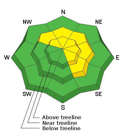
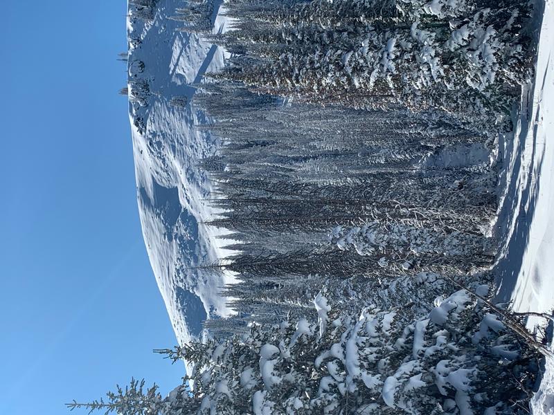
No new avalanche activity to report, but there's just enough snow to ride and of course, enough snow to slide. Steep terrain like this roadside attraction near Wolf Creek Pass pictured above, is the exact type of terrain where we could trigger an avalanche today. And remember- even a small avalanche this time of year will instantly end your season if you slam into a rock, or stump, or get raked through deadfall. But that doesn't mean you can't ride, you just need to tone it down a few notches. As a matter of fact, you can still have a blast on lower angle terrain.
To view trip reports and recent avalanche activity, simply click here.
Ad
Avalanche Problem #1
Wind Drifted Snow
Type
Location
Likelihood
Size
Description
Yesterday's strong winds had no problem forming dense drifts sensitive to our additional weight. In fact, all of yesterday's field observations indicate inverted or upside-down snow conditions. Michael J submitted the images above which clearly illustrate the current snowpack setup (top image) along with a midpack shear (bottom image), suggesting a weak layer. The good news... this isn't an earth shattering instability and should stabilize rather quickly. The cautious news is.... continue to step out lightly and play a little mini golf before getting after any steep terrain. Stomp on a few test slopes similar to the type of slopes you wanna ride and see how they react to your additional weight.
Additional Information
I'll update this information as conditions warrant and the snowpack develops. Once we get rolling and winter gets going in earnest, you can expect detailed daily avalanche advisories updated by 7:00 AM.
Your observations are import, so please let me know what you're seeing... click HERE and contribute to this amazing community based program
Information on outdoor recreation - The State of Utah created this webpage with information about recreating on both state and federal public lands during the current health crisis.

Skiing and riding at closed ski resorts - Some resorts allow access now, and some do not. Please check HERE for the latest info on ski area access.

New to the backcountry (including riding at closed resorts) - Watch the award-winning, 15 minute Know Before You Go video, or take the 5-part, free online-learning series.
General Announcements
If you see or trigger an avalanche or just wanna let me know what you're seeing you can reach me directly at 801-231-2170 or [email protected]
The information in this forecast is from the US Forest Service which is solely responsible for its content.