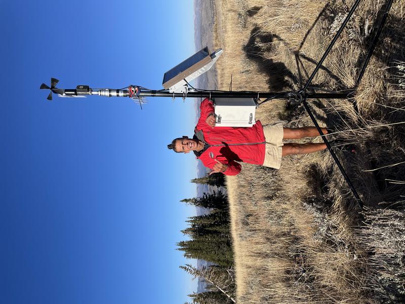
I hope you got it whilst the gettin' was good. Friday was probably the last day you were able to work on your ridgetop weather stations in shorts and flipflops. Yup, we've been super busy this summer upgrading the western Uinta weather station network and this real-time info is found
HERE (
there's some early season hoops to jump through, but please be patient with the prompts, click weather stations, and then on Western Uinta tab)
SAVE THE DATE and TAKE A DATE-
Grab your riding posse and sign up for the 15th Annual
Utah Snow and Avalanche Workshop (USAW). It's two nights of solid avy education, delivered by a remarkable group of presenters, all delivered virtually to the comfort of your own home... November 2nd and 9th. Sign up and get more info for the
first session HERE and the
second session HERE.
The
Avalanche Professional and Ski Patrol Snow and Avalanche Workshop (PROSAW) will be during the day of November 7th. Sign up and get more info
HERE.
Additional Training Opportunities-
It's never to early to start thinking about avalanches. A few things to consider doing:
Attend USAW and learn more about avalanches and decision making.
Sign up for an avalanche class.
Take the
online courses listed on the KBYG website (Develop skills -> Online Learning).
Get your avalanche rescue gear ready for winter. Put fresh batteries in your transceiver and update the firmware. Inspect your shovel and probe. Get your airbag backpack ready by possibly doing a test deployment and update the firmware if it is an electric version.
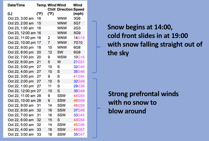
Graphic above depicts the evolution of our storm from a data dump at Windy Peak (10,662')
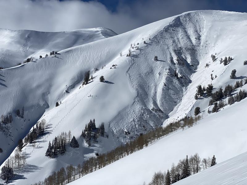
Great storm for the eastern front, especially the North Slope and Mirror Lake Highway where nearly a foot of fresh snow with just over an inch of H2O blankets the high ridges. About half that amount stacked up on the south half of the range. So, just like that... there's enough snow to move around on. And now I think about early season roadside attractions like Murdock Bowl off the Mirror Lake Highway or Wolf Creek Bowl near Highway 35 and Wolf Creek Pass. Easy grabs... right? Even though it might not seem like there's enough snow to avalanche, today you'll want to avoid any steep, wind drifted slope. Remember- even a small wind drift packs enough punch to knock you off your feet and may result in a season ending injury if you slam into a stump, rock, or deadfall barely hidden under the shallow snow.
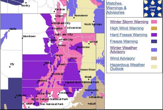
Wow... talk about a meteorological Rorschach Ink Blot test. That's the kind of winter weather map we like to see!