Join us at our 2nd Annual Blizzard Ball

Forecast for the Uintas Area Mountains

Craig Gordon
Issued by Craig Gordon on
Saturday morning, January 4, 2025
Heads up... as today's storm materializes, it'll light up the snowpack like a cross-fire hurricane-
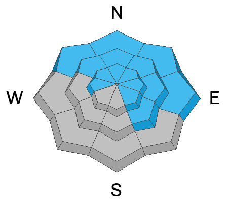
At and above treeline, HIGH avalanche danger quickly evolves around the dial this morning with both human triggered and natural avalanches becoming VERY LIKELY. While fresh storm snow is the obvious avalanche dragon, let's not take our eyes off the prize. Deep, dangerous, and potentially unsurvivable human triggered avalanches can be initiated particularly on steep, shady, leeward slopes in the wind zone, and especially in terrain with an easterly component to its aspect. Today’s avalanches will break deeper and wider than you might expect and they'll not only boss you around and deliver a body bruising ride, they have the potential to instantly end your season.
Lower elevation shady slopes (polars) offer CONSIDERABLE avy danger human triggered avalanches are LIKELY on steep, wind drifted slopes.
Even low elevation sunnies get in on the act where you'll find MODERATE avalanche danger and human triggered storm snow avalanches are POSSIBLE.
It's gonna be an epic day of riding and I want us to come home safely to our families at the end of the day, so here's our exit strategy.... simply head to low angle slopes or big open meadows with no overhead hazard where we can have a blast and a trench-fest, carving deep powder turns. I know you're with me... I'll see you there :)
Low
Moderate
Considerable
High
Extreme
Learn how to read the forecast here
Special Announcements
We are deeply saddened to confirm two avalanche fatalities. The first involved a 38 year old man in Main Porter Fork of Mill Creek Canyon who went missing on Saturday. The second avalanche fatality occurred Tuesday and involved a 54 year old man off Davenport Hill into Silver Fork of BCC. Both individuals were traveling alone in the backcountry. Please know, our hearts are heavy for the family and friends of these gentlemen.
Many thanks to those who responded to these accidents: search and rescue teams from AirMed, LifeFlight, Utah Dept Public Safety, Utah Department of Transportation, Salt Lake County Search and Rescue, Wasatch Backcountry Rescue, Alta Ski Area, and members of the Utah Avalanche Center.
Weather and Snow
Nowcast- A band of thickening clouds rolled in overnight, putting a lid on temperatures which feel downright balmy at o'dark thirty, registering in the mid 20's and low 30's. The bigger news are the cow tipping winds which of course, weren't hurt or injured in the use of this analogy, yet still clock in at 40-50 mph with gusts in the 70's near the high peaks. Yesterday's snow took on heat and is moist and spongy. But if you want fresh pow, the linecook arrives in a few hours and today's special is Memphis Soul Stew along with an intense band of snow developing by about sunrise.
Forecast- It'll be rough and rowdy as a robust looking cold front slides into the eastern front, delivering much colder temperatures which crash into the teens by the time you break for lunch. Southerly winds are gonna be movin', groovin', and utterly obnoxious as you roll into the trailhead, but should shift to the west and northwest in the snap of the fingers, usher in a cold front and stomp out a solid shot of snow, quickly stacking up about a foot by days end.
Futurecast- Snow showers linger through tonight, but a break is on tap Sunday through a good portion of Monday, before yet another system rolls through early in the work week.
Recent Avalanches
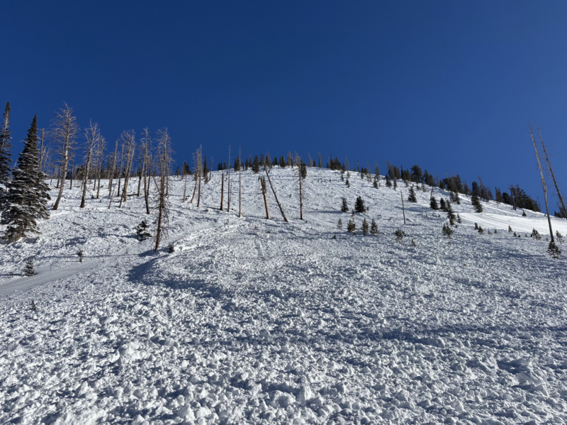
No significant avalanche activity to report from yesterday, but the image above is an eye-catcher... a very well-connected avalanche on the east side of the range near the Boundary Creek yurt that slid during the New Years Eve storm cycle. A group spending the night in the yurt commented... "In the morning of the 31st we saw that the steep west/northwest facing slope just south of the yurt avalanched overnight. It ran full length of the path, missing the Boundary Creek Yurt by 200 feet." Yikes!
Ted was in Gold Hill yesterday, while Micheal J stomped around the lower Weber Canyon zone... both trip reports offer excellent insight and are well worth the read.
Huge thanks to everyone for helping us out by providing very timely observations, insight, and honesty. Remember... your Uinta based intel helps save lives, so please keep the cards and letters coming in! All Uinta obs and trip reports along with info from neighboring Utah forecast zones are found here.
Ad
Avalanche Problem #1
Persistent Weak Layer
Type
Location
Likelihood
Size
Description
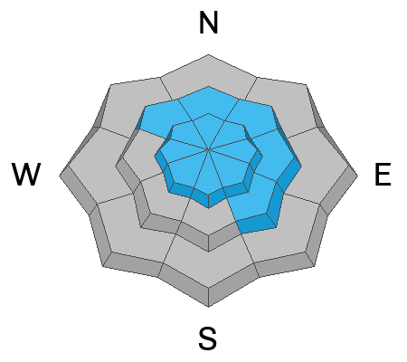
Man... talk about New Year's resolutions. Sick of being teased by big, beefy, water laden snowpacks (I won't mention any names, but you know who you are :), the western Uinta's transformed from a weak, trapdoor, sandboxy mess into a mostly solid, and amazingly reboundable piece of snow with tremendous body... baby! But there's a catch... a mostly one finger slab now rests on top of the well preserved and very uniform mid December drought layer which stretches tip to tail. Anything with old snow is highly suspect and still produces rolling thunder. And while ECT's in the low to mid 20's suggest strengthening, there's so many big pieces of snow that hang in the balance, it's a game of Minesweeper.
Avalanche Problem #2
Wind Drifted Snow
Type
Location
Likelihood
Size
Description
Strong overnight winds whipped up a round of stiff slabs and today's incoming storm will further instigate a fresh round of drifts that'll be super reactive to our additional weight. Found mostly on the leeward side of mid and upper elevation ridges, I think today's strong winds are gonna transport snow much lower down-slope than we might expect. In addition, cross-loaded terrain features like chutes and gully walls should be avoided. In either case, my strategy is... lose the wind and you lose the problem. Yeah, I'm simply avoiding fat rounded pieces of snow, especially if they sound hollow like a drum. And remember, fresh wind drifts aren't always a manageable avalanche problem. Once triggered, today's drifts can get out of hand quickly if they break into faceted weak layers, now buried several feet deep in the snowpack.
Avalanche Problem #3
New Snow
Type
Location
Likelihood
Size
Description
An intense band of snow should light up steep terrain at all elevations and I suspect we'll see a mini, new snow avalanche cycle. Super manageable and very predictable, know that shallow avalanches will occur not only in mid and upper elevation terrain, but also in our mountain communities and near the trailheads. Something to keep in mind if you're going for a snowshoe or taking your fur-kid out for an early morning stroll.
Additional Information
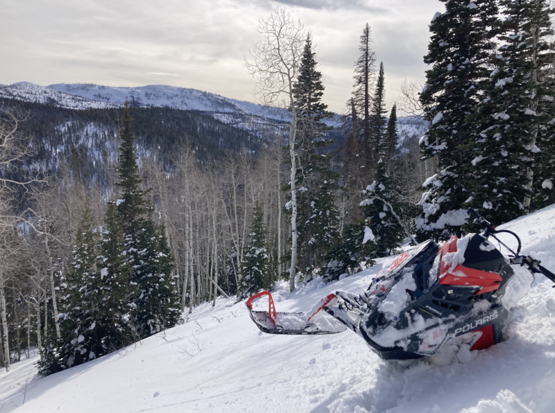
Pro-rider extraordinaire and all around amazing human Dan Gardiner was out and about Friday and commented how the snow was warm and tacky, taking in heat, even on an early January day.
General Announcements
The Uinta weather station network was upgraded this summer and all that real-time info is found here. Simply click on the "Western Uinta" tab and then the "Weather Stations" tab to find all your weather needs.
We are always looking for snow and avalanche observations or just general riding conditions. So... if you see something, say something. You can reach our team directly by contacting: Craig at [email protected], 801-231-2170, or Andrew at [email protected], or 860-460-8142.
General Information
This forecast is from the U.S.D.A. Forest Service, which is solely responsible for its content. This forecast describes general avalanche conditions and local variations always occur. This forecast was issued on Saturday, January 4th at 04:00AM and expires 24 hours after it was issued. We will update the forecast by 0700 AM tomorrow. But, in the meantime reach out to us with questions, or if you see anything in your travels.