Forecast for the Uintas Area Mountains

Craig Gordon
Issued by Craig Gordon for
Thursday, January 24, 2019
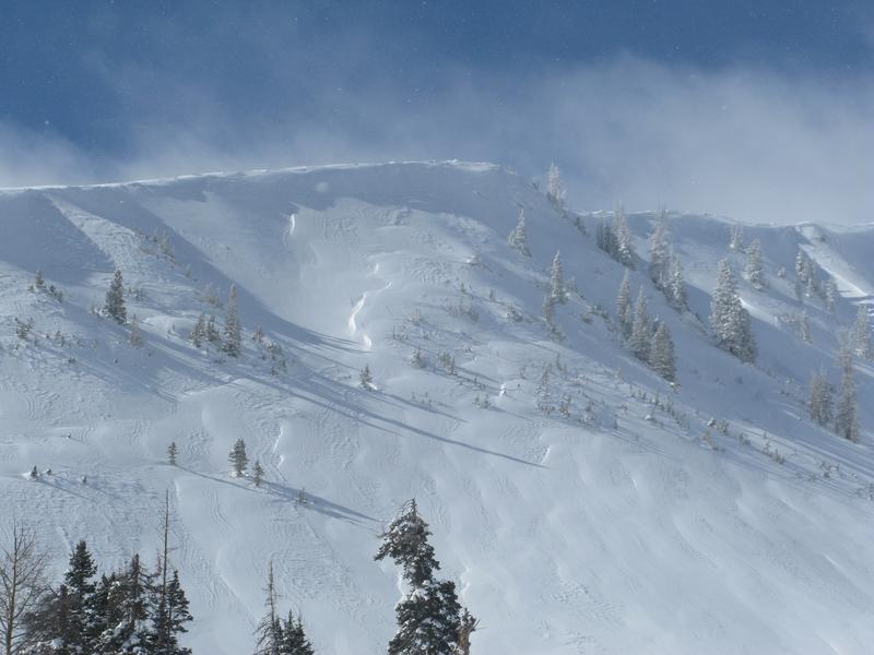
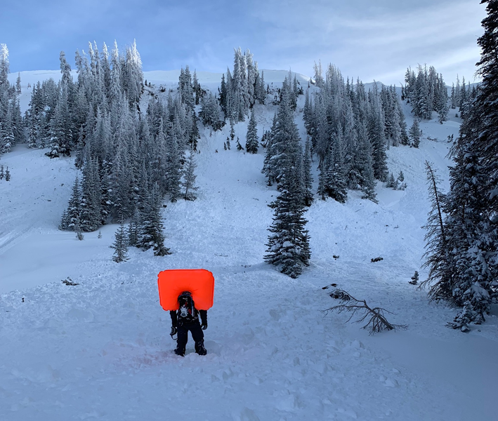
DECEPTIVELY TRICKY AVALANCHE CONDITIONS CONTINUE ON THE EASTERN FRONT
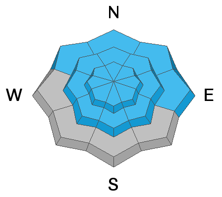
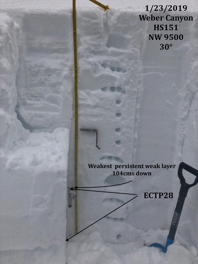
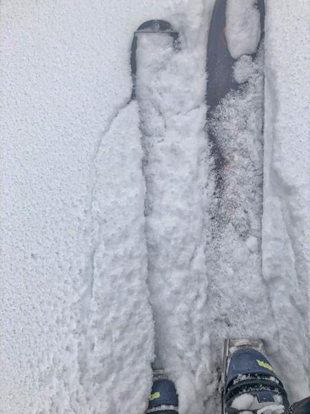
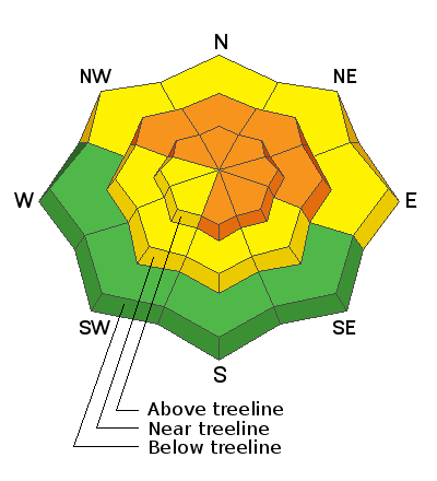
In the wind zone at and above treeline, you'll find you'll find CONSIDERABLE avalanche danger. Human triggered avalanches are PROBABLE on all steep wind drifted slopes, particularly those with an easterly component to their aspect. Any avalanche that breaks into deeper buried weak layers near the ground will result in a scary and very dangerous avalanche that will instantly ruin your day.
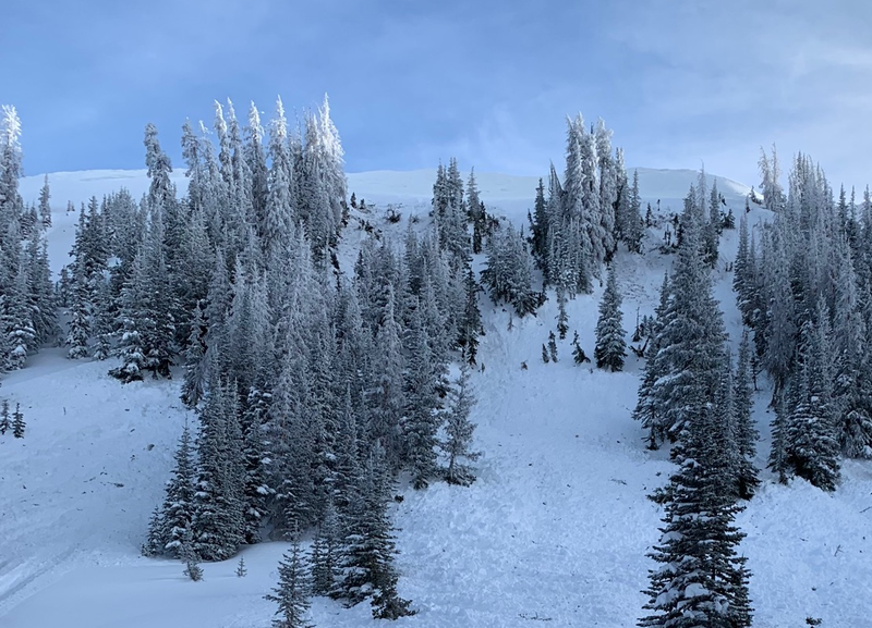
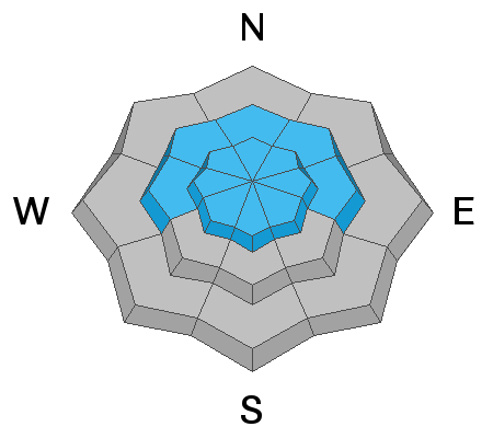
MODERATE avalanche danger exists on steep, lower elevation slopes facing the north half of the compass and human triggered avalanches are POSSIBLE.
Here's your exit strategy.... low elevation south facing terrain still has cold snow and a generally LOW avalanche danger.
Low
Moderate
Considerable
High
Extreme
Learn how to read the forecast here
Weather and Snow
Skies are mostly cloudy and light snow falls, adding a few more flakes to yesterday's 3" of storm snow. Temperatures are in the teens and west-northwest winds blow in the 20's and 30's along the high ridges.
Above is hourly data from Trial Lake (9,945') and Windy Peak (10,662'). To view more regional weather stations click here.
Unfortunately, Monday night's post-frontal winds damaged large swaths of upper elevation snow. But there's plenty of wind sheltered terrain that offers deep, cold, surface snow which rests on a soft, reboundable, spongy base... mmm.... spongy :)
Recent Avalanches
Not so breaking news from Tuesday-
A couple days old, but significant none-the-less... a large, deep, and dangerous sled triggered slide near Humpy Basin from earlier in the week, broke on weak snow close to the ground and took this rider for a wild ride. His sled was partially buried, but he came out on top. We are sifting through details, trying to locate the exact location, will visit the site once we get a better idea, and will report back soon. Thanks to Michael J for providing the preliminary info found here.
Ad
Avalanche Problem #1
Persistent Weak Layer
Type
Location
Likelihood
Size
Description
The snowpack is slowly adjusting to the recent big storms, but remains sketchy and the distinct possibility of triggering a deep, dangerous slide still exists. There's no mystery here.... as a matter of fact it's basic snow science. Now I'm no snow scientist, but what I do know is this... beginning last Thursday, the snowpack received a remarkable amount of snow, water, and wind. The bigger issue is all this added weight stacked up on a weak snowpack and it just needs a little break in the action and some time to adjust. What we need to do is practice a bit of patience and remember, in due time the pack will begin to heal and become a little less agitated. Right now however, we're at a critical juncture in the life of the snowpack where all it takes is for us to come along and collapse a slope, essentially knocking the legs out from underneath it, and now we're staring down the barrel of a dangerous avalanche.
So here's where it gets even more tricky. Many steep slopes throughout the range experienced a widespread natural avalanche cycle late last week, but recent snow and wind has filled in much of that evidence. So today it's all gonna look white and that's the challenge. You can ride some slopes without incident (perhaps they already slid) and think you're good to go, while an adjacent slope that remained intact throughout the storm, is just waiting for a trigger like us to roll up and tip the balance.
So how do we manage an unmanageable avalanche? We simply avoid it... avoid being on, underneath, or connected to steep wind drifted slopes. And here's your exit strategy... great riding conditions exist on low angle, low elevation slopes facing the south half of the compass. Done and done.
JG was in Weber Canyon and reports the same old... same old. His trip report offers this interesting comment.... "On and off collapsing throughout the day but most widespread skinning on a SW aspect. The snowpack structure hasn't changed and we're still dealing with a scary mid-pack persistent weakness."
More Uinta obs found here.
Avalanche Problem #2
Wind Drifted Snow
Type
Location
Likelihood
Size
Description
Winds have been busy at work and there's no shortage of snow to blow around and form fresh, stiff drifts along the leeward side of upper elevation ridges and around chutes and gullies. Don't get fooled into thinking today's fresh drifts are the only avalanche dragon you're dealing with. Underneath the new drifts are old, connected drifts, that once triggered, will break deeper and wider than you might expect. Today you'll want to utilize all the awareness tools in your quiver. Look for obvious clues to unstable snow like shooting cracks out in front of our skis, board, or sled. Also remember to avoid any fat, rounded piece of snow especially if it sounds hollow like a drum. And finally the hugest clue... recent avalanches on the same kind of terrain you want to ride on.
Cracking around or out in front of your skis, board, or sled is a big indicator to wind drift formation. If you're seeing this red flag down low, you can expect a bigger brother version the higher you go in elevation.
Additional Information
Today, look for occasional snow showers, though accumulations will be negligible. West and northwest winds are gonna be a nuisance, blowing in the 30's and 40's, gusting to 50 mph along the high peaks. Highs reach into the 20's and overnight lows dip into the teens. Snow showers taper off this afternoon as high pressure builds over the region.
General Announcements
The information in this advisory expires 24 hours after the date and time posted, but will be updated by 7:00 AM Friday January 25th, 2019.
If you're getting out and about, please let me know what you're seeing especially if you see or trigger and avalanche. I can be reached at [email protected] or 801-231-2170
It's also a good time to set up one of our very popular avalanche awareness classes. Reach out to me and I'll make it happen.
This information does not apply to developed ski areas or highways where avalanche control is normally done. This advisory is from the U.S.D.A. Forest Service, which is solely responsible for its content. This advisory describes general avalanche conditions and local variations always occur.