Forecast for the Uintas Area Mountains

Craig Gordon
Issued by Craig Gordon for
Tuesday, January 17, 2023
Curiously straight-forward these days and the song remains the same-
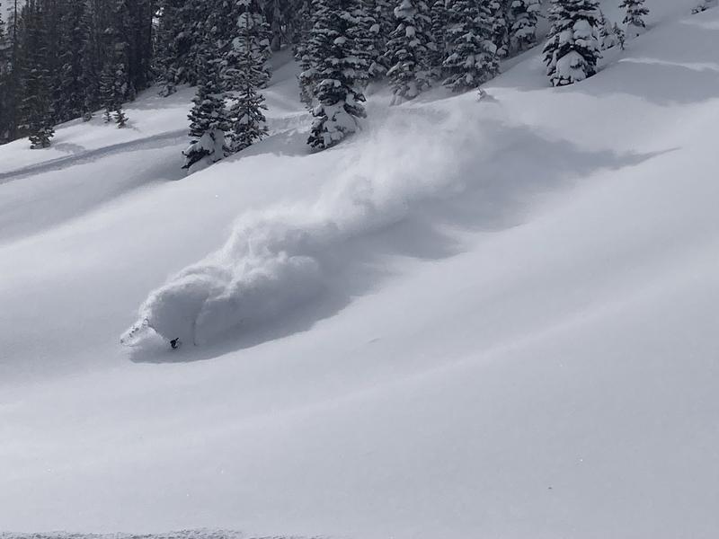
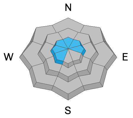
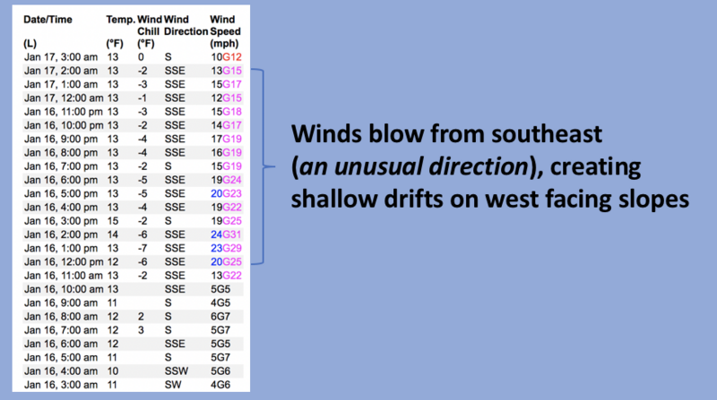
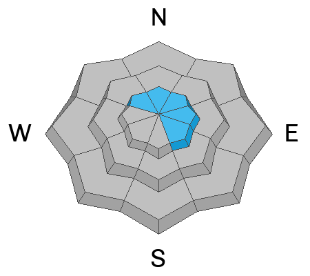
MODERATE avalanche danger is found on upper elevation shady slopes, especially in the wind zone at and above treeline. The danger is most pronounced in steep, rocky terrain facing the north half of the compass.. Human triggered wind drifts, along with more dangerous slides breaking to weak layers now buried deep in our snowpack are POSSIBLE.
Generally LOW avalanche danger is found on most south facing terrain along with mid and lower elevation shady slopes.

Low
Moderate
Considerable
High
Extreme
Learn how to read the forecast here
Weather and Snow
Nowcast- A band of moisture slid through the region last night, delivering a south-side shuffle which focused its sights near Currant Creek. It looks like 6" of snow with .40" H2O, whilst the North Slope clocks in with half that amount. Southeast winds blow 10-20 mph along the high ridges and temperatures register in the teens under mostly cloudy skies.
Forecast- Another shot of moisture keeps the powder party rolling and we should stack up an additional 3"-6" inches, beginning right around sunrise through mid morning. Winds remain rather well-behaved and temperatures climb into the mid 20's. Wrap around moisture late in the day could help enhance snowfall right around dinnertime.
Futurecast- A break is slated for tomorrow afternoon with another storm diving south for Thursday. Not a bust for us, just scattered snow showers. Weak high pressure is on tap to round out the work week.
Our good friends and partners at the NWS lay out the timeline for our next series of storms in the graphic above

Brock Berry finds himself deep in the white room yesterday.
Huge thanks for all the great obs streaming in from the eastern front. Detailed trip reports and recent obs are found HERE.
Recent Avalanches
Other than a shallow wind drift or two, no significant avy activity to report. But a slew of Uinta avy obs are found HERE.
Ad
Avalanche Problem #1
Wind Drifted Snow
Type
Location
Likelihood
Size
Description
24 hour data dump from Windy Peak(10,662') shows recent run of southeast winds.
Recent southeast winds created shallow drifts on upper elevation slopes with a hint of west to their aspect, which is slightly unusual for us. So, for today... you'll find fresh wind drifts on the leeward side of upper elevation ridges, but they've been camouflaged under a few inches of fresh snow, making them hard to detect. Manageable in size and breaking at or below our skis, board, or sled this is an easy avalanche dragon to avoid... lose the wind and you lose the problem.

Avalanche Problem #2
Persistent Weak Layer
Type
Location
Likelihood
Size
Description
Can I trigger a deep, dangerous avalanche that breaks to the midpack November facets? Yeah... but I've really gotta hunt this one out and all the planets have to align to ruin my day. Likely suspects include steep, rocky, upper elevation terrain where the snowpack is lean or slopes that avalanched earlier this season and are therefore slightly more thin and fragile. And remember... all I need to do is find one weakness in the pack, pull the rug out from underneath, and the entire roof crashes down on me. It's a low probability/high consequence scenario. I'm stepping out cautiously, but with intent, gathering as much snowpack intel as I can along the way.
Additional Information
Such a rock star! Huge thanks to Joey Manship for all the hard work and Herculean efforts getting the Nobletts Beacon Park up and running. Located on the northeast corner of the parking lot, give it a go and practice your rescue skills on a down day, or while you wait for your crew before a ride.
Weather stations-
And... we were super busy this summer upgrading the western Uinta weather station network and this real-time winter info is found HERE (click weather stations, and then on the Western Uinta tab)
Observations-
Your observations are important, so please let me know what you're seeing... click HERE and contribute to this amazing community-based program
General Announcements
Issued at 03:43 on Tuesday January 17th, this forecast expires 24 hours after the date and time posted, but will be updated by 07:00 Wednesday January 18th, 2023.
Before it gets too crazy, now is the time to book an avalanche awareness presentation for your group, club, or posse. You can reach Craig directly at 801-231-2170 or [email protected].

This forecast is from the U.S.D.A. Forest Service, which is solely responsible for its content. This forecast describes general avalanche conditions and local variations always occur.