UDOT PLANNED AVALANCHE CLOSURES!!

Forecast for the Uintas Area Mountains

Craig Gordon
Issued by Craig Gordon for
Wednesday, January 16, 2019
Heads up... expect rising avalanche danger the next couple of days.
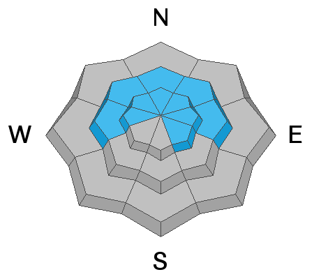
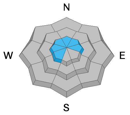
For today, at mid and upper elevations, near and above treeline, the avalanche danger is MODERATE. Human triggered avalanches are POSSIBLE on steep wind drifted slopes, especially those facing the north half of the compass and particularly those with an easterly component to their aspect.
Any avalanche that breaks into deeper buried weak layers near the ground will result in a deep, scary, and dangerous avalanche.
If you're looking for LOW avalanche danger, simply head to lower elevation terrain or big open meadows with no steep terrain above or connected to where you're traveling.
Low
Moderate
Considerable
High
Extreme
Learn how to read the forecast here
Weather and Snow
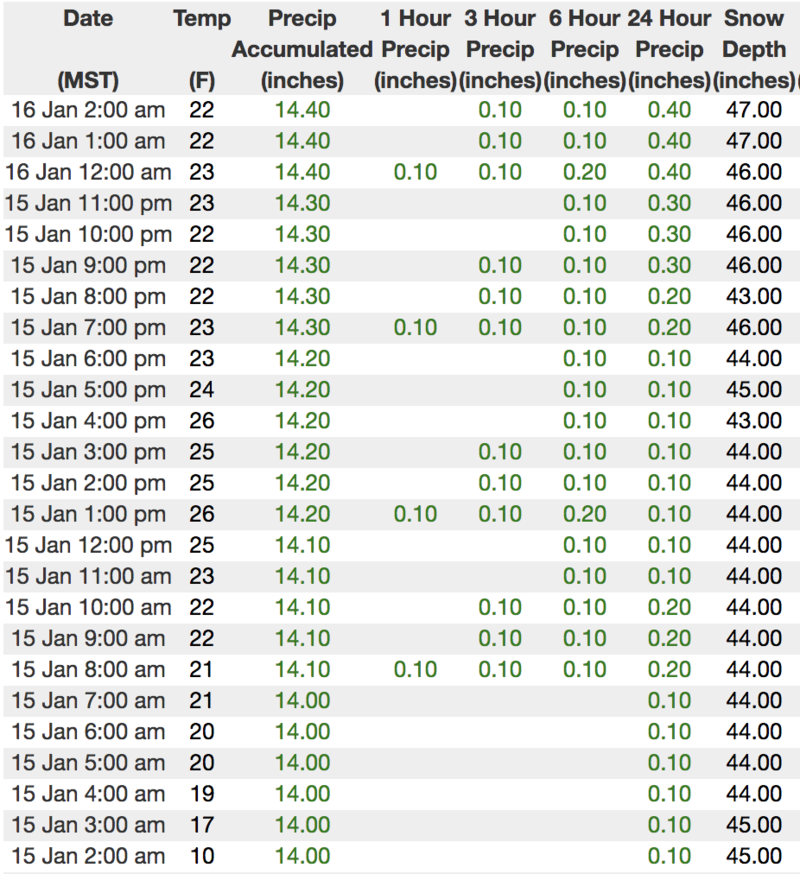
Under mostly cloudy skies, light snow is falling and a shallow, primer coat of white paint blankets the range this morning. Last nights little storm delivered an evenly distributed 4" of medium density snow along with temperatures in the teens and low 20's. Riding and turning conditions are much improved and I'd steer towards low angled shady slopes today where there's less of a chance of feeling old tracks under you skis, board, or sled.
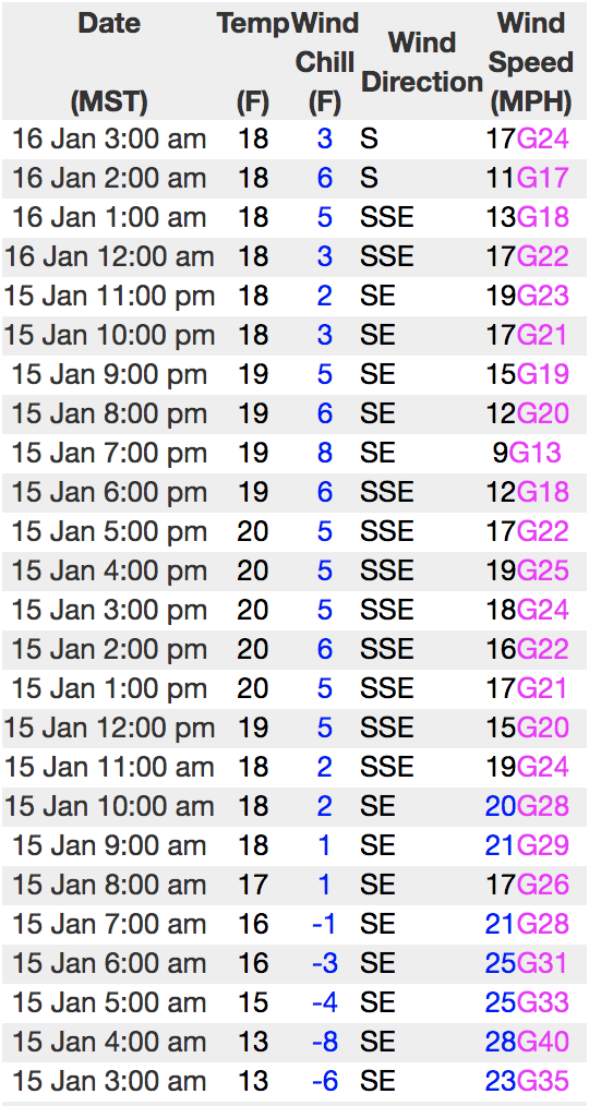
Above is hourly data from Trial Lake (9,945') along with recent wind data from Windy Peak (10,662'). To view more regional weather stations click here.
Recent Avalanches
No new avalanche activity to report. However, on Sunday, Andy and Bo stomped around the south half of the range, noting a widespread, midweek avy cycle. The viddy above clearly illustrates a weak, midpack layer that lit up with last weeks big storm. With more snow, water, and wind slated for this week, it's a layer to to keep and eye on, especially as it gets buried deeper in our pack.
Check out their well documented and very detailed trip report here. Solid work men!
Ad
Avalanche Problem #1
Persistent Weak Layer
Type
Location
Likelihood
Size
Description
So far this week we haven't heard much from our problem child, the persistent weak layer, now buried in the mid portion of our snowpack. However, given its recent track record what we do know is this... each time the snowpack receives a big thump of water, snow, and wind, this dormant layer comes back to life and we see avalanches breaking deeper than we might expect, particularly in terrain where the snowpack is thin and weak. Now here's the problem- "persistent weak layers" in the snowpack are a headache because all we need to do is find one weakness, maybe around a bush or rock that we can't see buried underneath the snow, collapse the pack, and now we've triggered a slide that quickly gets out of hand.
With a big storm on tap we'll need to recalibrate our cerebral travel policy and implement an avoidance plan. So you're asking, "how do we manage an unmanageable avalanche dragon is the snowpack?" Well we simply avoid it... and the usual suspects come to mind- steep, rocky terrain and slopes that have already avalanched this year. In addition, periphery terrain where the pack has remained shallow all season should be considered guilty until proven otherwise.
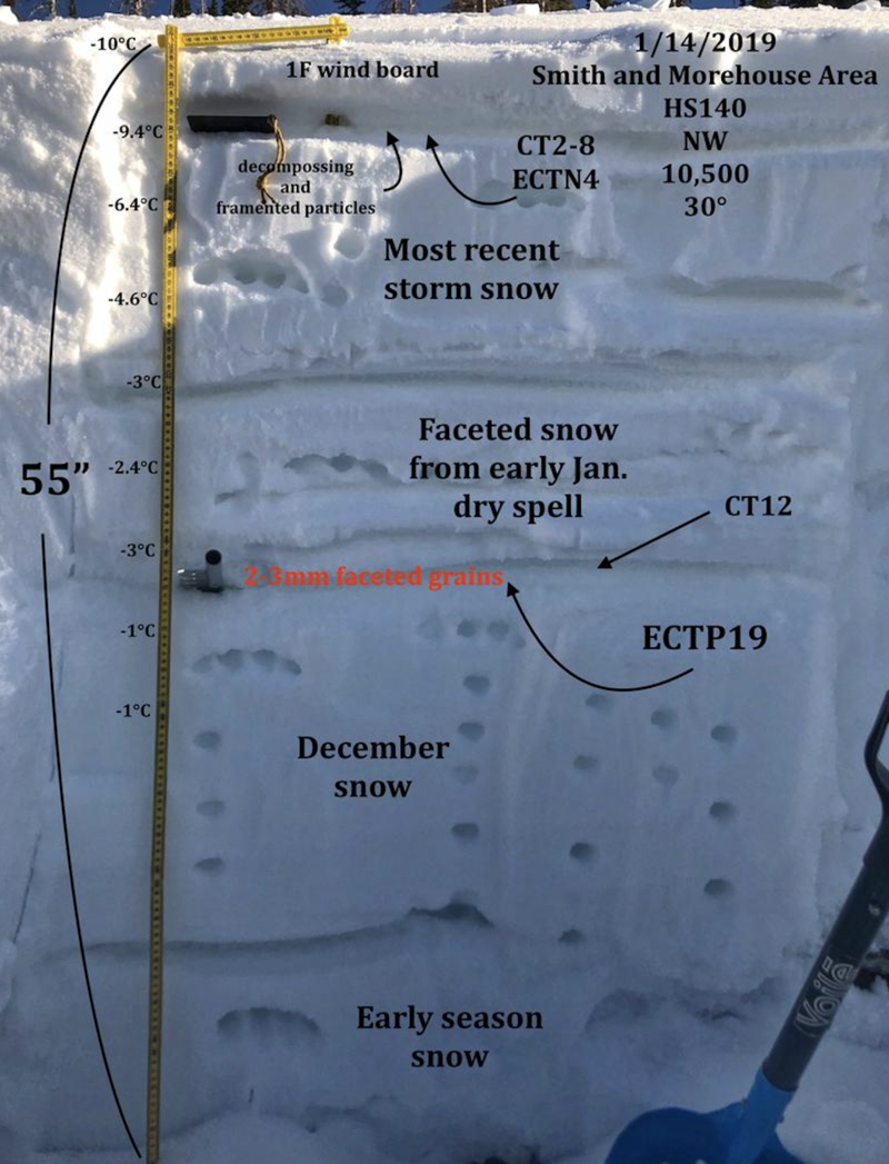
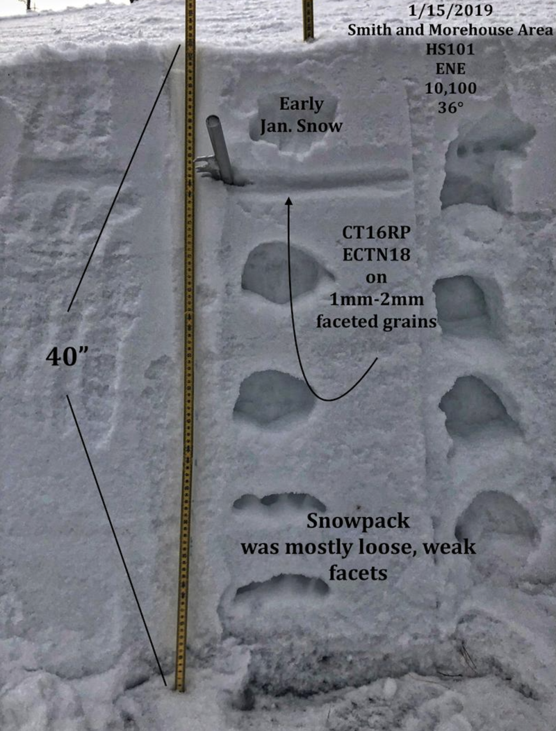
These beautifully detailed JG pits clearly illustrate a tale of two snowpacks.
In the upper image a pack with a bit of body and short-term stability. Whilst the lower image shows a pack with structural weaknesses and questionable strength.
In either case, snowpit stability tests reveal failures on or near the early January snow which has faceted, confirming a suspicious layer to keep an eye on, especially as a series of storms sets its sights on the range this week.
Avalanche Problem #2
Wind Drifted Snow
Type
Location
Likelihood
Size
Description
Today's shallow wind drifts are generally manageable, predictably breaking at or below our skis, board, or sled. However, with a good looking storm headed our way and winds forecast to ramp up, I expect drifting to become more widespread and more connected, later today and especially as the next storm develops. Remember- the Uinta's are a big place. So as always, be aware of changing weather conditions and also look for and avoid any fat, rounded piece of snow especially if it sounds hollow like a drum.
Additional Information
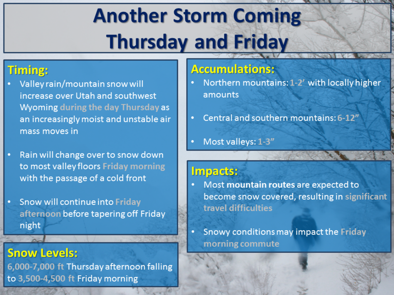
Another quick hitting shot of moisture slides through the region this morning, with a couple more inches of snow expected. Southerly winds started out light early this morning, but are ramping up and expected to gust into the 40's. Temperatures climb into the low 30's and dip into the mid 20's overnight. The main event is still on track for Thursday night and Friday with 12"-18" of snow and about 1.5" of H2O expected. More on timing and details for tomorrows update.
General Announcements
The information in this advisory expires 24 hours after the date and time posted, but will be updated by 7:00 AM Thursday January 17th, 2019.
If you're getting out and about, please let me know what you're seeing especially if you see or trigger and avalanche. I can be reached at [email protected] or 801-231-2170
It's also a good time to set up one of our very popular avalanche awareness classes. Reach out to me and I'll make it happen.
This information does not apply to developed ski areas or highways where avalanche control is normally done. This advisory is from the U.S.D.A. Forest Service, which is solely responsible for its content. This advisory describes general avalanche conditions and local variations always occur.