Avalanche forecasts for the Manti Skyline will be intermittent and storm dependent through the rest of April.
Current Conditions
The most recent storm was on Friday, April 22nd that dropped 6 to 8 inches of new snow. It was very windy during this storm.
Mountain Weather
Starting Monday, April 25, we will be in a warming trend. We'll see scattered clouds with high temperatures in the mid 50s for most of the week. There is not much of a chance for snow over the next two weeks.
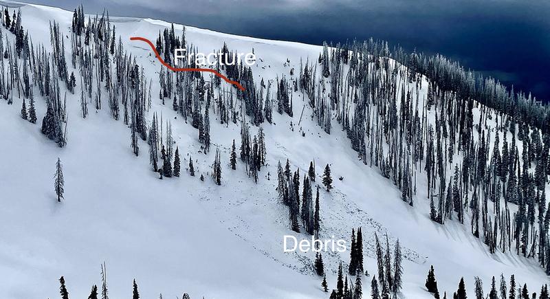
There was a significant natural wet slab avalanche that released sometime around April 20th in Blue Slide Fork. It was on a northeast facing 40˚ slope at about 10,000' and broke 3 to 5 feet deep down to the mid winter Persistent Weak Layer of sugary facets. The snowpack went from cold dry snow to wet snow during very warm weather. This made the snowpack lose strength and the avalanche released. There may be more around the range that I'm not aware of.