UDOT PLANNED AVALANCHE CLOSURES!!

Forecast for the Skyline Area Mountains

Brett Kobernik
Issued by Brett Kobernik on
Thursday morning, March 28, 2024
The overall avalanche danger is LOW.
There is a MODERATE danger of triggering a lingering wind slab that may still be unstable from the last storm. These will be most prominent on upper elevation east facing slopes just below ridges.
Low
Moderate
Considerable
High
Extreme
Learn how to read the forecast here
Weather and Snow
Current Conditions: Temperatures stayed a bit cooler on Wednesday than I anticipated with highs in the mid 20s at most upper elevation weather stations. This kept the riding conditions excellent and there will be more good conditions today. Sunny slopes did get wet as well as all lower elevation terrain. The wind was generally light from the southwest on Wednesday and is almost calm this morning.
Mountain Weather: We'll have cloudy skies with high temperatures into the low to mid 30s. Wind will be light from the southwest but looks like it could get pretty strong later this afternoon as the next storm system moves in. We should see a few inches of new snow accumulate overnight. We'll see a number of periods of snow through Sunday. Totals are looking better than what I was anticipating yesterday. We should see at least a foot of new snow by late Sunday.
Recent Avalanches
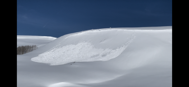
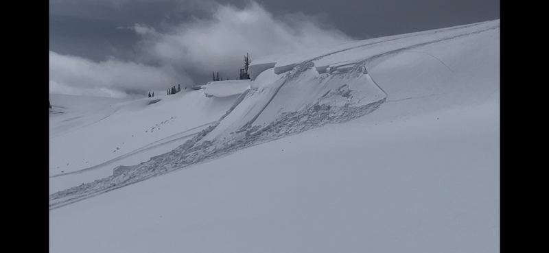
There were a few natural avalanches that occurred during the storm due to wind loading. There were also a number of small snowmobile triggered pockets on Wednesday. All of these were on steep wind loaded slopes just below ridgelines on east facing terrain.
This natural avalanche (photo below) was the largest one that I found. This is large enough to be a serious concern.
The photo below shows what type of pockets were triggered by snowmobilers on Wednesday.
Ad
Avalanche Problem #1
Wind Drifted Snow
Type
Location
Likelihood
Size
Description
About the only concern out there today is triggering a recently formed drift or slab that has not completely stabilized yet. Wind from a generally west direction has taken snow from west facing slopes and deposited it onto east facing slopes during the last storm. These drifts are stabilizing but I have little doubt that you could still get one to crack out today. Simply avoid steep wind loaded slopes in the higher east facing terrain.
Also, keep in mind that the strong wind later today could form some fresh drifts and these will be sensitive to people poking at them.
General Announcements
This forecast is from the U.S.D.A. Forest Service, which is solely responsible for its content. This forecast describes general avalanche conditions and local variations always occur.