Donate to Our Spring Campaign or Bid on our Spring Auction to Support Forecasting

Forecast for the Skyline Area Mountains

Brett Kobernik
Issued by Brett Kobernik on
Saturday morning, March 22, 2025
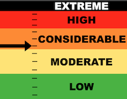
The danger rating on the Skyline is CONSIDERABLE today.
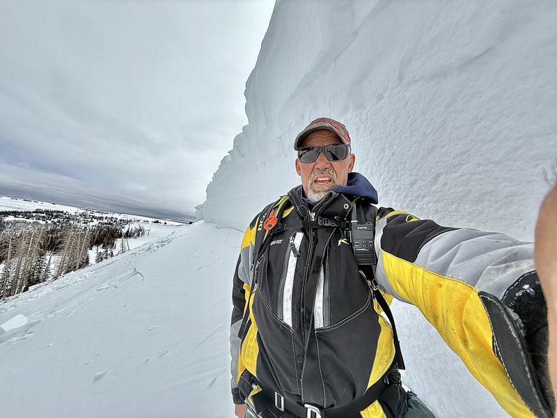
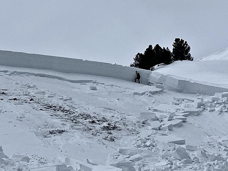
Any steep slope in the upper elevation terrain that faces north, northeast or east could produce a deep, dangerous avalanche.
Some slopes will stay in place, some won't. You can't tell which ones are stable and which ones aren't. You won't see any signs of danger. This makes things exceptionally dangerous.
Low
Moderate
Considerable
High
Extreme
Learn how to read the forecast here
Weather and Snow
Current Conditions: The Skyline picked up 4 to 6 inches of snow early this morning. It looks like the Electric Lake area may have done the best. Temperatures were in the mid to upper 20s overnight. Wind from the southwest has been in the moderate speed range but there was a bump in speed this morning along the most exposed peaks. Riding conditions remain very good.
Mountain Weather: The storm is basically over. We'll see cloudy skies that may break a bit as the day goes on. Temperatures will be around 30˚F or a bit warmer. Wind will be from the west. It looks like it'll be a bit breezy along the higher ridges. Things clear out a bit more Sunday and Monday as high pressure and warm weather move in for the week.
Recent Avalanches
SOMEONE'S LUCK IS BOUND TO RUN OUT.......
I received reports of two more close calls where riders were caught and buried in avalanches. I was able to visit one in the south fork of Manti Canyon. On Thursday, two riders were caught while they were parked at the bottom of a steep north facing slope. One was completely buried with only a small piece of gear visible. One was partially buried. They were both rescued by their group and sustained only minor injuries. MORE DETAILS HERE
Ad
Avalanche Problem #1
Persistent Weak Layer
Type
Location
Likelihood
Size
Description
The new snow itself shouldn't pose a real big threat out there today. You may find some small shallow pockets that might release in the windier terrain.
BY FAR the most dangerous situation is the chance for triggering a deep avalanche that breaks into older weak sugary faceted snow. The avalanche in Manti Canyon has made me change my outlook on this problem. This was in an area with an overall deep snowpack. I would've guessed that this area would've been as stable as any area on the Skyline. This shows that avalanches can break anywhere regardless if it is a shallower or deeper location. THINGS ARE VERY UNPREDICTABLE. Not all slopes will avalanche if you get onto them. Some will. It's a "low probability - high consequence" situation. It is a very dangerous situation because you can't tell which slopes won't avalanche.
General Announcements
This forecast is from the U.S.D.A. Forest Service, which is solely responsible for its content. This forecast describes general avalanche conditions and local variations always occur.