Forecast for the Skyline Area Mountains

Saturday morning, March 12, 2016
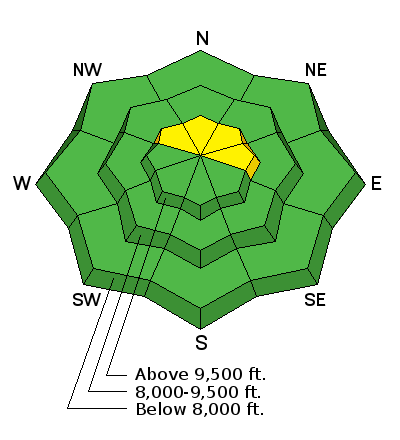
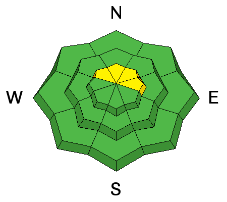
The overall avalanche danger is generally LOW today. You may find a few small wind drifts along the upper ridges mostly on north through east facing slopes.


The overall avalanche danger is generally LOW today. You may find a few small wind drifts along the upper ridges mostly on north through east facing slopes.

Well, there just isn't much going on up on the hills right now. Riding conditions are marginal and avalanche conditions are pretty safe for the most part. Travel is easy with good snow cover up high and supportable conditions most everywhere. Overnight temperatures hovered right around freezing and southerly wind was moderate in speed. Skies were mostly clear so the snow surface should be pretty locked up this morning with firm crusts almost everywhere.
Below is an interesting video talking about avalanche danger ratings:

With a generally LOW danger, there are a few things to consider.
We're going to see increasing clouds today with ridgetop temperatures only into the mid 30s. It's actually possible that we might see some very light snowfall. We should see an increase in northwest wind speed most notably afternoon. Sunday will have partly cloudy skies and slightly warmer temperatures with ridgetop highs around 40 and moderate speed ridgetop southwest wind. A storm will move through starting Monday. It is not looking like a huge event but we might wind up with 6 inches of snow if we're lucky.
We will publish full detailed advisories Saturday and Sunday mornings by 7am. We will also be publishing basic avalanche danger ratings & info during the week.
If you are getting out into the mountains, we love to hear from you! You can SUBMIT OBSERVATIONS ONLINE or EMAIL US
If you would like to have avalanche advisories emailed to you, SIGN UP HERE
We can provide basic avalanche awareness presentations for your school, group or club. To enquire, CLICK HERE