Forecast for the Skyline Area Mountains

Brett Kobernik
Issued by Brett Kobernik for
Friday, February 2, 2024
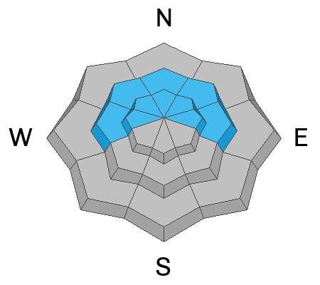
The overall avalanche danger is MODERATE on the Manti Skyline.
Human triggered avalanches are possible today especially on mid and upper elevation very steep slopes that face northwest, north and east.
The danger may increase to CONSIDERABLE by Saturday due to more snowfall and wind which will drift snow.
Low
Moderate
Considerable
High
Extreme
Learn how to read the forecast here
Weather and Snow
Current Conditions: As expected, the first part of the storm didn't produce all that much snow. Only a couple of inches accumulated on the west side of the Skyline. The east side did slightly better with up to 5 inches of new snow. The new snow if fairly high density. Temperatures have remained mild with overnight readings around 30˚F. The wind has been light to moderate in speed from the southeast.
Mountain Weather: We should see some more snowfall today and tonight. Weather models indicate we could see up to an inch of water associated with the snowfall today and tonight. That would translate to about a foot of new snow. I think that's too optimistic. My hunch is we'll see 3 to 6 inches of new snow by Saturday, maybe a bit more if we're lucky. Temperatures today will be in the mid to upper 20s. Wind will start to slowly shift around and come from the southwest then eventually the northwest. The storm will linger into Saturday and start moving out mid day. The wind from the northwest will increase and get a bit breezy tonight into Saturday.
Ad
Avalanche Problem #1
Persistent Weak Layer
Type
Location
Likelihood
Size
Description
A Persistent Weak Layer of sugary faceted snow at the base of the snowpack remains my greatest concern right now. The new snow won't change avalanche conditions a whole lot today but by Saturday we may see an increase in danger. For now, I continue to advise people to avoid steep slopes that face northwest, north and northeast.
General Announcements
This forecast is from the U.S.D.A. Forest Service, which is solely responsible for its content. This forecast describes general avalanche conditions and local variations always occur.