Check out our Holiday Auction - Sign Up for the Utah Snow and Avalanche Workshop (USAW)

Forecast for the Skyline Area Mountains

Brett Kobernik
Issued by Brett Kobernik on
Monday morning, December 4, 2023
The overall avalanche danger is MODERATE today. Human triggered avalanches are possible. The snowpack should stabilize within a day or so but use caution today especially where the wind has drifted new snow.
Low
Moderate
Considerable
High
Extreme
Learn how to read the forecast here
Special Announcements
The 5th Annual Avalanche Awareness Week is December 3-10. The week's goal is to save lives through activities that promote avalanche awareness, education, and safety. We have a variety of events around the state. Find an event near you.
Weather and Snow
Current Conditions: The warm, windy storm that started Friday dropped 10 to 15 inches of high density snow. The north end of the Skyline picked up the most with 15" new but a solid 10" was measured in 12 Mile Canyon. It's a little tricky to measure because depths vary due to wind drifted snow. The new snow is very dense and it landed on lower density snow from last week. This gave it an "upside down" feeling. Skies are clearing and temperatures are hovering around 30˚F. The wind has slowed down and is generally light from the west southwest.
Mountain Weather: We'll have mostly clear skies over the next few days. Temperatures will get into the low 30s today and a bit warmer Tuesday and Wednesday. The wind should be light and variable for the next few days. The next storm should move through Thursday into Friday bringing perhaps another 6 to 8 inches of snow.
Recent Avalanches
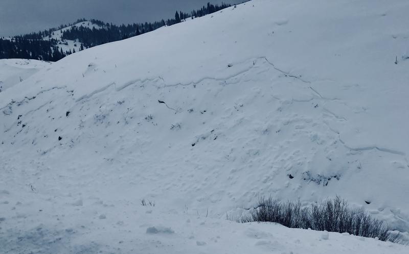
Visibility has been poor making it difficult to look around for avalanche activity. However, Scott Paine spotted this little slide off the side of State Road 264 near Electric Lake. It's a small north facing steep slope that I've found to be an excellent indicator of avalanche activity.
Ad
Avalanche Problem #1
New Snow
Type
Location
Likelihood
Size
Description
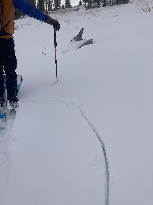
The new dense snow sitting on lighter, lower density snow is the main problem today. This is what we call an "upside down" snowpack. It also is the formula for a slab; strong snow on top of weak snow. This scenario produced a lot of cracking on Sunday and I suspect at least some minor avalanche activity given the small slide described above.
This weakness is widespread on all aspects at the mid and upper elevations. This weakness should settle out and become stable fairly rapidly but anticipate it to be active still today.
There was a small amount of old snow on the ground from October that didn't completely melt away. This snow turned into a weak sugary grain. There's only a few inches of it scattered about on the more northerly high elevation slopes. I don't think this is going to pose too much avalanche threat but I don't know this yet for sure. I'll have a good look around today and should have some answers. In the meantime, if you're getting into high elevation terrain, keep this issue in mind. A few quick snowpit tests should reveal what's going on.
General Announcements
This forecast is from the U.S.D.A. Forest Service, which is solely responsible for its content. This forecast describes general avalanche conditions and local variations always occur.