Current Conditions: Wind. Strong wind from the west really stirred things up over the last 24 hours. Gusts reached 80mph along the highest peaks. The wind maxed out overnight and is now starting to slow a bit but remains pretty strong. We have not seen as much snow as I was expecting. The northern end of the Skyline around Fairview Lakes looks like it's picked up 6 to 8 inches of new snow. It's difficult to confirm amounts because of all the wind drifting that's occurred. The central and southern end of the Skyline has not received any measurable new snow in the last 24 hours. Riding conditions remain challenging. The wind has really made the surface snow thick in many areas. The newer snow is starting to settle and consolidate. On skis Friday, I was staying more near the surface and not punching as deep into the snowpack as I was a few days back. Riders on snowmachines also noted the change. That said, I still trenched DEEP into the pack one time on Friday.
Mountain Weather: We'll see light snowfall today with things ramping up later this afternoon. It's going to be windy today again but probably nothing like it was Friday. Anticipate moderate to strong wind from the west. Temperatures will be a bit warmer than Friday with highs pushing up to near 20˚F. The next storm wave moves through tonight and will last into Monday. Another foot of snow is not out of the question and we could see more.
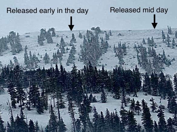
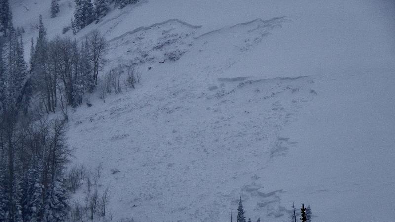
A natural avalanche cycle is in progress. There were natural avalanches that were confirmed to have released during the day on Friday. Photo below: Scotty's in Ephraim Canyon, DJ Osborne.
MORE DETAILS HERE My partner and I were actually able to get into a higher-elevation basin in Spring City Canyon and view some natural activity that released very recently. There is something interesting to note about these slopes. They only release during the most unstable conditions. I've only seen them avalanche a few times since I've been forecasting on the Skyline. Since these slopes released, this tells me that MANY other slopes have also released.