Forecast for the Skyline Area Mountains

Brett Kobernik
Issued by Brett Kobernik for
Sunday, January 13, 2019
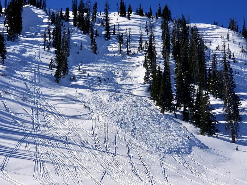
HUMAN TRIGGERED AVALANCHES ARE STILL POSSIBLE especially on slopes approaching 40 degrees in steepness and are more likely on the north end of the Skyline. North through east facing slopes are the most suspect but you could find a pocket on a crossloaded west facing slope as well.
Overall, the avalanche danger is MODERATE across the majority of the Skyline. If you avoid the slopes over 35 degrees, you will stay out of danger from avalanches. There is plenty of good safe riding out there, just use your head.
Low
Moderate
Considerable
High
Extreme
Learn how to read the forecast here
Weather and Snow
It's going to be another nice day in the mountains with mostly clear skies and high temperatures in the mid 20s. Storms for next week are still on track and we could see a decent amount of snow by the end of the week.
Recent Avalanches
There were three Snowmobile triggered avalanches on Saturday, one being a serious avalanche although no one was caught in any of these. A smaller pocket was in Staker Canyon and was about 2 feet deep and 60 feet wide on an east facing slope at about 10,200 feet on a slope of about 40 degrees in steepness. STAKER AVALANCHE REPORT HERE
A medium sized pocket was remotely triggered by snowmobilers meaning they were not directly on the slope when it released. Details on the location of this one are still being reported at this time.
The largest one was in Rolfson Canyon and was 2 to 4 feet deep, 300 feet wide and ran about 500 feet piling up debris 10 feet deep. It was a northeast facing slope that was 40 degrees in steepness at the top. ROLFSON AVALANCHE REPORT HERE
Ad
Avalanche Problem #1
Persistent Weak Layer
Type
Location
Likelihood
Size
Description
The snowmobile avalanches on Saturday fit the pattern to what we've seen since the last storm:
  • They were located on the north end of the Skyline which received the most snow from the last storm
  • They were on slopes of 40 degrees in steepness
  • They were on northerly or easterly facing slopes
  • The slopes had been loaded by the wind
  • They all broke into a "Persistent Weak Layer" of snow that formed in mid December and is now buried by about 2 feet of snow.
If you're getting into big terrain today, ask yourself how many of these characteristics does the terrain have that you're riding in. Human triggered avalanches are again possible today on slopes with these characteristics.
A Persistent Weak Layer is just that. It can "persist" for a long period of time. How long will this layer affect avalanche conditions? It's hard to say for sure, it will depend on how the future storms behave. The good news is that it does not appear to be one of the worst weak layers that I've seen. It is not all that loose and test results in many locations are good. This is also what makes it tricky because it is clearly still capable of producing avalanches.
Additional Information
This forecast is from the U.S. Forest Service, which is solely responsible for its content. This forecast describes general avalanche conditions and local variations always occur.