Heading out early? We record the Dawn Patrol Hotline (888-999-4019 option 6) by about 5-5:30am each morning with a quick summary of weather, recent avalanche activity, and the general avalanche hazard for the day.
The latest blog-casts are out -
Skies are mostly cloudy becoming overcast ahead of the first of two loosely organized storm systems to affect the state through Sunday. Mountain temperatures are in the mid to upper 20s; the southeasterlies continue to blow 25-30mph with gusts to 45 but should lose steam as the storm moves overhead.
The idea that the Inuit have many words for snow is generally attributed to the linguist and anthropologist Franz Boas based upon his research on Baffin Island before, and just after, the turn of the century. Examples included aput, expressing snow on the ground; another one, qana, falling snow; a third one, piqsirpoq, drifting snow; and a fourth one, qimuqsuq, referring to a snowdrift proper.* Current snow conditions in english are otherwise unprintable in this polite company. But conditions should improve with a few inches here and there that may add up to a foot through Sunday.
Yesterday while descending
Stairs Gulch of BCC, a skier unintentionally triggered a shallow 50' wide wind slab that broke above him, catching and carrying him over a 15' cliffband. He sustained minor injuries but was able to self-extricate. (Forecaster Note: Thanks for the observation and report; glad all's mostly well.)
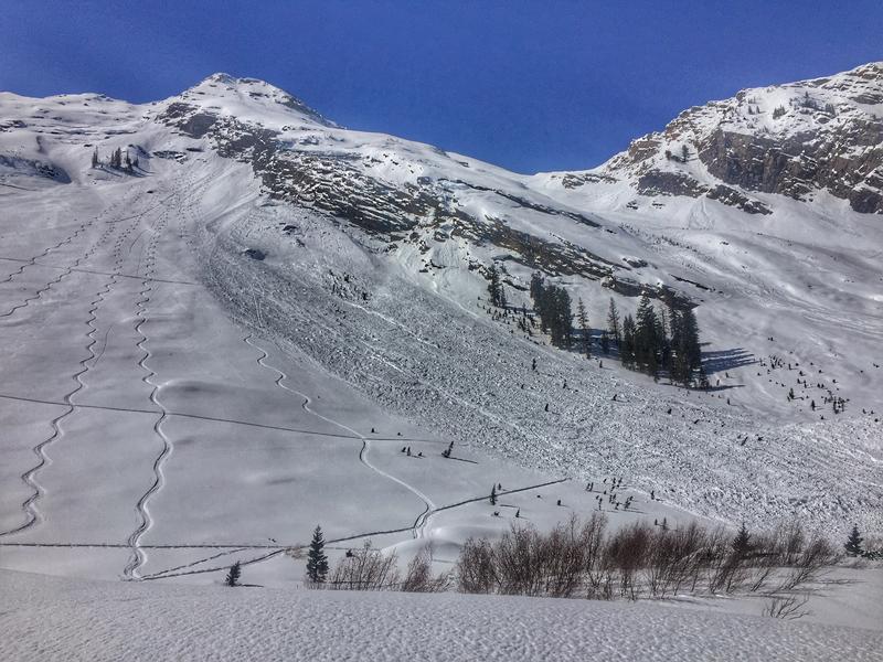
Others noted a significant glide avalanche that likely released on Monday in Broads Fork (between Bonkers and the Diving Board). pic below. The debris easily overran previous tracks. This is roughly 9600' east-northeast facing and classic glide release habitat on the steep and smooth and unsupported rocky slabs in mid-Broads Fork.