Join us at our 2nd Annual Blizzard Ball

Forecast for the Salt Lake Area Mountains

Trent Meisenheimer
Issued by Trent Meisenheimer on
Monday morning, March 1, 2021
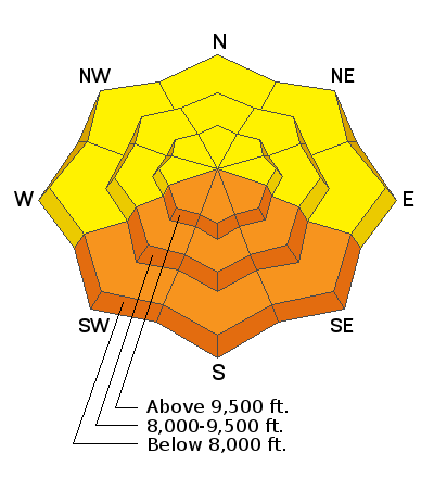
Today will be a day of rising avalanche danger on the southerly-facing terrain due to the strong March sun and rapidly rising temperatures. As the sun heats the snow surface, the avalanche danger will quickly rise to CONSIDERABLE, with natural and human-triggered avalanches becoming likely. Do not overstay your welcome in steep, sunlit terrain. Rollerballs are the first sign that the snow is becoming unstable. (Wet Snow Problem)
There is a MODERATE avalanche danger for triggering a soft slab avalanche that fails 10-18 inches deep within the new storm snow on all aspects at the mid and upper elevations. (New Snow Problem)
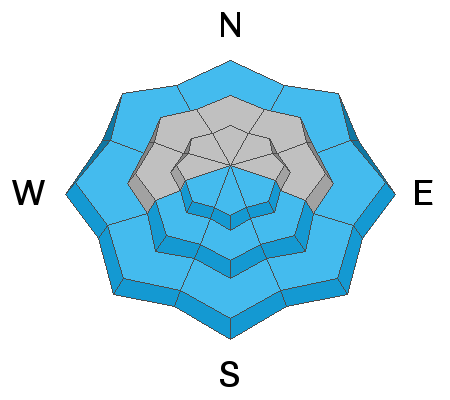
On slopes facing west to north to southeast at the mid and upper elevations, there remains a MODERATE danger for the possibility of triggering a deep and dangerous avalanche on our buried persistent weak layer found towards the bottom of the snowpack. (Persistent Weak Layer Problem)
Low
Moderate
Considerable
High
Extreme
Learn how to read the forecast here
Special Announcements
Monday's Livestream recording of the Wilson Glades avalanche accident debrief and review can be found on our YouTube channel HERE and on the UAC podcast.
Weather and Snow
As a ridge of high pressure builds over Utah, we will see plenty of sunshine for the next two days. Mountain temperatures are going to skyrocket from the strong March sun as well as the warming atmosphere. Winds will be calm with a few gusts here and there. Our next chance for some weather comes on Wednesday. Unfortunately, this system moves onshore as a closed low and doesn't look to favor Northern Utah. A more progressive and active pattern sets up later in the week. For now, bring your sunscreen and skin wax.
Yesterday's 700 millibar (~11,000') temperature was -13°C / 8°F. Today our forecast indicated it would warm to -2°C/ 28°F at 700 millibars. This is very rapid warming over a short time period. Currently, our mountain temperature at 9,600' is 13 °F, and if you compared this to yesterday morning, it's already warmed 16 degrees. Winds are from the northwest and are blowing 5-10 mph across the upper elevations.
The past couple of days of unsettled weather left 10-18 inches of fresh powder on all aspects and elevations, drastically improving the riding and turning conditions. The clouds and cold temps from yesterday kept the snow cold on all aspects. Today will be a different story.
Recent Avalanches
All of yesterday's avalanche activity was confined to the new storm snow, roughly 10-18 inches deep and 40-125 feet wide. Some of these avalanches were reported on southerly aspects, and I suspect crusts and/or the possibility of a facet/crust combo was responsible for the storm snow sliding. On shady aspects, the avalanches again failed 10-18 inches deep, and it's possible the old snow surface was slightly faceted. You can read all the recent observations HERE. Some highlights below:
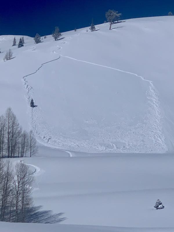
Pinecone Ridge: Human triggered, 10 inches deep, 100 feet wide. Southeast facing at 9600' (photo below).
Patsy Marly: Human triggered, 18 inches deep, 40 feet wide. West facing at 9,600'.
Mineral Fork: Human triggered, 10 inches deep, 40 feet wide. West facing at 8,600'.
Murdock Peak: Natural, 11 inches deep, 60 feet wide. Northeast at 9,200'.
Ad
Avalanche Problem #1
Wet Snow
Type
Location
Likelihood
Size
Description
Rapidly rising temperatures and strong direct sunlight will make the snow unstable on the sunny aspects today. Do not overstay your welcome in steep, sunlit, sustained terrain. If you start noticing the snow surface becoming damp or wet and/or seeing roller balls cascading down, it's time to get out of there. Both human triggered, and natural avalanches will be likely in steep southerly facing terrain today. These avalanches could be large enough to catch, carry and bury a person. If you're exiting out a drainage/canyon bottom late in the day, remember that low elevations (below 8,000') can also be wet and unstable.
As our winter snowpack sees its first real day of warming, be aware of what's above you. Roofs (roof-a-lanches) with winter snowpacks and other hanging snow on structures will likely fall/slide naturally today.
Avalanche Problem #2
New Snow
Type
Location
Likelihood
Size
Description
The list of human-triggered avalanches should be enough to convince us that the new snow can avalanche. These new snow avalanches will be soft storm slabs roughly 10-18 inches deep and up to 125' wide. Hopefully, these storm snow instabilities will settle quickly, but for today I would keep this problem in mind if riding in steeper terrain.
Avalanche Problem #3
Persistent Weak Layer
Type
Location
Likelihood
Size
Description
Our deep slab avalanches, while becoming increasingly stubborn, can roar back to life with any additional stress, i.e., rapid warming, heavy snowfall, strong winds, etc. Cornices may also be a good trigger for these larger avalanches. We haven't heard of any avalanches into this old layering 3-6' deep for a week or so, but they very much remain central to my route selection. These deeper slabs exist on west to north to southeast facing slopes at the mid and upper elevations. We are more likely to trigger these along the Cottonwoods periphery or in steep, thin, rocky terrain.
My travel advice is to continue to avoid being on or beneath steep terrain where there is weak faceted snow on the ground.
General Announcements
Please visit this website with information about Responsible Winter Recreation by the Utah Office of Outdoor Recreation.

This information does not apply to developed ski areas or highways where avalanche control is normally done. This forecast is from the U.S.D.A. Forest Service, which is solely responsible for its content. This forecast describes general avalanche conditions and local variations always occur.