Join us at our 2nd Annual Blizzard Ball

Forecast for the Salt Lake Area Mountains

Drew Hardesty
Issued by Drew Hardesty on
Tuesday morning, February 4, 2020
Areas of MODERATE DANGER exist on all aspects and elevations for new snow avalanches. Human triggered dry sluffs and soft slab avalanches are possible.
An occasional wind drift may be found up high, but these may be more prominent in the lower elevations and foothills.
Low
Moderate
Considerable
High
Extreme
Learn how to read the forecast here
Special Announcements
Discounted lift tickets - Thanks to the generous support of our Utah ski resorts and Ski Utah, all proceeds from these ticket sales go towards paying for avalanche forecasting and education! Get your tickets here.
Weather and Snow
Skies are partly cloudy.
Winds veered to the north and northeast and are blowing 10mph with gusts to 15.
Mountain temperatures are all below zero. 11,000' temps are -10°F. Reynolds Peak at 9400' is a balmy -2°F. Wind chill is -16°F
Snow totals are 10"(0.68"SWE) in upper LCC. 15" was reported mid-canyon.
BCC and PC totals are 6" and 4", respectively (at least in the upper elevations). Greg Gagne reported over 2' of new snow in Porter Fork of Mill Creek Canyon.
Valley and bench totals are 12-20", but that's no secret. The SLC airport set a snowfall record for Feb 3rd with 8.6". The old record of 7" was in 1936.
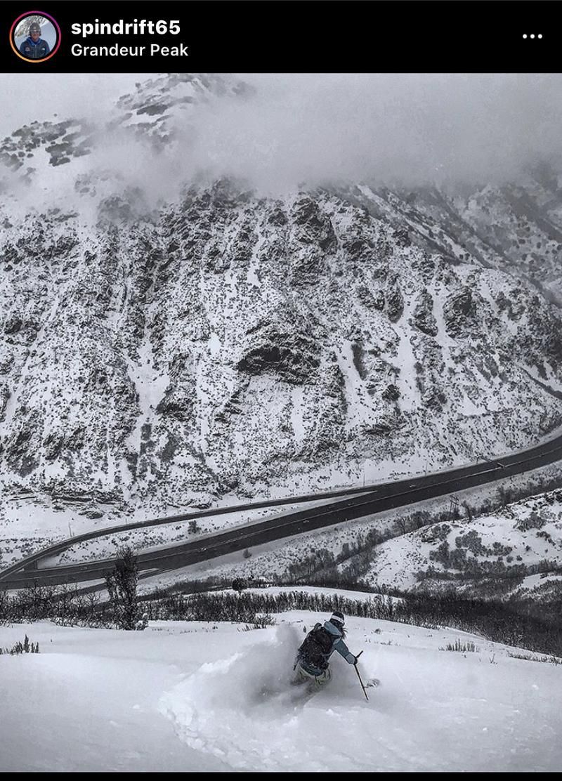
Skiing and riding conditions are good, if not unusual. (Marla looking down on the traffic of I-80; pc: Mark White)

A quick nod to the SLC National Weather Service: yesterday's storm was well forecast and well messaged. Great work to the meteorologists down here.

Today we'll have partly cloudy skies, light north to northeast winds and temps in the low single digits.
The next storm is under Additional Info, below.
Recent Avalanches
Minor sluffing and an occasional shallow wind drift triggered by ski area control teams.
Ad
Avalanche Problem #1
New Snow
Type
Location
Likelihood
Size
Description
Sluffing and soft slab avalanches in the new snow are possible on all aspects and at all elevations. Dry point release avalanches may run naturally or with provocation but they generally need starting zone slope angles pushing 40° degrees. These can be well managed through avoidance (what's above you?) and with ski cuts. They may also run fast and far on the buried crusts beneath and then pile up deeply in terrain traps.
Additional Information
Tree-well immersions and asphyxiation should be on the radar in areas that received the most snow. Frost-bite is of concern. Roof-alanches should also be on the radar in the coming days.

We'll see a break in the action today and tonight before the next storm arrives tomorrow afternoon through Friday. This storm will be quite different: a warm front with heavy, dense snow, warming temperatures, and moderate to strong northwest winds. Upwards of 2' of snow possible by later Friday.
General Announcements
This information does not apply to developed ski areas or highways where avalanche control is normally done. This forecast is from the U.S.D.A. Forest Service, which is solely responsible for its content. This forecast describes general avalanche conditions and local variations always occur.