Forecast for the Salt Lake Area Mountains

Thursday morning, November 12, 2015
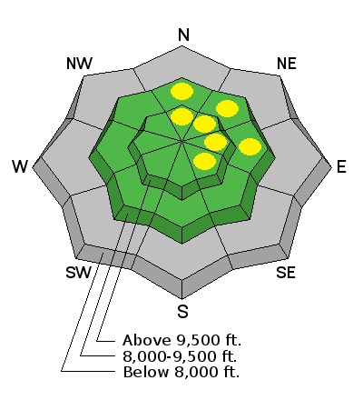
Most terrain harbors a LOW avalanche danger. Pockets of Moderate exist for lingering, isolated pockets of wind drifts in steep wind loaded terrain. These are most pronounced on north through southeast facing slopes along the lee of ridgelines or cross-loaded in chutes and gullies. Cracking or audible collapsing should be enough to steer one away from suspect terrain. With such a thin and shallow snowpack, the best and safest recreational terrain is on lower angle grassy slopes.
The overall avalanche danger will trend toward LOW over the next few days and we will continue to issue advisories as conditions warrant.
 Special Announcements
Uphill travel at Snowbird is currently closed. Public use is prohibited as avalanche control and slope preparation is in progress. Please check here for changes to the status
 Weather and Snow
Skies are mostly clear. Mountain temps are in the teens and low 20s. Winds remain from the west and northwest and generally less than 15mph. Snow stakes across the range depict 10-18" on the ground in the upper elevations on the north side of the compass and this is easily confirmed by anyone heading off-piste among the thinly buried rocks, stumps, and deadfall. It may be enough to say that we kept our skins on for both the uphill and the descent.
 Recent Avalanches
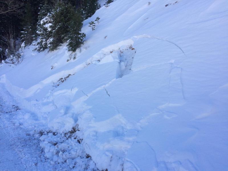
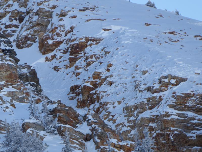
Skiers triggered three avalanches yesterday, predominantly in steep northeast heavily wind drifted terrain above 10,200'. This included one catch and carry in the Baldy chutes of upper Little Cottonwood and fortunately he was only partially buried and did not report any injuries or lost gear. The other two include our own intentionally triggered shallow wind slab off Rocky Point and another intentionally triggered shallow drift out of Gunsight. The three slides in upper LCC were 6-15" deep and generally "pockets" of wind slab with failures both within the storm snow and along the interface of last week's faceted snow. Another fourth slide - an outlier - a snowcat undercutting a cut-bank below the Park City ridgeline pulled out what looks to be a 10" deep and 15' wide piece of snow failing on likely damp faceted snow near the ground. (Photos below: Baldy avalanche noted in afternoon by Kobernik; Gunsight - Barnes; road cut slide by PCMR)
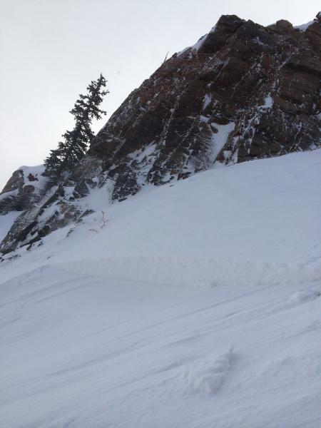
Wind Drifted Snow
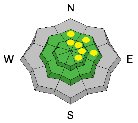
Description
Most activity tends to be active during or just after the height of the storm. The moderate to strong northwest winds made the difference - it seemed night and day looking at snow that harbored the additional wind load and that which did not. Failure planes included both weak interfaces within the storm snow and along the upper boundaries of last week's faceted grains. For today, again look for and avoid the smooth, rounded, rippled, or sculpted whales of snow both just off the ridgelines and in other deceleration zones off the ridgelines. Some of these drifts are soft (you ride through the drift), some of these are hard (you ride on top of the drift- but it commonly buckles and breaks above you). Compare the photo (Barnes) of cracking in wind drifted snow below with forecaster Brett Kobernik's snow test in non-wind drifted snow.

ECT test 20151111, Collins gulch from Brett Kobernik on Vimeo.
Normal Caution
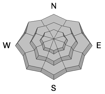
Description
Early Season Info
Remember in this early season you must the mountain resorts as having a backcountry snowpack - we often have early season accidents each season.
Please check in as different mountain resorts have different uphill policies. Some resorts are open to uphill traffic before they open, others not. Please obey all signs, and if you've got questions, stop in and talk to an employee.
We're posting observations from the backcountry on a daily basis now. See or trigger an avalanche? Shooting cracks? Hear a collapse? It's simple. Go here to fill out an observation.
Additional Information
Mostly sunny skies will give way to a few clouds as a clipper races by to the north. Otherwise, we'll have benign weather with light west to northwest winds and temps in the 20s at 10,000', the mid-30s at 8000'. High pressure builds over the next couple days ahead of the next system on the horizon for Sunday night. Some snow and much colder temps look to accompany this system, plunging temps to the low single digits.
General Announcements
Remember your information can save lives. If you see anything we should know about, please participate in the creation of our own community avalanche advisory by submitting snow and avalanche conditions. You can also call us at 801-524-5304, email by clicking HERE, or include #utavy in your tweet or Instagram.
To get help in an emergency (to launch a rescue) in the Wasatch, call 911. Be prepared to give your GPS coordinates or the run name. Dispatchers have a copy of the Wasatch Backcountry Ski map.
If you trigger an avalanche in the backcountry, but no one is hurt and you do not need assistance, please notify the nearest ski area dispatch to avoid a needless response by rescue teams. Thanks.
Salt Lake and Park City – Alta Central (801-742-2033), Canyons Resort/PCMR Dispatch (435)615-1911
Snowbasin Resort Dispatch (801-620-1017), Powder Mountain Dispatch (801-745-3772 x 123).
Sundance Dispatch (801-223-4150)
EMAIL ADVISORY If you would like to get the daily advisory by email you will need to subscribe here.
DAWN PATROL Hotline updated daily by 5-530am - 888-999-4019 option 8.
Twitter Updates for your mobile phone - DETAILS
UDOT canyon closures: LINK TO UDOT, or on Twitter, follow @UDOTavy, @CanyonAlerts or @AltaCentral
Utah Avalanche Center mobile app - Get your advisory on your iPhone along with great navigation and rescue tools.
Wasatch Powderbird Guides Blog/Itinerary for the Day.
Lost or Found something in the backcountry? - http://nolofo.com/
To those skinning uphill at resorts: it is your responsibility to know the resort policy on uphill travel. You can see the uphill travel policy for each resort here. IMPORTANT: Before skinning or hiking at a resort under new snow conditions, check in with Ski Patrol. Resorts can restrict or cut off access if incompatible with control and grooming operations.
Benefit the Utah Avalanche Center when you shop from Backcountry.com or REI: Click this link for Backcountry.com or this link to REI, shop, and they will donate a percent of your purchase price to the UAC. Both offer free shipping (with some conditions) so this costs you nothing!
Benefit the Utah Avalanche Center when you buy or sell on ebay - set the Utah Avalanche Center as a favorite non-profit in your ebay account here and click on ebay gives when you buy or sell. You can choose to have your seller fees donated to the UAC, which doesn't cost you a penny.
This information does not apply to developed ski areas or highways where avalanche control is normally done. This advisory is from the U.S.D.A. Forest Service, which is solely responsible for its content. This advisory describes general avalanche conditions and local variations always exist.


