Forecast for the Provo Area Mountains

Issued by Nikki Champion on
Tuesday morning, March 11, 2025
Tuesday morning, March 11, 2025
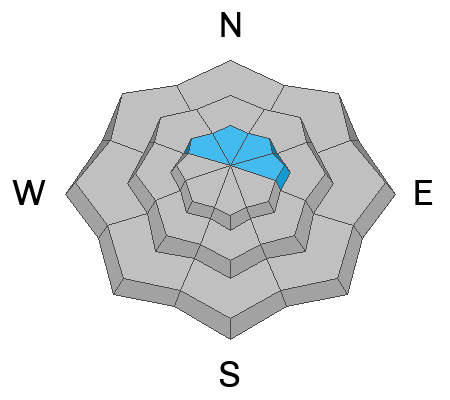
The avalanche danger is MODERATE on steep northwest, north, and northeast-facing slopes at mid and upper elevations, where human-triggered avalanches, 1 to 4 feet deep, remain possible on one of two buried weak layers. This is especially a concern in areas where both hard and soft slabs of wind-drifted snow have formed. Evaluate snow and terrain carefully today.
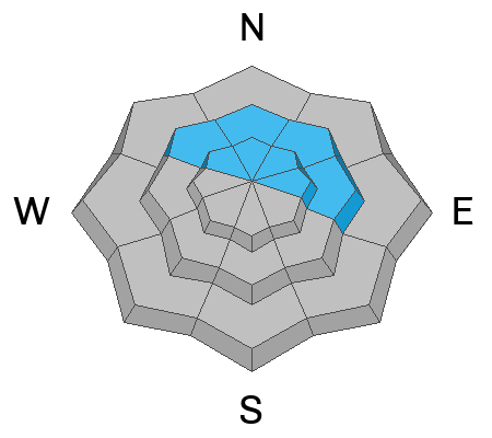
The remaining aspects and elevations will rise to MODERATE by this afternoon due to wet snow. This problem is all about timing—danger increases as the sun heats the snow. Start early, watch for warming, and get off solar slopes before they become unstable.
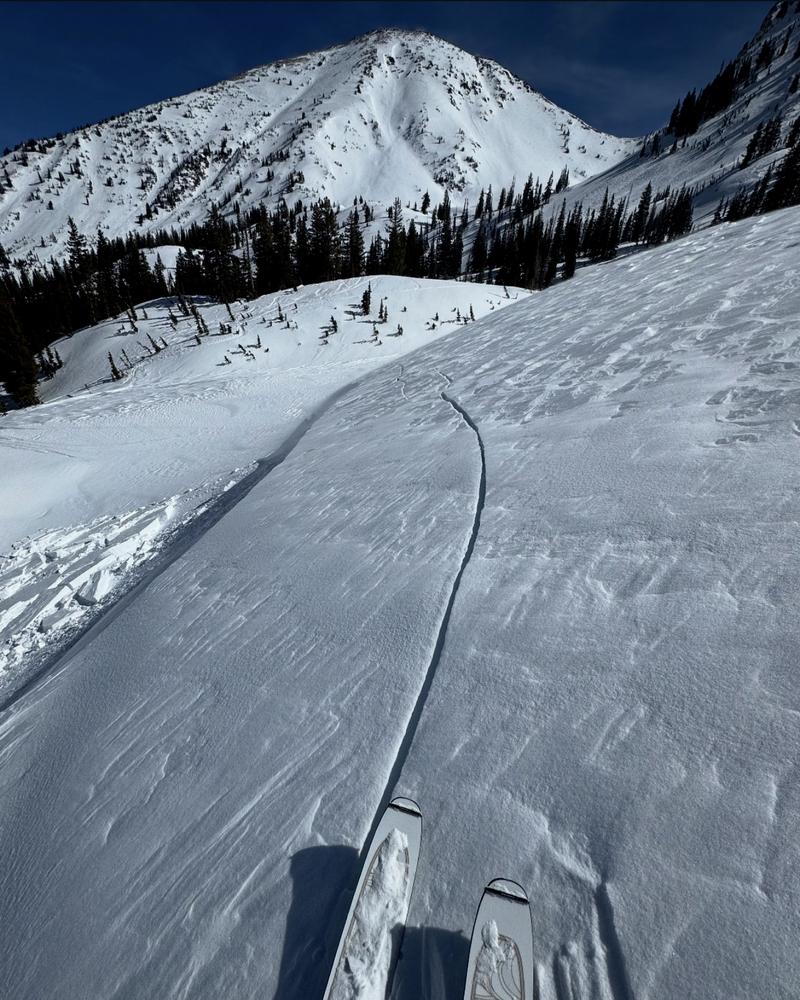
In the Provo Region, wet snow avalanches can run long distances, sometimes reaching below the snow line and crossing summer hiking trails. This means that even those not traveling in avalanche terrain could be caught in a late-afternoon wet slide descending from above.
In the Provo Region, wet snow avalanches can run long distances, sometimes reaching below the snow line and crossing summer hiking trails. This means that even those not traveling in avalanche terrain could be caught in a late-afternoon wet slide descending from above.

Low
Moderate
Considerable
High
Extreme
Learn how to read the forecast here