Cold mountain.
Mountain temperatures are in the single digits. Cold air flowing down Primrose Cirque has Aspen Grove temps of -3°F.
Winds, mercifully, have lost steam and are blowing 10-15mph from the north-northwest. At 11,000', hourly averages are 20mph with gusts to 35.
Today's weather will be clear and cold. Mountain temperature will slowly struggle into the teens. Winds will be light from the northwest.
High pressure briefly builds across the area through tomorrow and Saturday with a cut-off Low pressure system diving well to the south. The northern branch of the split-flow system will graze northern Utah Saturday night and produce a couple inches of snow. Another disturbance moves through on this northwest flow Sunday night into early Monday. These, mind you, are just setting the table for what looks to be a significant and complex weather system for early/mid next week. It's still a few days away and a number of details will become more clear, but it initially looks wet, warm, and windy. It has my attention.
Nothing good comes from an east wind.
We did not hear of any avalanche activity in the Provo area mountains yesterday. UAC staff Dave Coyne toured in Primrose and did not find any wind slabs; however I can't discount that they don't exist anywhere.
In the Central Wasatch....below
The north to east (
from the north and east) winds tormented even the low elevations and people found sensitive, albeit pockety, conditions even in the low elevation bands just under 8000'. Extensive down canyon winds also triggered some avalanches, with powderclouds roaring down some of the steepest (do people use the word Extreme anymore?) north facing couloirs in lower LCC. One person ascending Coalpit 4 was caught and carried 150' and lost gear but was otherwise ok. His partner was briefly caught but not carried (
Report).
Ski area avalanche teams triggered spotty and shallow soft slabs of wind drifted snow on a variety of aspects and elevations and this was mirrored by activity in the backcountry. A few examples below:
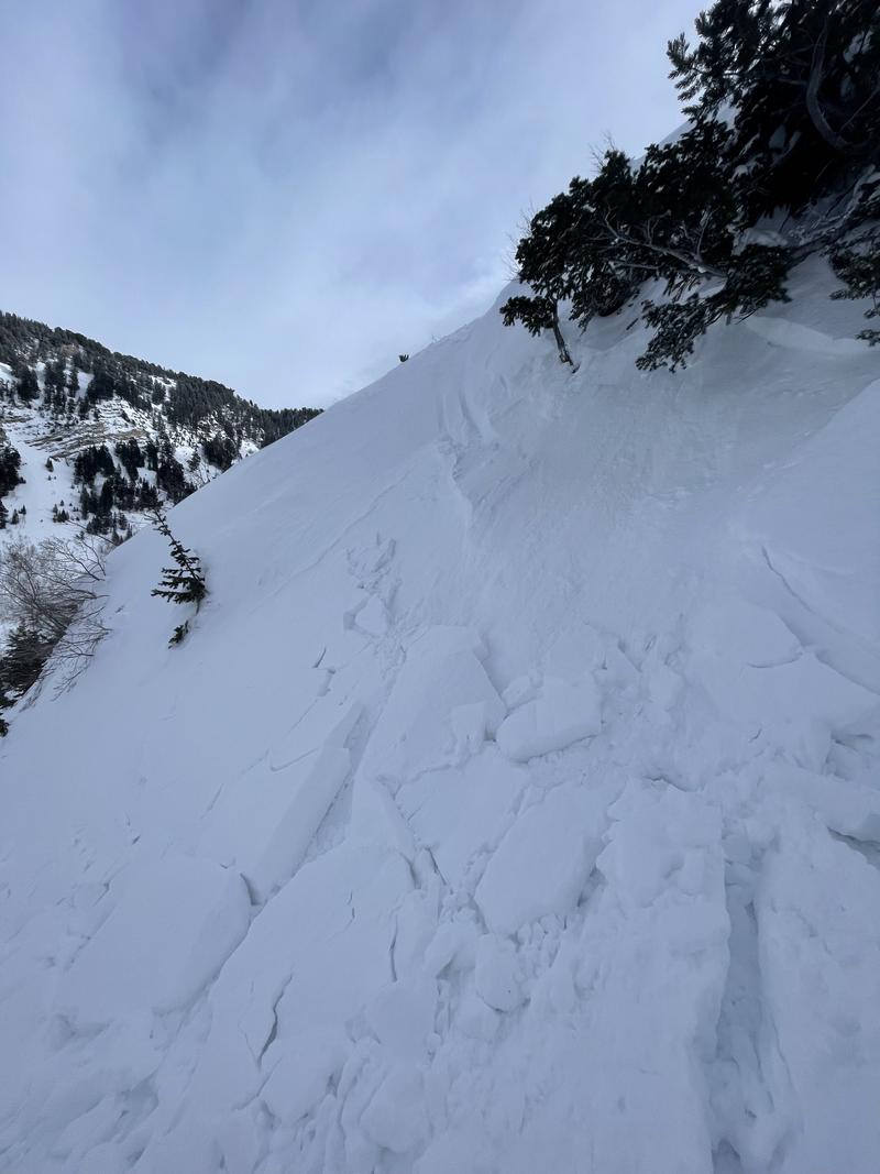
- Days Fork NE 9000' 6" deep and 10' wide (photo below)
- Bells Canyon NW 8100' 8" deep and 20' wide
- Neffs Canyon NW 8700' estimated 6-10" deep and 100' wide.
- A backcountry party experienced cracking and collapsing in Neffs Canyon at 7300', took the hint, and changed course.
Find all the recent observations
HERE.