UDOT PLANNED AVALANCHE CLOSURES!!

Forecast for the Provo Area Mountains

Evelyn Lees
Issued by Evelyn Lees on
Thursday morning, December 20, 2018
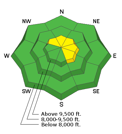
The avalanche danger is MODERATE for the isolated chance of triggering a slab avalanche 2 to 4 feet deep, on upper elevation slopes facing northwest through easterly, especially those with any recent drifts of wind blown snow.
There is also a MODERATE danger for triggering a new wind slab or wind drift, which will be scattered throughout the mid and upper elevation terrain.
Low
Moderate
Considerable
High
Extreme
Learn how to read the forecast here
Special Announcements
The new UAC IOS mobile app is now available on the app store. Check out the new "My Weather" feature.

Check out the new free online avalanche course series developed by the Utah Avalanche Center. This is a great way to refresh your skills or prepare you for a Backcountry 101 or Level 1 class.
Weather and Snow
Yesterday’s storm - of furious winds and a trace of snow - is moving to the east, and being replaced by strong high pressure. Temperatures are in the 20s at most stations this morning, and will soar into the mid 40s at the 8000’ level, and low 30s at 10,000’ by afternoon under sunny skies. Winds have shifted back to a more southerly direction, and are almost calm. Speeds should remain less then 20 to 30 mph today.
Recent Avalanches
In the Primrose Cirque above Aspen Grove on Saturday, a skier and a dog took a small ride in a wind slab while walking uphill. This wind slab was 70' wide and around a foot deep. The group decided not to head up any higher due to more consequential terrain above. All observations can be found HERE.

Drew went to look at the conditions in the Provo mountains Sunday. We did note one large natural avalanche high along the Cascade ridgeline from one of the recent wind events to confirm evidence of old snow layering.
Ad
Avalanche Problem #1
Persistent Weak Layer
Type
Location
Likelihood
Size
Description
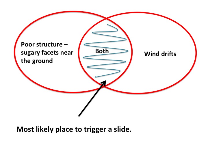
No recent avalanches have been reported, but poor snow pack structure remains on shady mid and upper elevation slopes. This layering is known as “strong over weak” - a denser slab of snow above a persistent weak layer of sugary, faceted snow. While this layering has not produced avalanches the past few days, it’s hard to completely trust it.
The strong winds will find some snow to drift, adding a little more weight in the form of wind drifts. Steep, rocky north and north easterly facing terrain with fresh wind drifts is particularly suspect, and even slopes that have already slid this season can slide again.
Avalanche Problem #2
Wind Drifted Snow
Type
Location
Likelihood
Size
Description
Yesterday’s strong winds eroded a lot of snow, creating small, isolated drifts. Mountain terrain channels the wind in odd ways, so look for these hard, rounded, hollow sounding wind slabs or drifts on a variety of aspects and elevations. They will be on the lee sides of ridge crests and around terrain features, like gully walls, sub ridges and down into open bowls at both the mid and upper elevations
General Announcements
This information does not apply to developed ski areas or highways where avalanche control is normally done. This forecast is from the U.S.D.A. Forest Service, which is solely responsible for its content. This forecast describes general avalanche conditions and local variations always occur.