Forecast for the Provo Area Mountains

Mark Staples
Issued by Mark Staples on
Wednesday morning, November 27, 2019
HEADS UP: The avalanche danger will be increasing during the next few days as a major storm impacts most of the state. We have issued an Avalanche Watch which means we expect very dangerous avalanche conditions to develop within the next 24-48 hours.

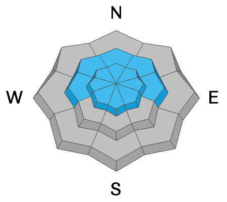
Today, the avalanche danger is CONSIDERABLE on upper elevation northerly facing slopes. A combination of wind drifted snow and old, weak, faceted snow underneath will create dangerous avalanche conditions on these slopes. Other slopes have a MODERATE danger because they have been scoured or don't have the old weak snow underneath.
Slopes at low elevations and south-facing slopes mid-elevations, simply don't have enough snow to ride and hardly enough snow to create an avalanche, thus they have a LOW danger.

What to do? The only viable strategy is to ride low angle slopes (less than 30 degrees in steepness) which are not steep enough for an avalanche. Also, avoid being underneath steep slopes.
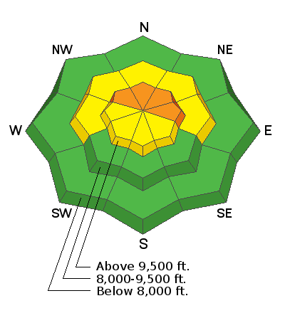
Low
Moderate
Considerable
High
Extreme
Learn how to read the forecast here
Avalanche Watch
IN EFFECT FROM 6 AM MST THIS MORNING TO 6 AM MST THURSDAY MORNING
FOR THE CENTRAL AND SOUTHERN WASATCH RANGE, INCLUDING THE WESTERN UINTAS.
THE AVALANCHE DANGER IS EXPECTED TO RISE TO HIGH WITH THE FORECAST HEAVY SNOW AND WIND.
DANGEROUS AVALANCHE CONDITIONS ARE EXPECTED. HUMAN TRIGGERED AND NATURAL AVALANCHES ARE LIKELY. STAY OFF OF AND OUT FROM UNDER SLOPES STEEPER THAN 30 DEGREES. AVALANCHES MAY BE TRIGGERED FROM A DISTANCE OR FROM BENEATH STEEP SLOPES.
Special Announcements
The First Annual Statewide Avalanche Awareness Week is December 2-7. We have a week full of fun and educational events planned. Check out the schedule here.
Weather and Snow
Winds ramped up this morning ahead of the next storm. At 5 a.m. southerly winds at the highest peaks were blowing 50 mph gusting 60-70 mph. At lower elevations, remote stations are showing winds only blowing about 10 mph. Given reports of strong winds in other places, I suspect winds maybe blowing stronger than what these weather stations are showing.
Temperatures were mostly in the mid teens F. Wind chill temperatures are well below zero F.
Snowfall was just beginning this morning and 3-5 inches had accumulated by 5 a.m.
Today snowfall will increase and produce about a foot of snow by this evening. Exactly how much snow will be dependent on how this storm unfolds. Much of the precipitation could remain a little west or the system could line up directly over the Wasatch and produce more snow than expected. Temperatures will remain cold and only reach about 20 degrees F at lower elevations and mid teens F at upper elevations.
Scroll to the bottom of the page for a video from the National Weather Service about this storm.
Recent Avalanches
None reported
Ad
Avalanche Problem #1
Persistent Weak Layer
Type
Location
Likelihood
Size
Description
Old snow covered some upper elevation, northerly facing slopes through much of November, and that snow became weak and faceted. This weak snow has soft slab of new snow on top of it now. Yesterday's new snow wasn't enough of a load to stress this weak snow and cause avalanches. That should change today as a result of strong south winds transporting snow this morning followed by snowfall today. The combination of this wind-blown snow and snow falling from the sky will stress the weak, faceted snow underneath. This added stress will make human triggered avalanches likely and create dangerous avalanche conditions.
The dilemma is that with such early season conditions, the deepest snow and best coverage is on upper elevation, north-facing slopes. These slopes are the ones that will produce avalanches. The only option is then to find similar slopes that are not steep enough to avalanche (less than 30 degrees in steepness). South-facing slopes simply don't have enough snow to ride today.
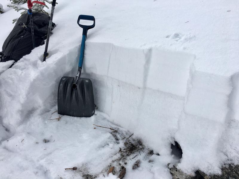
The photo below shows about a foot of weak snow underneath about 9 inches of soft new snow. It was taken on a north facing slope at 10,000 feet in upper Little Cottonwood Canyon. I suspect similar snowpack layering exists on the upper parts on Mt. Timpanogos and other mountains near Provo.
Avalanche Problem #2
Wind Drifted Snow
Type
Location
Likelihood
Size
Description
Expect both hard and soft slabs of wind drifted snow from this morning's very strong southerly winds.
These fresh slabs will be especially sensitive and break over a wider area on northerly facing slopes where they rest on top of the old, weak, faceted snow. What complicates the situation is that yesterday's strong north winds loaded some south-facing slopes where avalanches remain possible.
Additional Information
Below is a video from the National Weather Service outlining how the storm over the next few days could unfold.
General Announcements
This information does not apply to developed ski areas or highways where avalanche control is normally done. This forecast is from the U.S.D.A. Forest Service, which is solely responsible for its content. This forecast describes general avalanche conditions and local variations always occur.