Are you snowpack curious? wondering how the Persistent Weak Layer went from Zero to Hero. Well, then, you came to the right place! Please join Craig Gordon at 6:00 pm Monday, January 23rd, in Park City at the Kimball Junction Library for a State of the Snowpack presentation. It's going to be informative, educational, and quite possibly entertaining :)
Overnight under clear skies, the mountain temperatures plummeted and are frigid (at least for Utah standards), ranging from 2°F in the valley bottoms to 15°F at ridgetop, with windchill in the negatives. Winds have increased overnight and are currently blowing from the westerly direction at speeds of 10-20 mph across the upper elevations.
Today we will see increasing clouds, cold temperatures (15-19 °F), and snow as a closed low quickly tracks south through Utah. The cold front is expected to cross overhead between 8:00 am and 1:00 pm today. During this time, we will see an increase in northwest winds, with speeds of 15-25 mph and snowfall rates of 1" per hour possible. However, the storm is short-lived as it digs too deep and heads for the US/Mexico border, where it spins off to the east toward Texas. We can expect 2-6" of new snow throughout the day.
Once this storm tracks south of Utah this afternoon, the winds will veer from northwest to north to northeast and east, increasing in speed with averages in the 15-25 mph range and gusts into the 40s. I don't usually complain about storms, but I'd complain about this one. No good ever comes from east winds.
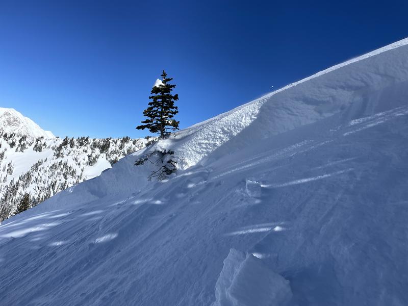
Backcountry riders reported sensitive wind slabs up to 1-2 feet deep. A couple of parties backed off their objectives on Provo Peak and Timpanogos because of these wind slabs. Most wind slab avalanches were 1-2 feet deep and up to 50 feet wide. However, there was one natural wind slab avalanche reported in upper
White Pine Canyon that was large enough to bury a person. Check out all the observations
HERE.
Photo: W.Shirey showing a wind slab they triggered in White Pine Canyon, LCC.


