Join us at our 2nd Annual Blizzard Ball

Forecast for the Provo Area Mountains

Trent Meisenheimer
Issued by Trent Meisenheimer on
Saturday morning, January 22, 2022
The danger is generally LOW and avalanches are not expected. Remember that LOW danger does not mean NO danger - risk is inherent in mountain travel.
Low
Moderate
Considerable
High
Extreme
Learn how to read the forecast here
Special Announcements
Thanks to the generous support of our local resorts and Ski Utah, discount lift tickets are now available. Support the UAC while you ski at the resorts this season. Tickets are available here.
Weather and Snow
Under clear skies, the current mountain temperatures range from 12°-16°F with some valley bottoms in the single digits °F. Overnight at 11,000', there was a seven-hour period where the northeast winds blew 15-20 mph across the uppermost terrain. This morning, the winds continue to be from the northeast but thankfully aren't blowing too strong. Most upper elevation anemometers are spinning 10-15 mph with the occasional gust into the 20's.
Today, we will see plenty of sunshine with temperatures warming into the 30°-35°F range at 8,500'. Winds are forecast to remain light and from the northeast.
Recent Avalanches
None.
Ad
Avalanche Problem #1
Normal Caution
Type
Location
Likelihood
Size
Description
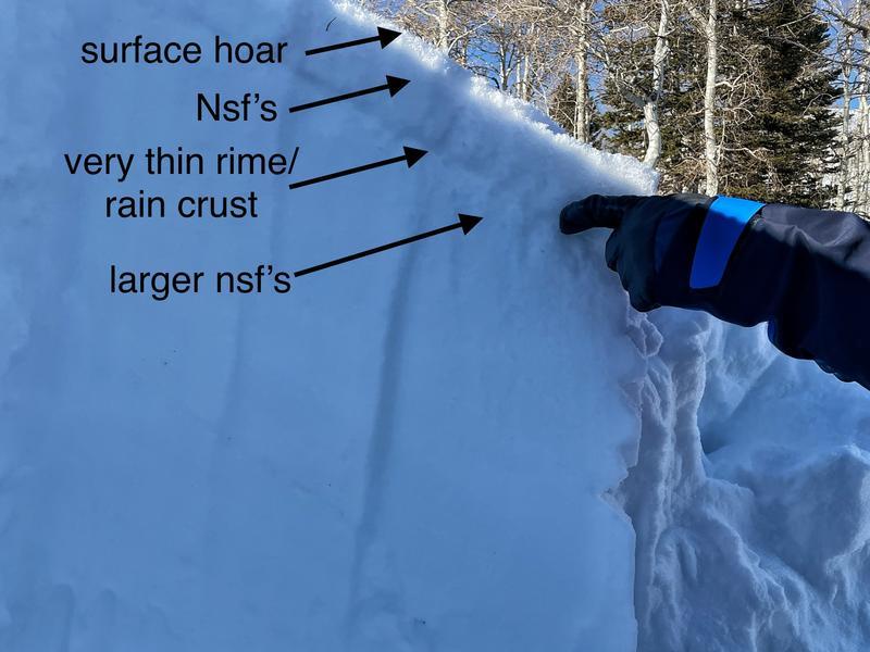
Mark and Trent were down near Mt Nebo on Thursday and their observation is HERE>. They found stable snow but weak snow developing at the snow surface. Photo below.
Normal caution is used when the avalanche danger is LOW and there is no predominant type of avalanche problem. Although avalanches are unlikely, they are not impossible and they could occur in isolated terrains, such as
  • small isolated areas of wind drifted snow in upper elevation terrain features that allow for drifting, such as gullies, sub ridges and directly below ridgelines;
  • a larger avalanche breaking down into faceted snow in steep, thin rocky terrain on aspects facing northwest through east at the mid and upper elevations.
Note - if you're headed into the upper reaches of American Fork or toward the LCC/AF ridgeline, the danger may trend more to Moderate. Consult the SLC forecast.
General Announcements
Who's up for some free avalanche training? Get a refresher, become better prepared for an upcoming avalanche class, or just boost your skills. Go to https://learn.kbyg.org/ and scroll down to Step 2 for a series of interactive online avalanche courses produced by the UAC.
This information does not apply to developed ski areas or highways where avalanche control is normally done. This forecast is from the U.S.D.A. Forest Service, which is solely responsible for its content. This forecast describes general avalanche conditions and local variations always occur.