Join us at our 2nd Annual Blizzard Ball

Forecast for the Provo Area Mountains

Drew Hardesty
Issued by Drew Hardesty on
Saturday morning, January 14, 2023
Areas of MODERATE DANGER exist for triggering soft and hard slabs of wind blown snow. In isolated areas on northwest to easterly facing slopes, it may be possible to trigger a large avalanche that steps into older weak layers from November.
Low
Moderate
Considerable
High
Extreme
Learn how to read the forecast here
Weather and Snow
Skies are mostly cloudy.
Mountain temperatures are in the low to mid-30s. Winds are from the southwest, blowing 25-30mph with gusts to 45. The most exposed ridgelines are seeing hourly averages of 35-40mph with gusts to 50. Sun, wind, and warm temperatures have taken a toll on the riding conditions, but another storm is on the doorstep. Coverage, however, is amazing, with 90-110" of snow in the mid-elevations and 60" at the trailheads.
Today we'll have increasing clouds with light snowfall in the afternoon. Mountain temperatures will be in the mid-20s up high, the low 30s down low. Moderate winds will blow from the southwest with occasional strong gusts. The bulk of the snowfall will be tonight through tomorrow. 4-8" may be expected, with higher amounts in favored areas. A weaker storm is slated for Monday night and perhaps another storm on Thursday.
Recent Avalanches
No new avalanches were reported from the backcountry yesterday. Ski area control teams triggered new soft slabs of wind blown snow and cornices were breaking back further than expected.
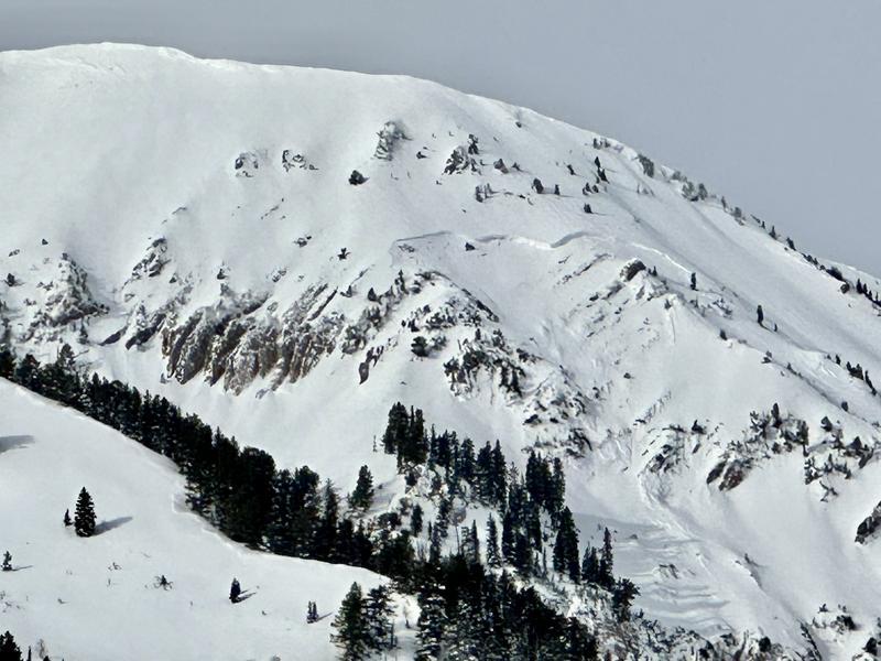
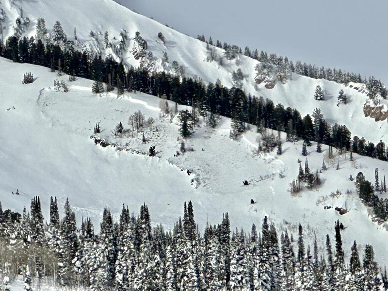
Thursday's and Friday's clearing skies provided for first class avalanche viewing, from Logan to Ogden to the central Wasatch and down to Provo. These avalanches are something to behold. I have to say that these large destructive natural avalanches are - again - nothing short of amazing. Forecaster Dave Kelly and his partner Nat Grainger found more evidence of these large naturals near Box Elder Peak yesterday. Full report HERE.
Ad
Avalanche Problem #1
Wind Drifted Snow
Type
Location
Likelihood
Size
Description
Today, you'll find shallow soft and hard slabs of wind driven snow, particularly on west to north to easterly facing aspects. These will be primarily in the upper elevation bands, but pockets of soft slab may be found to the lee of mid-elevation ridgelines. Drifts will be smooth and sculpted and may crack out upon approach. Shooting cracks may or may not be present.
Avalanche Problem #2
Persistent Weak Layer
Type
Location
Likelihood
Size
Description
The mid week storm produced many large hard slab natural avalanches failing on our persistent weak layer of facets (PWL) from mid-November. Many of these avalanches were 4-6' deep....and upwards of 10' deep in heavily wind loaded terrain. The PWL is so deeply buried that it would require a significant trigger (large cornice, multiple people on a slope, powerful storm) to avalanche. For skiers and riders, it may require finding a thinner snowpack area (4' deep or less) to trigger one of these avalanches. The trend is toward stabilization and I suspect we will remove this as an avalanche problem soon.
Another natural avalanche on Box Elder
Additional Information
Large natural avalanche Bridal Veil Falls, Provo Canyon January 10th, 2033
General Announcements
This information does not apply to developed ski areas or highways where avalanche control is normally done. This forecast is from the U.S.D.A. Forest Service, which is solely responsible for its content. This forecast describes general avalanche conditions and local variations always occur.