


Forecast for the Ogden Area Mountains

Issued by Greg Gagne on
Friday morning, February 2, 2024
Friday morning, February 2, 2024
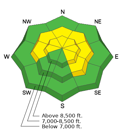
The avalanche danger is MODERATE on steep mid and upper-elevation slopes facing west through north and southeast where there is a possibility of triggering a large and dangerous avalanche failing in a buried persistent weak layer. If you trigger one of these avalanches, it will break 3-6' deep and well over a hundred feet wide. The avalanche danger could rise to MODERATE at the mid and upper elevations if snowfall totals today approach 6".
There is a LOW danger at low elevations and slopes facing south and southwest.
Expect a rising avalanche danger with snow and wind forecast through much of the next 7 days.
Low
Moderate
Considerable
High
Extreme
Learn how to read the forecast here
 Weather and Snow
Overnight into this Morning: Temperatures are a few degrees on either side of 30° F. Winds are from the south/southeast and light at low and mid elevations, with gusts into the lower 20's mph at the upper elevations. Snowfall began overnight with 1-2" as of 6 am.
Today: Temperatures will reach the mid 30's F. Winds will be from the south this morning and shifting westerly throughout the day, with a west/northwest wind by sundown. Wind speeds will remain light at low and mid elevations, with gusts into the 20's mph at the upper elevations. 2-4" of snow with periods of heavy snow possible, especially by late afternoon.
This Weekend and Beyond: More snow overnight and into Saturday, with weekend snow totaling over a foot. A brief break on Sunday with heavy snow likely Monday through at least Wednesday.
 Recent Avalanches
No avalanches were reported from the backcountry on Thursday, to our south in the Salt Lake mountains, three large avalanches failing in the PWL over the past six days should stay on everyone's mind as there is a similar structure in the Ogden mountains:
Monday - Natural avalanche in Mineral Fork
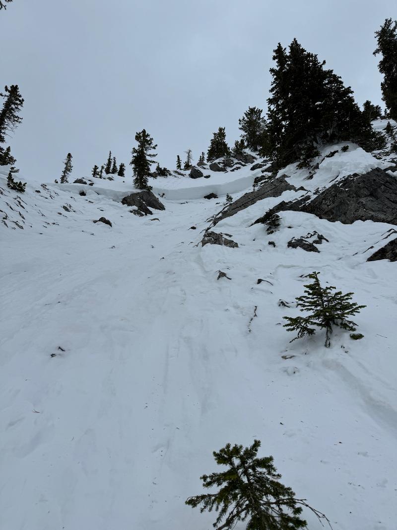
Tuesday - Skier-triggered avalanche in Days Fork (photo below looking up at the crown which was 6' deep in places)
These avalanches were 3-6' deep, well over a hundred feet wide, and running up to 2,000'. The two skier-triggered avalanches were close calls, and luck is not a good strategy when dealing with a PWL.

Avalanche Problem #1
Persistent Weak Layer
Type
Location
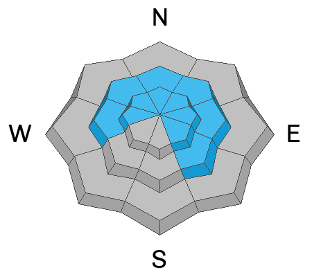
Likelihood
Size
Description
Three avalanches failing in the persistent weak layer (PWL) over the past week indicates this avalanche problem remains a serious concern. Yesterday, UAC forecaster Dave Kelly and I visited the site of Tuesday's skier-triggered avalanche in Days Fork. This avalanche occurred on a steep, upper-elevation north-facing slope and was most likely triggered from a thin spot on the slope and propagated well over a hundred feet wide, with a crown up to 7' deep in places.
UAC forecaster Nikki Champion was in Mineral Fork and describes the PWL issue in her observation and this video:
General Announcements
This information does not apply to developed ski areas or highways where avalanche control is normally done. This forecast is from the U.S.D.A. Forest Service, which is solely responsible for its content. This forecast describes general avalanche conditions and local variations always occur.