Join us at our 2nd Annual Blizzard Ball

Forecast for the Ogden Area Mountains

Drew Hardesty
Issued by Drew Hardesty on
Thursday morning, December 19, 2024
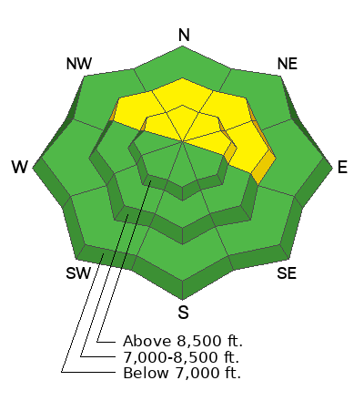
The avalanche danger is MODERATE on mid and upper elevation northwest to north to east-facing slopes, where it's possible to trigger avalanches failing on buried weak, faceted snow. Human triggered avalanches are possible. You may also find a pocket of hard slab in the high alpine around terrain features.
Lastly, don't underestimate today's sun and warming temperatures: WET LOOSE SLUFFS may become problematic on steep solar aspects.
Low
Moderate
Considerable
High
Extreme
Learn how to read the forecast here
Special Announcements
Now is a great time to dial in your safety gear including putting fresh new batteries in your beacons! Local shops across the state will be handing out free Batteries for Beacons now until February 1, 2025. All you need to do is fill out a quick survey and grab the AAA or AA batteries you need to keep your beacon fresh this season. Find participating shops and more info here.

Join the UAC and DPS Skis for a fun night of Avalanche Jeopardy this Friday, December 20th from 6:00 - 8:30 PM at Industry SLC. More information for this FREE event is available here. See you there!
Weather and Snow
Skies are clear, ain't it a shame. At least temperature inversions are building under a transitory weak ridge of high pressure. Mountain temps are in the low to mid-30s and winds are light to moderate from the west. For today, we'll have sunny skies, light westerly winds and temps rising to the low to even mid-40s. Riding conditions are best described as thin and variable with a thin crust from Tuesday's rain event to 6500' or so.
We do have the chance of a couple inches of new snow with a weak storm late Sunday. The longer range models tease of a pattern change Christmas through New Year's.
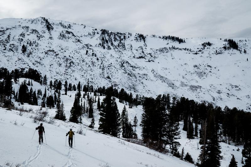
Photo from our outing on the Cutler ridge yesteday with Bill Brandt. Our observation HERE>
Recent Avalanches
There was no reported avalanche activity yesterday. Three days ago, snow safety teams reported triggering (remotely and with explosives) persistent weak layer avalanches in mid and upper elevation north-facing, wind-loaded terrain.
Read all observations here.
Ad
Avalanche Problem #1
Persistent Weak Layer
Type
Location
Likelihood
Size
Description
Like many other areas of the Wasatch, the Ogden mountains has a generally poor thin snow structure with a checkerboard of hard and soft 'strong' snow over a PWL (persistent weak layer) of weak sugary faceted grains from early season. Avalanches running on this structure have been isolated and spotty, but enough to keep me from getting into steep polar terrain, particularly steep polar terrain that has recently been wind loaded. Despite the fact that the last reported avalanches on this layering were in the moutains east of Eden three days ago, remember that these weak layers are called persistent for a reason. Collapsing and cracking may or may not accompany other signs of unstable snow.
Avalanche Problem #2
Wind Drifted Snow
Type
Location
Likelihood
Size
Description
The relentless winds...They've been from both the northwest and the southwest over the past few days and the landscape is littered with pockets of soft and hard slab. You can still manage to trigger one of these today; most likely in the higher elevation bands.
General Announcements
This information does not apply to developed ski areas or highways where avalanche control is normally done. This forecast is from the U.S.D.A. Forest Service, which is solely responsible for its content. This forecast describes general avalanche conditions and local variations always occur.