Check out the Banff Mountain Film Festival at Grand County High School tonight, March 7, and Tuesday, March 8 at 7:00 p.m. Buy tickets for $10 in advance at Back of Beyond Bookstore, 83. N. Main St., Canyon Voyages Adventure Co., 211 N. Main St., Pagan Mountaineering, 59 S. Main St., and Poison Spider Bicycles, 497 N. Main St.or $15 at the door. Procedes benefit the Utah Avalanche Center Moab, and Second Chance Wildlife Rehabilitaiton.
Skies are clear, temperatures are cold, and 6-10" of new snow grace the mountains from the Monday night - Tuesday morning storm. Northeast winds overnight have been light but have picked up into the 15-20 mph range as of 5:00 a.m. I took a tour yesterday up along Pre Laurel ridge and down into Gold Basin, and conditions are vastly improved with great riding and turning below tree line, and on sheltered, upper elevation, north facing terrain. Above treeline winds during the storm managed to do some sculpting, primarily on south and west facing aspects and along exposed ridgecrests. Needless to say, it will be a great day to get out in the mountains with the only drawback being the strong March sun. It only came out for a few hours yesterday, but it was long enough to moisten exposed aspects and these slopes will have developed a thin crust overnight.
Base depth in Gold Basin: 69"
Winds, temperature and humidity on Pre-Laurel Peak
New snow totals, temperature and humidity in Gold Basin
Total snow depth and temperature at Geyser Pass Trailhead
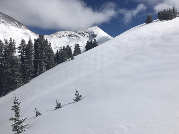
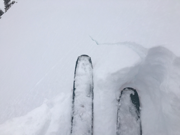
A new coat off snow has improved things greatly and good powder exists just below treeline or on more sheltered slopes above.
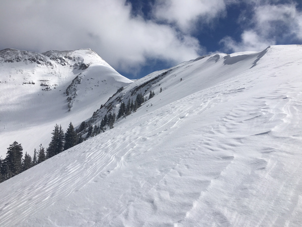
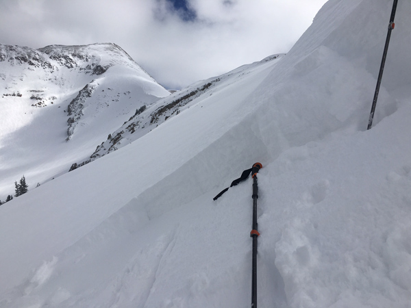
But go a little higher into more exposed terrain and it starts to look like this.
During the height of the storm on Monday night, numerous loose sluffs ran on N-E aspects in extreme, upper elevation terrain, on slopes greater than 40 degrees. In my travels yesterday, I did not observe any natural slab avalanche activity.