Join us at our 2nd Annual Blizzard Ball

Forecast for the Moab Area Mountains

Issued by Chris Benson on
Wednesday morning, February 24, 2021
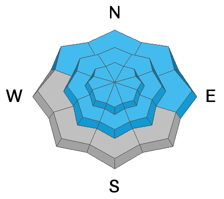
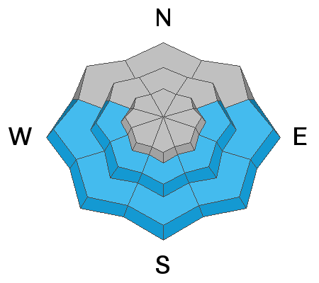
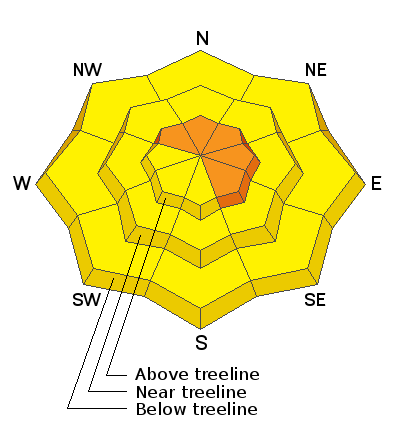
The avalanche danger remains CONSIDERABLE on slopes facing NW-NE-SE above treeline. In these areas, wind drifted snow has added stress to buried persistent weak layers, and deep and dangerous human-triggered avalanches remain likely. The avalanche danger is MODERATE near and below treeline and human-triggered avalanches remain possible. As the day heats up, be alert to signs of wet loose instability such as rollerballs. Stick to slopes under 30 degrees and avoid being underneath or adjacent to avalanche terrain.
Low
Moderate
Considerable
High
Extreme
Learn how to read the forecast here
Special Announcements
The Geyser Pass Road was plowed last week. 4x4 with good tires is recommended.
The Lower Utah Nordic Alliance (LUNA) last packed and rolled the lower meadow through Gold Basin on Thursday.
Weather and Snow
24 Hour Snow 0" 72 Hour Snow 0" Base Depth in Gold Basin 48" Wind 15-20 Temp 10 F
Today it will be sunny. Highs 35 to 45 F. Southwest winds 15 to 25 mph in the afternoon. A low pressure trough entering the area this evening will bring light to moderate NW winds but no precipitation to our area. Another storm is on the horizon for the upcoming weekend, although snow totals look to be quite modest.
Wind, temperature, humidity on Pre Laurel Peak (11,700')
Snotel site near Geyser Pass Trailhead (9600')
Storm totals at the Gold Basin study plot (10,000')
Snowpack Discussion
Warm temperatures and time have helped consolidate the snowpack, but weak layers are still present on many aspects and elevations. Yesterday's high at 10,000' was 38 degrees for the second day in a row, and all but the shadiest of aspects now have melt-freeze crusts. You can expect glopping and "fly-paper" conditions, so don't forget your wax! On Monday, while breaking trail in upper Gold Basin, I found supportive snow and did not experience cracking or whumpfing.
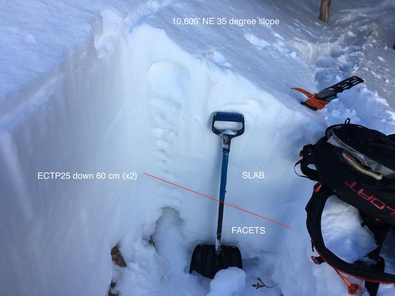
However, weak snow can be found in most areas, and is easily identified in snowpits or by probing with a ski pole. The snow we received last week has settled into a 1-3' slab that may disguise the buried weak layers underneath. In areas where this slab is thinner, you are more likely to trigger deep and dangerous avalanches. On a NE aspect near treeline, I observed poor snowpack structure and a somewhat stubborn slab. On a west aspect near treeline, Travis Nauman reported signs of a strengthening snowpack in this observation. By contrast, this observation from the Corkscrew Glades reports collapsing and whumpfing to be fairly widespread. The bottom line is that a weak, faceted snowpack is not going away anytime soon, and you can still trigger large and destructive avalanches that entrain the entire season's snowpack.
Recent Avalanches
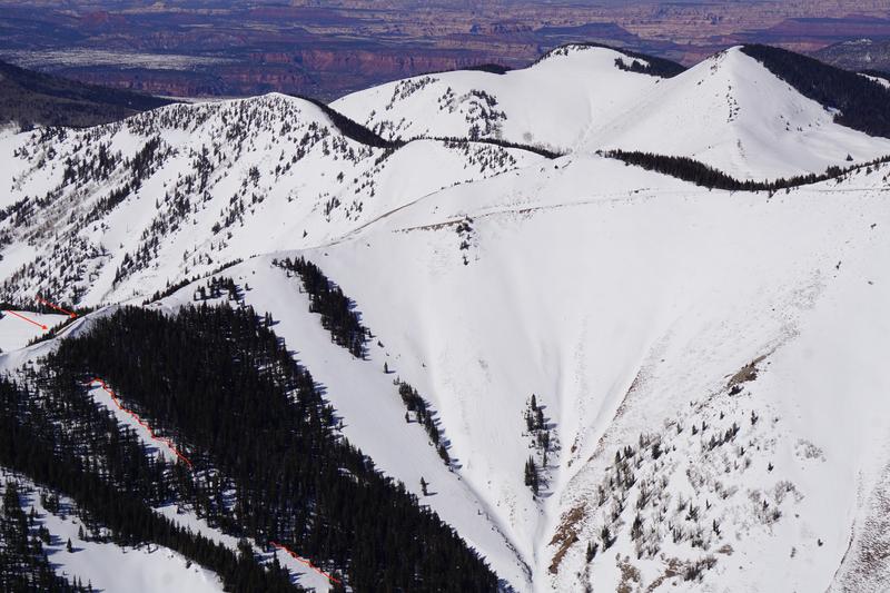
Yesterday in the Abajo Mountains, I observed this avalanche on a NE aspect at 10,800' near Abajo Peak. This avalanche probably occurred sometime after Feb. 13th. Evidence of wind loading from the SW is visible in the left portion of the photo. With the current poor snowpack structure, this means many steep slopes are hanging in balance just waiting for a human trigger. Remember to avoid steep slopes with the same aspect, elevation, and configuration as recent avalanches.
Ad
Avalanche Problem #1
Persistent Weak Layer
Type
Location
Likelihood
Size
Description
More than 2' of snow has fallen since Feb. 13th, adding significant stress to buried persistent weak layers of loose, sugary, faceted snow. The most dangerous areas are above treeline facing NW-N-SE. This structure is unusually hazardous this winter. Persistent weak layer problems are insidious, give overhead hazard a wide margin. Avoid being underneath avalanche terrain, and keep your slope angles under slopes 30 degrees to avoid this hard-to-predict avalanche problem.
Avalanche Problem #2
Wind Drifted Snow
Type
Location
Likelihood
Size
Description
SW-NW winds last week formed deposits of wind drifted snow, primarily in upper elevation, wind-exposed terrain. Pay particular attention to areas that have been cross-loaded. Although these slabs may be stubborn to trigger, they will likely break into deeper weak layers, and cause the entire season's snowpack to come crashing down. Wind drifts are recognizable by their smooth, rounded appearance, and they may sound or feel hollow underneath. Avoid steep slopes that have recent deposits of wind drifted snow.
Avalanche Problem #3
Wet Snow
Type
Location
Likelihood
Size
Description
We can expect to see small natural avalanches on east to south to west aspects where slopes are warming from intense solar radiation. Ridgetop winds should keep high-elevation slopes fairly cool, but be aware that some slopes could still be warming. Be alert to signs of wet loose instability such as rollerballs or pinwheels and stay away from slopes if they become wet.
Additional Information
Sadly, over the last week, several more avalanche accidents have occurred. Although our snowpack is not to be trusted, enjoyable riding conditions exists on low-angle slopes.
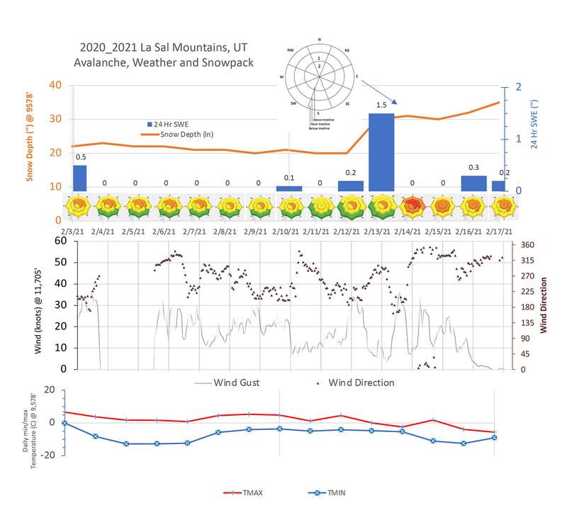
Here is a summary of data for the period between Feb 3 - 17. Note the single greatest loading event of the season with more than 15" of snow 1.5" Snow Water Equivalent (SWE) in a 12 hour period on Feb 13.
General Announcements
This forecast is from the U.S. Forest Service, which is solely responsible for its content. This forecast describes general avalanche conditions and local variations always occur.