Join us at our 2nd Annual Blizzard Ball

Forecast for the Moab Area Mountains

Eric Trenbeath
Issued by Eric Trenbeath on
Saturday morning, January 14, 2023
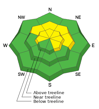
The avalanche danger is MODERATE and human triggered avalanches remain possible on steep slopes near and above treeline that face W-N-SE.

The greatest danger exists on steep slopes facing NW-N-NE-E where a combination of wind drifted snow and a buried persistent weak layer could produce deep and dangerous avalanches 2'-5' deep.

Travel advice: Continue to avoid steep, wind drifted slopes; slopes with steep convexities; thinner snowpack areas; and areas of steep, rocky, more radical terrain.
Low
Moderate
Considerable
High
Extreme
Learn how to read the forecast here
Special Announcements
Improve your avalanche awareness and rescue skills and sign up for our Backcountry 101 Class on January 20, 21.
Road Conditions: The road is plowed but areas of soft snow exist near the top. AWD and good tires recommended.
Grooming: All trails were groomed yesterday and conditions are excellent.
Weather and Snow
24 Hour Snow 0" 72 Hour Snow 0" Season Total Snow 138" Base Depth at Gold Basin 59"
Winds on Pre Laurel Peak SSE 20-25 G33 Temp 28F

Weather
Warm, cloudy, and breezy conditions will characterize the day as the next storm moves into the region. Snowfall should begin sometime tonight and continue through Sunday. Though the automated NWS point forecast is throwing out some impressive totals, I'm thinking 8"-12" seem a fair bet at this time. I'd be happy to be proven wrong! The storm train continues with another system on track for Monday night into Tuesday, and yet another weaker system later in the week.

General Conditions
At around 200% of normal for this time of year, coverage is excellent and a generally deep and strengthening snowpack can be found in most areas. Near treeline and below, the November persistent weak layer is deeply buried and difficult to affect, but in the wind zone, the overlying slab is thinner and there is a greater abundance of shallow, rocky trigger points. In these areas, the odds of triggering a slide on the persistent weak layer are greater. In addition, strong winds early in the week built stiff slabs of wind drifted snow on leeward slopes. Recognizable by their smooth, rounded appearance, a triggered wind slab could step down to the persistent weak layer causing a deeper and more dangerous avalanche.
In our travels on Thursday, we dipped our toes into avalanche terrain for the first time this season. We remained cautious and continued to avoid steep wind drifted slopes as well as slopes with convex features. We didn't jump into any chutes, and we avoided areas of steep, rocky, more radical terrain. Consider your slopes carefully as you begin to venture out. Things are starting to turn the corner, but it's not yet green light, and deep and dangerous avalanches remain possible.

Snowpack and Weather Data
Gold Basin Storm Stake (10,000')
Gold Basin SNOTEL site (10,000')
SNOTEL site near Geyser Pass Winter Trailhead (9600')
Wind Station on Pre-Laurel Peak (11,400')
NWS forecast for the La Sal Mountains.
Recent Avalanches
No new avalanches have been reported. Here is the La Sal Avalanche Database.
Ad
Avalanche Problem #1
Wind Drifted Snow
Type
Location
Likelihood
Size
Description
Strong southwest through northwest winds earlier in the week created stiff slabs of wind drifted snow on leeward slopes primarily on N-NW-E aspects. Crossloading has also occurred creating isolated drifts on the leewaard sides of terrain featuers such as gully walls and sub ridges on slopes facing W and SE. Recognizable by their smooth, rounded appearnce, stiff wind slabs may sound hollow underneath. Wind slabs have gained strength and will be more stubborn to release which means you may be further down the slope before they break above you. A triggered wind slab also has the potential to step down to the buried persistent weak layer causing a deeper and more dangerous avalanche. Avoid, steep, wind drifted slopes.
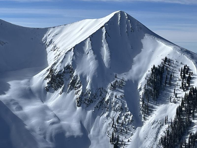
Photo illustrates "fat" areas of wind drifred snow on this steep, NE face. Continue to avoid this type of terrain.
Avalanche Problem #2
Persistent Weak Layer
Type
Location
Likelihood
Size
Description
The widespread persistent weak layer (PWL) that formed in November is showing signs of strengthening and stability tests continue to be less reactive. This means avalanches are becoming harder to trigger but the consequences remain the same. Any avalanche triggered on this deeply buried PWL would be large and unsurvivable. The greatest risk exists on steep, wind drifted, northerly aspects above treeline. As we start to think about easing into larger terrain, areas to avoid include slopes with steep convexities or blind break-overs; thin snowpack areas along slope margins or near rock outcrops; and areas of steep, rocky, more radical terrain.
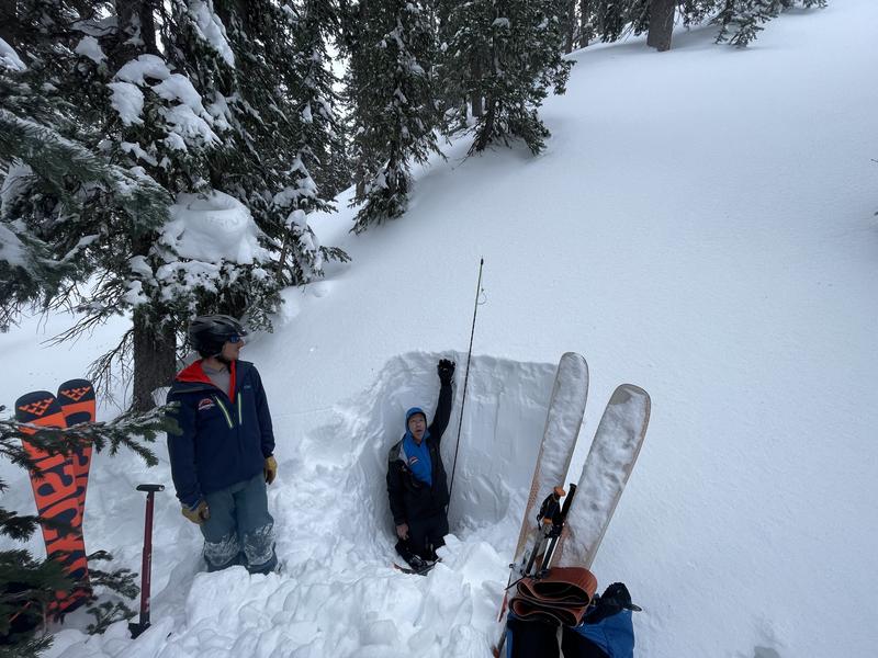
For more information on this check out Dave's fieldwork from Tuesday.
A deep and strenghthening snowpack exists in most areas near treeline and below. In these areas the November persistent weak layer is deeply buried and becoming harder to affect. Above treeline, snow depths are much more variable and trigger points are much more plentiful, and the problem can't be ruled out yet.
Additional Information
The Avalanche Beacon Training Park is up and running just above the Geyser Pass Traihead. It's right there and easy to use, so get some practice as you head up for your next tour.
General Announcements
This forecast is from the U.S.D.A. Forest Service, which is solely responsible for its content. This forecast describes general avalanche conditions and local variations always occur. This forecast will be updated by 7:30 tomorrow morning.