AVALANCHE WARNING!! Tap for info
UDOT PLANNED AVALANCHE CLOSURES!!

Forecast for the Moab Area Mountains

Eric Trenbeath
Issued by Eric Trenbeath on
Monday morning, January 13, 2025
A MODERATE avalanche danger exists on steep slopes facing W-N-E-SE where slabs of wind drifted snow exist over top of a buried persistent weak layer. In these areas, human triggered avalanches a foot deep or more are possible. An outlying possibility also exists for full depth avalanches failing on weak facets near the ground. Minimize this type of risk by avoiding thin slope margins and areas of very steep, rocky, radical terrain.

Most other terrain has LOW danger. Small avalanches involving thin slabs of wind drifted snow may be possible on isolated terrain features.
Many slopes have thin cover and rocks, stumps, and logs are lurking just beneath the surface.
Low
Moderate
Considerable
High
Extreme
Learn how to read the forecast here
Special Announcements
Geyser Pass Road: Surface is mainly snowpacked and icy. AWD with good tires required.
Grooming Conditions: Trails have not been groomed since Friday.
Weather and Snow
6 A.M. Snow and Weather Data
24 Hour Snow: 0" 72 Hour Snow: 2" Season Total Snow: 60" Depth at Gold Basin: 29"
Winds on Pre-Laurel Peak: SSE 5-8 Temp: 4° F Percent of Normal (SWE): 96%
Weather
A broad low pressure trough and cold northerly flow remains over the region. Like yesterday, this could continue to produce some mountain cloudiness and a slight chance for snow or it could be mostly sunny! Light southerly winds will shift to the NW and high temps will be in the mid teens. Tue-Fri looks cold, dry and sunny with a chance for snow on Saturday. A carrot appeared at the end of the model run stick this morning. It's too far out to put any stock in at this time, but keep the dream alive.
General Conditions
A couple inches of snow on Saturday helped freshen things up in select sheltered areas, but overall conditions aren't very good after last week's north wind event. Ryan Huels found some soft turns on a sheltered NW aspect where 3-4 inches had drifted in. Read his observation here. I took a trip around to the east side yesterday and found an assortment of wind affected surfaces lightly dusted over. Slabs of wind drifted snow formed several days ago are mostly stuck in place now, but there may be a few shallow, fresh drifts about. Our main concern lies in areas where slabs exist over top of a faceted weak layer. More on that below.
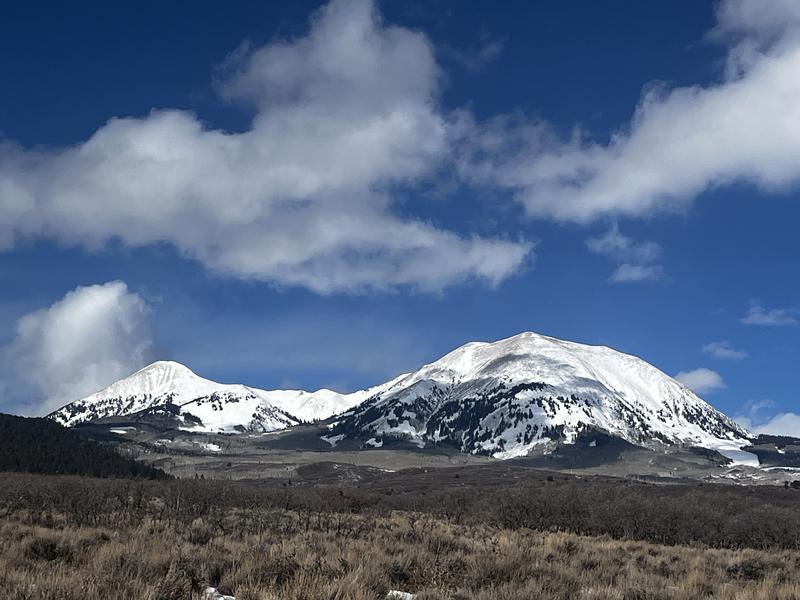
Conditions remain thin but at least the mountains look pretty! In some respects, we're lucky to be getting what we've got out of the predominant northerly storm track. South of here into AZ and NM they are far worse off.
Snowpack and Weather Data
Gold Basin SNOTEL site (10,000')
SNOTEL site near Geyser Pass Winter Trailhead (9600')
Wind Station on Pre-Laurel Peak (11,400')
NWS forecast for the La Sal Mountains.
Recent Avalanches
Ad
Avalanche Problem #1
Persistent Weak Layer
Type
Location
Likelihood
Size
Description
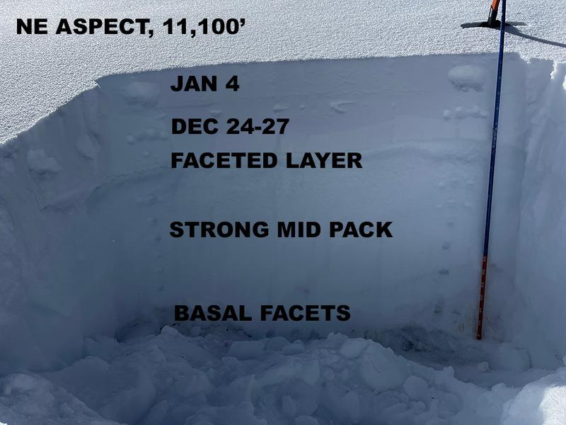
A persistent weak layer of faceted snow that formed during the December dry spell is our primary avalanche concern. This layer can be found about a foot below the surface on slopes facing W-N-E-SE. Near and above treeline, slabs of wind drifted snow have formed over top of this weak layer and this is where you are most likely to find trouble. Above treeline, however, northerly winds have created an erratic distribution of over-riding slabs, stripping and eroding snow off of many north and east aspects that are usually loaded. Cross-loading, however, is still a factor. This means you can be traveling through terrain that looks scoured and benign, and then suddenly find yourself on top of a hard slab with facets underneath. Suspect this scenario when the texture changes from rough and thin, to smooth, hard, and fat. Be alert to likely deposition zones such as gullies, depressions, and the leeward sides of terrain features. In these same areas, an outside chance lingers for avalanches to fail on weak facets near the ground. Avoiding extreme, rocky, slopes with a thin snowpack is the best way to mitigate this problem.
The snowpit below illiustrates the location of our current weak layers:
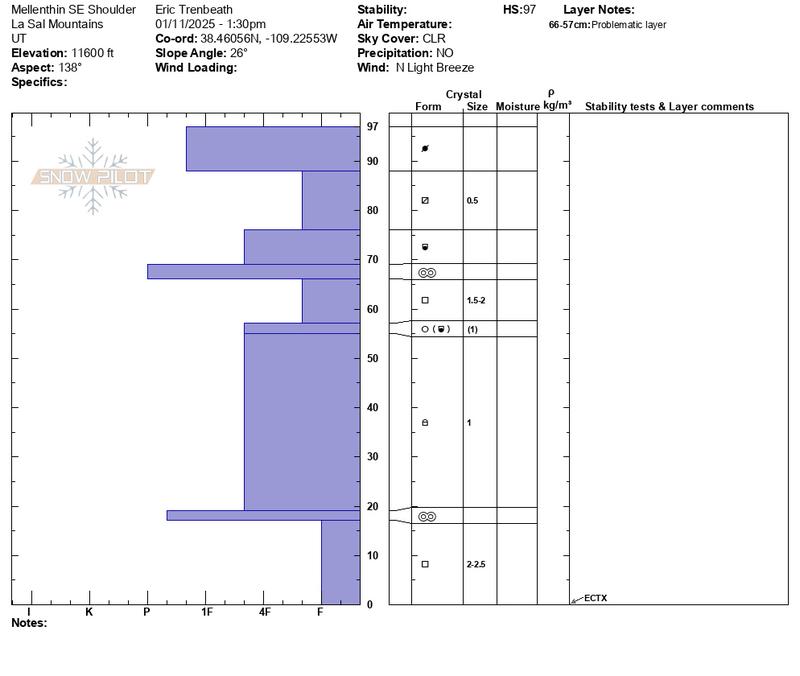
In our travels on Friday, Dave and I investigated a SE aspect at 11,600' where we continued to find the December drought layer as well as facets at the base of the snowpack. Stability tests produced no results but the adage that "structure trumps test results" keeps me leary of this kind of terrain. See the snowpit below.
Additional Information
Sign up for text alerts to get the most up to date information about changing conditions, road plowing, special avalanche announcements.
Follow us on Instagram @utavy_moab
General Announcements
This forecast is from the U.S.D.A. Forest Service, which is solely responsible for its content. This forecast describes general avalanche conditions and local variations always occur.