Donate Now to Our Year End Campaign!

Forecast for the Logan Area Mountains

Nikki Champion
Issued by Nikki Champion on
Friday morning, December 19, 2025

Avalanche danger is generally LOW this morning but will rise to MODERATE through the day as the incoming storm brings heavy, wet snowfall and strong winds above 8,000 feet. Below 8,000 feet, most precipitation will fall as rain.

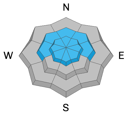
Heightened avalanche conditions will develop throughout the day on all upper-elevation slopes and on some mid-elevation aspects facing northwest through north to southeast, where strong winds will deposit heavy snow. Slab avalanches of fresh wind-drifted snow and larger avalanches failing on a persistent weak layer buried up to 2 feet deep are possible. Evaluate the snow and terrain carefully today.

Slopes below 7,000 feet are bare or have only very shallow snow cover.

Low
Moderate
Considerable
High
Extreme
Learn how to read the forecast here
Weather and Snow

This morning, temperatures have climbed to 37°F at the Tony Grove SNOTEL at 8,400 feet. Since yesterday afternoon, Tony Grove has picked up only 2 inches of new snow, most of it falling before sunset. On Logan Peak at 9,700 feet, it’s 31°F with west-southwest winds around 35 mph and gusts at the station topping out at 66 mph. At 9,500 feet on Paris Peak, it’s slightly cooler at 27°F, with strong west-southwest winds blowing 30 to 50 mph.

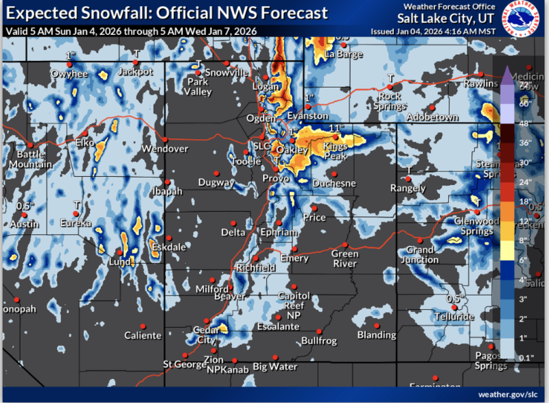
Snow is likely at upper elevations above 8,000 feet in the Logan Zone today, mainly after 11 AM. Expect 3 to 5 inches of dense new snow before sunset, with an additional 3 to 5 inches possible overnight. Temperatures will hover near 32°F, leaving some uncertainty around the rain-snow line. Most precipitation below 8,000 feet is expected to fall as rain. Winds will remain strong in the mountains, coming from the west-southwest.

Looking ahead, we stay in a warm, active pattern through Christmas. A short break is possible early next week, but temperatures remain warm for late December. Another storm around Christmas looks more wet than white down low.

Wednesday’s winds took a toll on both the snow surface and travel. While traveling in the backcountry yesterday, large downed trees were widespread, including along the Tony Grove Road and Copenhagen Basin Road. See photo below.

Recent Avalanches

No new avalanches have been reported locally since early December. For all observations and avalanche activity in the Logan Zone, go HERE

Avalanche Problem #1
Wind Drifted Snow
Type
Location
Likelihood
Size
Description

Through the afternoon, the new snow will accumulate at upper elevations and be drifted onto steep slopes by strong west winds. As this loading increases, avalanche danger will rise, and human-triggered soft slabs of wind-drifted snow will become possible. In many places, this new snow is drifting onto a supportable crust.

  • Even small avalanches can have serious consequences in shallow snow conditions, where a slide could drag you through rocks or downed trees below.
  • Stick to safe travel practices: travel with a partner and cross or ride steep slopes one at a time, while the rest of your group watches from a safe spot.

Watch for slopes that are actively loading or have a rounded, pillow-like appearance. Cracking under your feet, a hollow feel, or stiff, chalky snow are all signs of fresh wind drifts to avoid.

Avalanche Problem #2
Persistent Weak Layer
Type
Location
Likelihood
Size
Description

This incoming warm and wet event is building a slab on our thin snowpack. In the Central and Northern Bear River Range, weak, faceted snow from November is buried beneath last week’s thick surface crust and a layer of weakening heavy snow from early December. On steep, drifted slopes, especially where the rain crust is thin or absent, human-triggered avalanches are possible and could propagate widely across a slope.

Collapsing, indicated by shooting cracks or whumpfs, is a clear warning of unstable snow. Remotely triggered avalanches failing on a persistent weak layer are also possible.

While the weak layer is generally capped right now, additional loading from the heavy snowfall and strong winds will start to stress the faceted snowpack and tip the scales back toward instability. As the load increases, avalanche danger will rise.

Snowpit profile from the Emigration Summit Area - North Aspect - 8300'. You can see the stout crust near the surface, capping the weaker snow near the ground.

Additional Information

Are you interested in learning more about avalanches? Visit our education page for details on all our classes.

For more information, visit the UAC weather page here: UAC Weather Page For Logan-specific weather, go here: Logan Mountain Weather

-For all questions on forecasts, education, Know Before You Go, events, online purchases, or fundraising, call 801-365-5522.

-Remember, the information you provide could save lives, especially if you see or trigger an avalanche. To report an avalanche or submit an observation from the backcountry, go HERE

-Receive forecast region-specific text message alerts to receive messages about changing avalanche conditions, watches, and warnings. Sign up and update your preferences HERE

This forecast is from the U.S.D.A. Forest Service, which is solely responsible for its content. This forecast describes general avalanche conditions and local variations always occur.

General Announcements
This information does not apply to developed ski areas or highways where avalanche control is normally done. This forecast is from the U.S.D.A. Forest Service, which is solely responsible for its content. This forecast describes general avalanche conditions and local variations always occur.