Forecast for the Logan Area Mountains

Issued by Toby Weed on
Friday morning, April 3, 2020
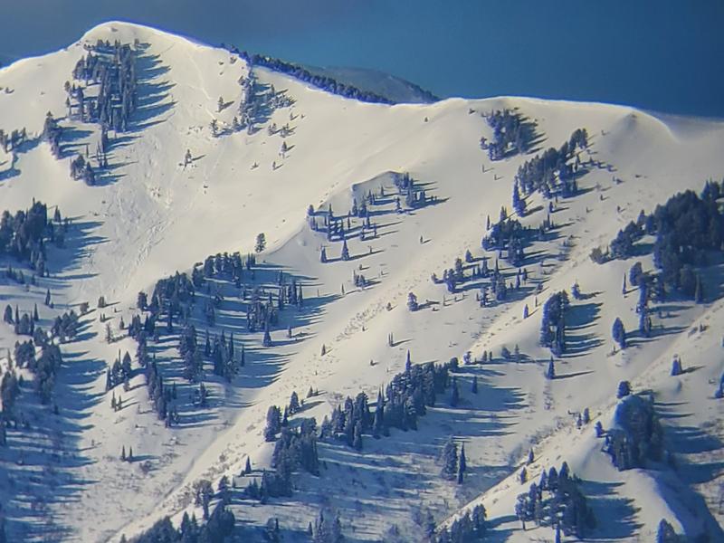
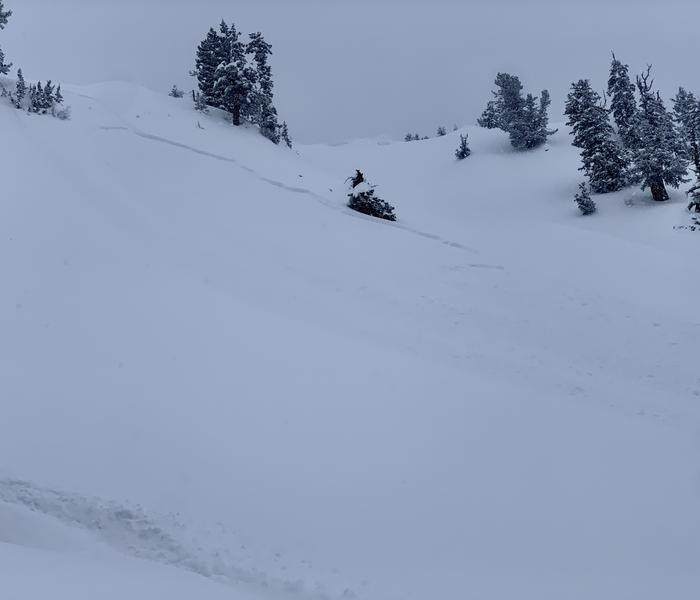
Heightened avalanche conditions exist on drifted upper elevation slopes in the Logan Zone. People could trigger 1 to 3 foot deep slab avalanches of wind drifted snow on steep slopes. Despite cooler temperatures the high angle April sun will be out, and loose wet avalanches may become possible in the middle of the day in steep sunny and lower elevation terrain.
- Evaluate snow and terrain carefully.

Low
Moderate
Considerable
High
Extreme
Learn how to read the forecast here
Special Announcements
Spring Awareness Campaign - Help us save lives through avalanche forecasts and education. Consider making a donation before April 8th.
Information on outdoor recreation - The State of Utah created this webpage with information about recreating on both state and federal public lands during the current health crisis.
January 5, 2019 - Read this collection of 6 stories and a podcast about that day with a low avalanche danger, 8 skier triggered avalanches, four catch and carries...a partial and critical burial, and a trip to the emergency room.
Weather and Snow
It's 12°F at the 8400' Tony Grove Snotel and about 3 inches of new snow with 0.2" Snow Water Equivalent fell in the last 24 hours, bringing the storm total to about 19 inches with 1.9" SWE. There is now 101 inches of total snow with 111% of normal SWE. It's 8°F at the 9700' CSI Logan Peak weather station, and southeast winds are currently blowing about 10 mph.
A couple more inches of new snow fell yesterday at upper elevations. Heightened avalanche conditions exist at upper elevations, and people could trigger soft slab avalanches of wind drifted snow. Much colder temperatures at lower elevations have formed a crust on the saturated new snow, which has increased stability. Wet avalanches are unlikely, but may become possible during the day in steep sunny terrain.
- Evaluate terrain carefully and continue to practice safe travel protocols to minimize your risk. Staying on slopes less than 30 degrees is the best way to avoid problems.
A warming and drying trend is expected through Saturday. Somewhat unsettled conditions will develop Sunday and continue into next week as a slow moving low pressure system crosses the region.
Expect mostly sunny conditions in the mountains today, with 8500' high temperatures around 33°F and light southeasterly winds becoming southwest and blowing 6 to 11 mph in the afternoon. It will be clear and low temperatures tonight are expected to be around 16°F with 11 to 17 mph southwest winds. Tomorrow will be sunny with high temperatures near 42°F and 13 to 15 mph southwest winds.
Recent Avalanches
Natural slab avalanches of wind drifted snow from Wednesday were observed yesterday in the Wellsville Mountain Wilderness and in the Central Bear River Range.

A recent natural avalanche in Shumway Canyon in the Wellsville Mountain Wilderness above Mendon.
Yesterday afternoon, a rider triggered and rode out of a soft slab avalanche in Bullen Basin, in upper White Pine Canyon. The avalanche of wind drifted snow on a 40 degree east facing slope at about 9300' was estimated to be 16" deep and about 80' wide.

Avalanche Problem #1
Wind Drifted Snow
Type

Location

Likelihood

Size

Description
Heightened avalanche conditions exist in drifted upper elevation terrain. People could trigger avalanches of wind drifted snow, with slabs ranging from 1 to 3 feet deep, on steep upper elevation slopes again today.
- Watch for cracking as a sign of instability.
- Avoid stiffer, recently drifted snow near the ridge tops, on corniced slopes, and in and around terrain features like sub-ridges, gullies, scoops, and cliff bands.
Avalanche Problem #2
Wet Snow
Type

Location

Likelihood

Size

Description
Nice cold temperatures have really helped, but the intense April sun will be out, and heightened conditions may develop for loose wet avalanches on steep sunny and lower elevation slopes. Rain on snow, heavy wet snowfall, and seasonal warmth have saturated the snow which is now insulated by a shallow coating of colder snow.
- Watch for unconsolidated snow, roller balls, pin-wheels, and natural sluffs as telltale signs of instability.
- If you or your machine starts sinking into saturated snow or if the snow where you are gets warm and slushy, you should move off of and out from under steep slopes.
Additional Information
Skiing and riding at closed ski resorts - Some resorts allow access now, and some do not. Please check HERE for the latest info on ski area access.
New to the backcountry (including riding at closed resorts) - Watch the award-winning, 15 minute Know Before You Go video, or take the 5-part, free online-learning series.
General Announcements
EMAIL ADVISORY. If you would like to get the daily advisory by email you subscribe HERE.
Remember your information can save lives. If you see anything we should know about, please help us out by submitting snow and avalanche observations....HERE. You can also call us at 801-524-5304, email by clicking HERE, or include #utavy in your tweet or Instagram.
This forecast is from the USDA Forest Service, which is solely responsible for its content. The forecast describes general avalanche conditions and local variations always occur.
We will update this forecast before about 7:30 tomorrow morning.