Forecast for the Logan Area Mountains

Sunday morning, April 15, 2018
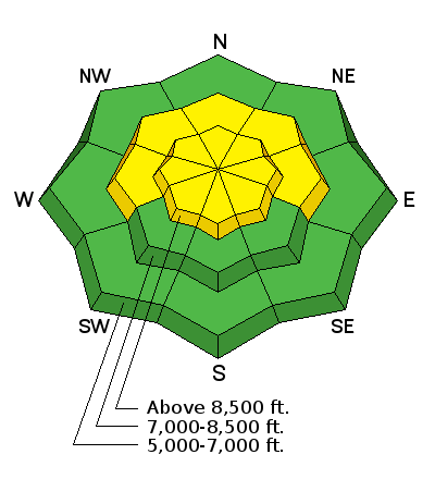
MODERATE: Heightened avalanche conditions exist in the backcountry. Despite mostly cloudy conditions, loose wet avalanches will become increasingly likely in steep terrain as the day warms.
- Avoid steep slopes with saturated surface snow.
- Stay off and out from under ridge-top cornices.
- Evaluate snow and terrain carefully.
 Special Announcements
This is the last regular advisory of the season, but stay tuned for updates through April.
Lift tickets for Snowbasin remaining. The tickets are discounted almost 50%. Details and order information here. All proceeds from these go towards paying for avalanche forecasting and education!
 Weather and Snow
You still might find some nice powder riding and skiing in sheltered, north facing terrain at upper elevations. Despite today's cloud cover, seasonal warmth will cause potential for loose wet avalanches entraining saturated snow.
- The Tony Grove Snotel at 8400' reports 30°F, and there is 75" of total snow with 96% of average SWE.
- The UDOT Hwy 89 Logan Summit weather station reports 24°F, and calm conditions.
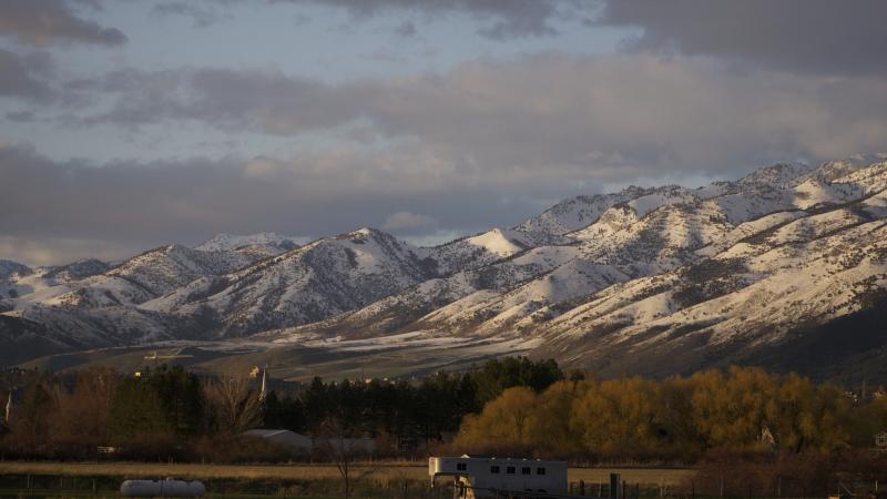
There is still plenty of snow up high, but getting there is an issue. Please do your best to limit resource damage. Stay on roads and avoid riding over bare ground, melted out meadows, and sage brush. It is possible to bring your trailer up the Tony Grove Road to the first overlook where you can park close to the retreating snow. There is still snow at the Beaver Creek and Sinks Winter THs...
 Recent Avalanches
Riders intentionally triggered a handful of small wind or storm slabs Friday in the Tony Grove Area. The new snow was not bonding too well to the underlying old snow, especially in drifted terrain and on very steep slopes. The storm snow is rapidly stabilizing this weekend, and wind slab avalanches are unlikely today, yet still a possibility.
Wet Snow
Description
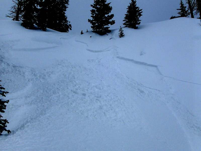
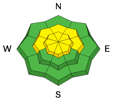
Seasonal warmth will cause heightened wet avalanche conditions in steep terrain. Natural and triggered loose wet avalanches (or sluffs) entraining saturated surface snow are possible and most likely during the heat of the day.
- Roller balls, pin-wheels and natural sluffs in steep terrain indicate potential for loose wet avalanches.
- Loose wet avalanches entraining moist or saturated surface snow could become large and unmanageable on long sustained slopes.
- Avoid being on or under steep slopes with saturated surface snow.
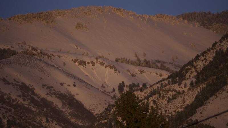
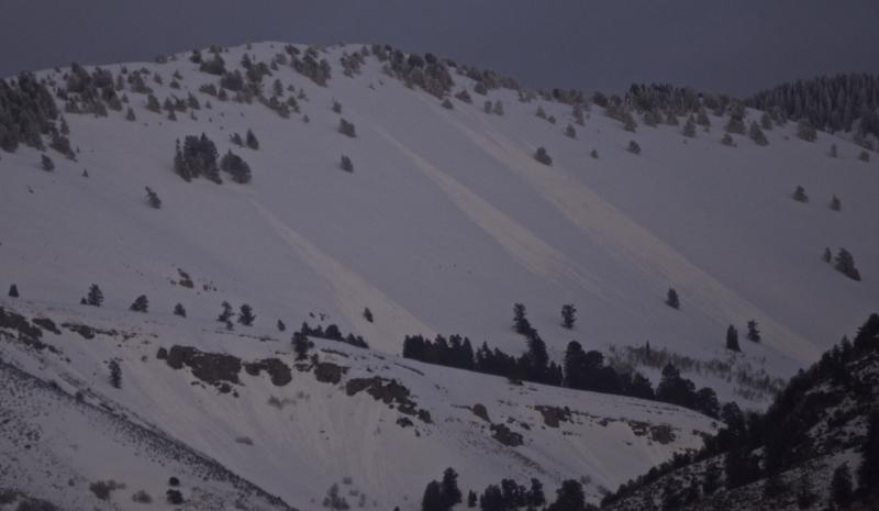
Watching the Folly in Logan Dry from town. In the first picture from Friday evening 4/13, there is a bit of wet surface activity visible on sunny mid elevation slopes. More activity is visible in the second, from around 7:30 pm yesterday, Saturday 4/14.
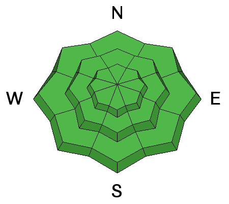
Normal Caution
Description
Use normal caution while traveling in the backcountry. Remember, all members of your party need to carry and practice with beacon, probe, and shovel. Continue to cross steep slopes and potential avalanche paths one-at-a-time, while the rest of the party watches from a safer place.
- Watch for and avoid drifted snow on the lee side of major ridges and in and around terrain features like gullies, scoops, sub-ridges, and rock outcrops.
- Avoid and stay out from under overhanging cornices, which might break further back than expected and could trigger avalanches on steep slopes below.
Additional Information
A spring storm will impact the region early in the week. The associated cold front will reach northwest Utah late tonight, then track across the area late Monday through early Tuesday. High pressure will return midweek, followed by the next storm system late in the week.
- Today: Mostly cloudy, with a high near 43. South southwest wind 11 to 17 mph.
- Tonight: Partly cloudy, with a low around 35. Windy, with a south wind 21 to 26 mph increasing to 29 to 34 mph after midnight. Winds could gust as high as 48 mph.
- Monday: A 50 percent chance of snow showers. Mostly cloudy, with a high near 42. Windy, with a west southwest wind 35 to 40 mph decreasing to 25 to 30 mph in the afternoon. Winds could gust as high as 55 mph. New snow accumulation of less than one inch possible.
General Announcements
Episode 7 of the UAC Podcast "Mastery and False Mastery - An Interview with 'Big' Don Sharaf" is live. With a snow career spanning over 30 years, Don has enough mileage in the mountains to have learned a thing or two, including the profound value of humility when staring into the face of the dragon. Listen in on our conversation about the idea of mastery and if such a thing can exist in the avalanche world. Check it out on the UAC blog, ITunes, Stitcher, or wherever you get your podcasts.
The UAC has new support programs with Outdoor Research and Darn Tough. Support the UAC through your daily shopping. When you shop at Smith's, or online at Outdoor Research, REI, Backcountry.com, Darn Tough, Patagonia, NRS, Amazon, eBay a portion of your purchase will be donated to the FUAC. See our Donate Page for more details on how you can support the UAC when you shop.
Benefit the Utah Avalanche Center when you buy or sell on eBay - set the Utah Avalanche Center as a favorite non-profit in your eBay account here and click on eBay gives when you buy or sell. You can choose to have your seller fees donated to the UAC, which doesn't cost you a penny Check it out on ITunes, Stitcher, the UAC blog, or wherever you get your podcasts.
Now is a great time to practice companion rescue techniques with your backcountry partners. Here's our rescue practice video.
EMAIL ADVISORY: If you would like to get the daily advisory by email you will need to subscribe here.
Remember your information can save lives. If you see anything we should know about, please help us out by submitting snow and avalanche observations. You can also call us at 801-524-5304, email by clicking HERE, or include #utavy in your Instagram.
This advisory is from the U.S.D.A. Forest Service, which is solely responsible for its content. This advisory describes general avalanche conditions and local variations always occur.


