31st Annual Backcountry Benefit - September 12th - Tickets Available Here!

Forecast for the Logan Area Mountains

Toby Weed
Issued by Toby Weed on
Saturday morning, April 1, 2023
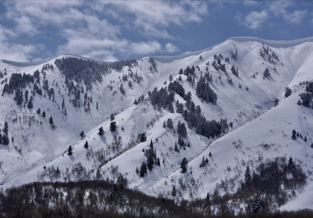
There is HIGH avalanche danger at all elevations in the backcountry. People should avoid being in avalanche terrain, and stay clear of avalanche runouts. Very dangerous conditions are found in drifted terrain and on slopes that received significant accumulations of new snow. As temperatures rise today, wet avalanches entraining big piles of heavy saturated new snow are likely at low elevations and on sunny slopes.
We advise that you stay off of and out from under slopes steeper than 30°
Low
Moderate
Considerable
High
Extreme
Learn how to read the forecast here
Avalanche Warning
Heavy snowfall and strong winds have created dangerous avalanche conditions in the backcountry. Both human triggered and natural avalanches are likely. Travel in avalanche terrain is not recommended. Stay off of and out from under slopes steeper than 30 degrees.
Weather and Snow
There is HIGH avalanche danger in the backcountry, and drifting snow from increasing westerly winds and solar warming will continue to elevate conditions today. Long running natural avalanches are likely. Large cornice falls are possible, and these or people are likely to trigger 2 to 4-foot thick and a few hundred-feet wide slab avalanches of wind drifted snow. With three feet of new snow, soft slab and loose avalanches of storm snow are likely on steep slopes at all elevations, even in sheltered terrain. Seasonal warmth, high angled sun and potential green-housing will elevate the danger of wet avalanches entraining big piles of moist new snow on steep lower elevation and sunny slopes.
The 8400' Tony Grove Snotel reports 13 inches of new snow from yesterday, bringing the storm total up to 34" with 3.8" SWE. It's 23° F and there is 160" of total snow. The wind is blowing from the southwest around 35 mph (with gusts close to 60 mph) at the top of Strawberry in Snowbasin. (CSI Logan Peak weather station stopped updating yesterday afternoon.)

Here is the NWS point forecast (36 hrs) for high elevations in the Central Bear River Range:
Today: A 40 percent chance of snow showers, mainly after 3pm. Increasing clouds, with a high near 34. Wind chill values as low as 8. Windy, with a west southwest wind 22 to 27 mph increasing to 29 to 34 mph in the afternoon. Winds could gust as high as 50 mph. Total daytime snow accumulation of less than one inch possible.
Tonight: Snow showers. Low around 19. Wind chill values as low as 7. Windy, with a west wind 28 to 33 mph decreasing to 18 to 23 mph after midnight. Winds could gust as high as 50 mph. Chance of precipitation is 80%. New snow accumulation of 3 to 5 inches possible.
Sunday: Snow. High near 29. Wind chill values as low as 5. Breezy, with a west southwest wind 18 to 22 mph. Chance of precipitation is 90%. New snow accumulation of 3 to 5 inches possible.

Unsettled, cold, and snowy weather will continue well into next week.
Recent Avalanches
  • Widespread natural (direct action) avalanche activity occurred during each of the last few storms in the Logan Zone, so I expect we'll see evidence of plenty of natural activity today.
  • A few natural wet loose avalanches occurred at lower elevations in Logan Canyon yesterday, including a couple that went into the Logan River below Temple Fork.
  • For a list of recent avalanches in the Logan Zone go HERE
  • There was lots of natural avalanche activity in the mountains of Northern Utah yesterday. Find a list of all recent observations & avalanches from across Utah HERE.
Ad
Avalanche Problem #1
Wind Drifted Snow
Type
Location
Likelihood
Size
Description
This morning, west winds continue to drift tons fresh snow into lee slope avalanche starting zones. If we were to go into upper elevation terrain we would find very dangerous conditions with huge sensitive cornices and deep freshly formed wind slabs.
  • Large natural cornice falls and 2' to 4' thick soft wind slabs are likely for people to trigger in windy terrain at upper and mid elevations.
  • Avoid corniced slopes and stiffer drifts on steep slopes near ridges and in and around terrain features like cliff bands, sub-ridges, mid-slope break-overs, and gully walls.
  • The overhanging cornices on the high ridges are huge this year, and recent storms have built them further out and made them unstable, so people should continue to stay well away and out from under them.
Avalanche Problem #2
New Snow
Type
Location
Likelihood
Size
Description
  • Soft slab and loose avalanches of storm snow are likely for people to trigger even in generally sheltered terrain on steep slopes where significant new snow accumulated.
  • Natural avalanches are most likely during periods of heavy snowfall or when significant drifting rapidly overloads a slope, but they could be triggered by cornice falls or tree bombs at any time.
Avalanche Problem #3
Wet Snow
Type
Location
Likelihood
Size
Description
  • Dangerous conditions are found at low elevations, especially in very steep northerly facing terrain including on shady forested slopes. ​​​​​​
  • Warm temperatures, very wet new snow, and a touch of rain elevated the danger of wet loose avalanches entraining large piles of moist snow.
  • High angle April sun and possible greenhousing could quickly moisten the new snow and rapidly increase potential for wet avalanches.
  • Wet avalanches could occur in unexpected places. We have seen numerous wet avalanches at low elevations this year even in places where we've not really seen any avalanches before.
Additional Information
Very large and long running natural avalanches occurred in the Wellsville Mountain Wilderness with the last storm. (N Hell Canyon, 3-25-23)
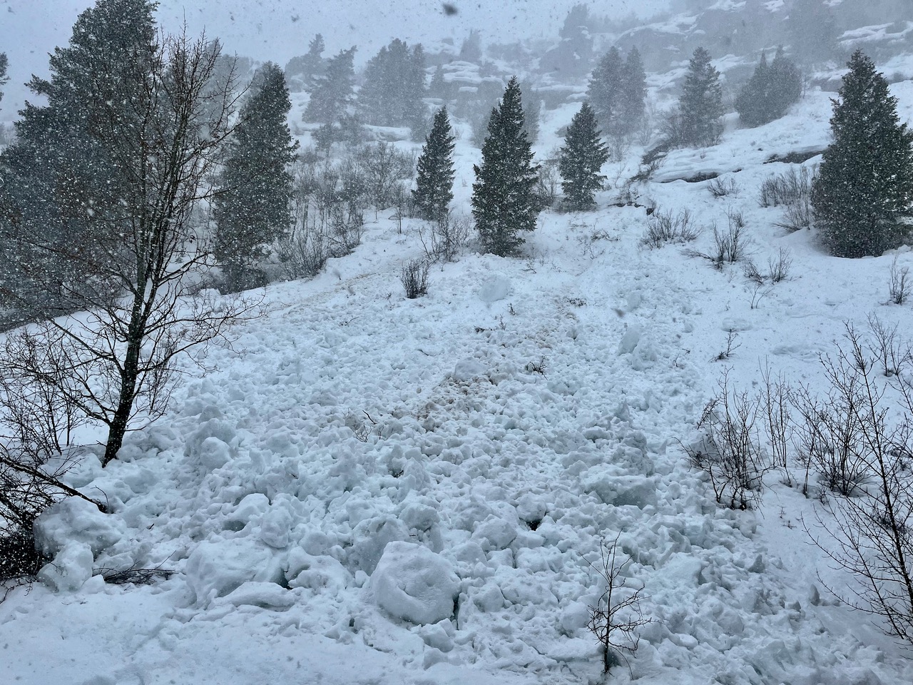
Wet avalanches like this natural one in Right Hand Fork will become more likely as temperatures warm up today.

Check out this recent video from KUTV:
General Announcements
  • Please submit your observations from the backcountry HERE.
  • For a list of avalanche classes from the Utah Avalanche Center go HERE
  • For information on where you can ride your sled or snow-bike, check out this map of the winter travel plan for the Logan and Ogden Ranger Districts HERE, and a close up of the Tony Grove and Franklin Basin Areas HERE.
This forecast is from the U.S.D.A. Forest Service, which is solely responsible for its content. This forecast describes general avalanche conditions and local variations always occur.