31st Annual Backcountry Benefit - September 12th - Tickets Available Here!

Forecast for the Logan Area Mountains

Toby Weed
Issued by Toby Weed on
Tuesday morning, March 28, 2023
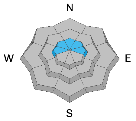
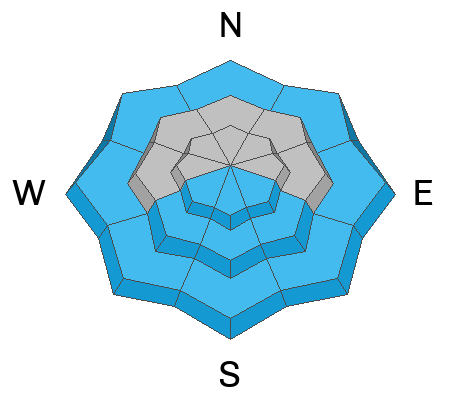
Avalanche conditions are dangerous and there is CONSIDERABLE danger in windy upper elevation terrain. People are likely to trigger large cornice falls, and/or 1 to 3-foot thick slab avalanches of wind drifted snow. Heightened conditions can be found at all elevations in the backcountry, and avalanches are possible on drifted slopes steeper than 30°. Strong late March sun will elevate potential for wet avalanches entraining big piles of moist snow at lower elevations and on sunny slopes. Safer conditions are found in sheltered terrain, in the meadows, and on lower angled slopes.

Make conservative decisions, evaluate snow and terrain carefully, avoid being on or below slopes with saturated snow, and stay well away from and out from under those big cornices.
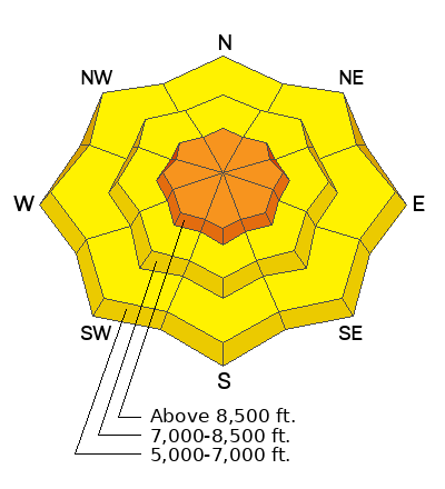
Low
Moderate
Considerable
High
Extreme
Learn how to read the forecast here
Special Announcements
  • Thank you to everyone who donated to our Spring Campaign. We appreciate your support and look forward to creating new tools to help you stay safe in the backcountry.
  • We are sorry to confirm an avalanche fatality yesterday in the Oquirrh mountains. UAC staff will be visiting the site today. Preliminary report is HERE, https://utahavalanchecenter.org/avalanche/77465
  • We are in the process of finalizing a report about the March 9th avalanche fatality in the Uintas. Thank you for your patience, and we will publish the final report in coming days.
Weather and Snow
We often think of wind slab avalanches as fairly small and only near ridgetops and terrain features, but some of our recent natural avalanches failed as very broad and well connected soft slabs on a weak layer. So, I suppose people could potentially trigger similar large avalanches still in drifted terrain. Expect significant influence of the high angled sun, and solar warming will elevate the danger of wet avalanches on sunny and low elevation slopes.

The 8400' Tony Grove Snotel reports 10° F and there is 141" of total snow. The wind picked up steam overnight and is blowing from the south around 35 mph (with gusts close to 50 mph) at the 9700' CSI Logan Peak weather station.

Here is the NWS point forecast (36 hrs) for high elevations in the Central Bear River Range:
Today: Partly sunny, with a high near 33. Wind chill values as low as 1. South wind 11 to 14 mph.
Tonight: Mostly cloudy, with a low around 18. Wind chill values as low as 8. South southeast wind around 14 mph.
Wednesday: Snow likely, mainly after noon. Mostly cloudy, with a high near 35. Breezy, with a south wind 16 to 22 mph, with gusts as high as 33 mph. Chance of precipitation is 60%. New snow accumulation of 2 to 4 inches possible.
Heavy snowfall can be expected Wednesday night, and unsettled, cold, and snowy weather will last through the remainder of the week and the coming weekend.
Recent Avalanches
  • On Saturday, I went up to Maple Bench and checked out several very large and long running natural avalanches that occurred in the Wellsville Range overnight, (3-24/3-25). The very broad ~3' deep soft slab avalanches ran the full width and length of several the classic large avalanche paths and crashed down onto Maple Bench, southwest of Mendon. (see photos in "additional info" below)
  • A skier reports intentionally triggering a two-and-a-half foot deep soft slab avalanche on a northeast facing slope at around 8000' in elevation in the Emigrant Summit Area. report HERE
  • An observer noticed a fresh skier or rider triggered avalanche at low elevations near the Backside parking spot. report is HERE
  • For a list of recent avalanches in the Logan Zone go HERE
  • It was a bit more active in the Wasatch Range in the last few days due to wind drifted snow. Find a list of all recent observations & avalanches from across Utah HERE.
Ad
Avalanche Problem #1
Wind Drifted Snow
Type
Location
Likelihood
Size
Description
This morning south winds are increasing significantly at upper elevations, and they continue to drift the fresh snow into avalanche starting zones. Expect to find sensitive huge cornices and freshly formed wind slabs in drifted upper elevation terrain. Avalanches of wind drifted snow are possible on drifted slopes at all elevations, but conditions are less dangerous in sheltered terrain and where the powder is not affected by the wind.
  • Large cornice falls and/or 2' to 3' thick wind slabs are likely for people to trigger in windy terrain at upper elevations.
  • Avoid corniced slopes and stiffer drifts on steep slopes near ridges and in and around terrain features like cliff bands, sub-ridges, mid-slope break-overs, and gully walls.
  • The overhanging cornices on the high ridges are huge this year, and recent storms have built them further out and made them unstable, so people should continue to stay well away and out from under them.
Avalanche Problem #2
Wet Snow
Type
Location
Likelihood
Size
Description
​​​​​​Avalanches of wet snow are possible in sunny terrain at all elevations including on low elevation slopes.
  • The intense high angle sun is expected to be out today, and solar warming could cause a rapid rise in danger of wet loose avalanches entraining large piles of moist new snow.
  • The snow on lower elevation slopes is quite a bit deeper than it normally is this time of year, especially on shady forested slopes. This means avalanches may be possible in unexpected places. We have seen numerous wet avalanches at low elevation this year in places where we've not seen any avalanches before...
Additional Information
Watch this Video...https://www.youtube.com/watch?v=w_Kn8UrKT2Q..
A natural avalanche dusted riders with a dust cloud at Sundance Yesterday. The avalanche stopped well before it came into the area, but the dust cloud continued for hundreds of yards.
Here is a look at a broad crown off Pleasant View Point in the Wellsville Range, where widespread large natural avalanches occurred Friday night.
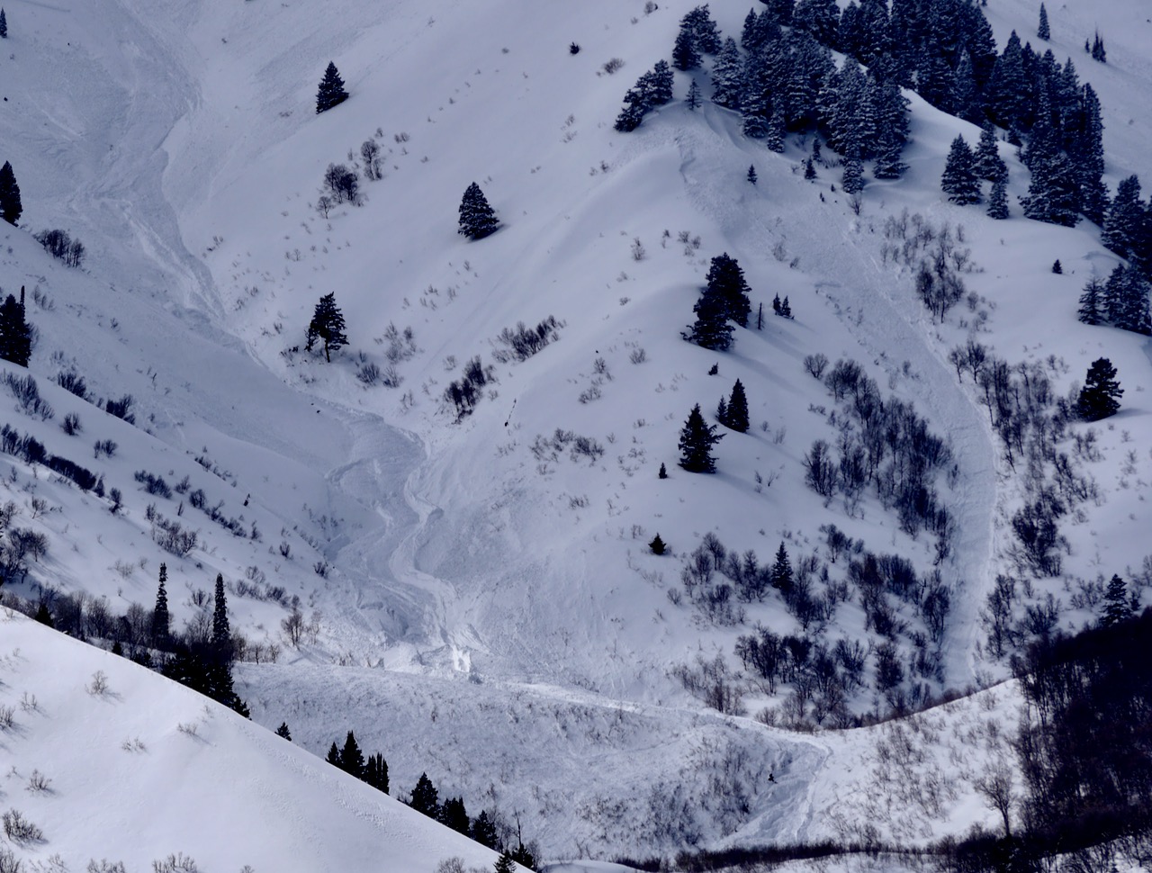
Here is a view of the runout of the monster natural avalanche the roared out of Hell Canyon Friday night.
General Announcements
  • Please submit your observations from the backcountry HERE.
  • For a list of avalanche classes from the Utah Avalanche Center go HERE
  • For information on where you can ride your sled or snow-bike, check out this map of the winter travel plan for the Logan and Ogden Ranger Districts HERE, and a close up of the Tony Grove and Franklin Basin Areas HERE.
This forecast is from the U.S.D.A. Forest Service, which is solely responsible for its content. This forecast describes general avalanche conditions and local variations always occur.