Sign Up for the Utah Snow and Avalanche Workshop (USAW) on December 7th!

Forecast for the Logan Area Mountains

Toby Weed
Issued by Toby Weed on
Thursday morning, February 18, 2021
VERY DANGEROUS AVALANCHE CONDITIONS EXIST.
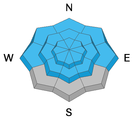
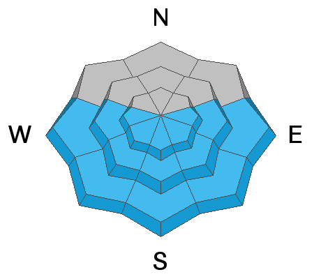
There is HIGH avalanche danger on mid and upper elevation slopes in the backcountry today. Large natural avalanches are possible as the sun rapidly warms slopes with significant accumulations of storm snow. People should not venture into any steep avalanche prone terrain today because very dangerous human triggered avalanches are likely.
  • AVOID ALL AVALANCHE TERRAIN INCLUDING TRAVEL ON OR BELOW SLOPES STEEPER THAN ABOUT 30 DEGREES.
Low
Moderate
Considerable
High
Extreme
Learn how to read the forecast here
Special Avalanche Bulletin
Conditions are perfect for avalanche accidents. Heavy snowfall and drifting from strong winds have overloaded an exceptionally weak snowpack leading to extremely dangerous avalanche conditions.
All the fresh Utah powder will likely lure people into dangerous avalanche terrain, and people are likely to trigger deadly avalanches. A brief break in the weather will allow the avalanche danger to drop slightly; however, people can still trigger large and deadly avalanches if they venture onto steep slopes.
  • Avalanches triggered by people could be extremely large, very dangerous, unexpected, and deadly.
  • The Utah Avalanche Center recommends people avoid travel on or underneath slopes steeper than about 30 degrees in the backcountry for the next several days.
  • .Even if you are experienced and have the proper avalanche safety equipment, you should still avoid all steep slopes in the backcountry.
Special Announcements
The UAC in Logan is offering a Youth BC 101 avalanche class for youth aged 16-20 on Feb 21. For more info and to register, click HERE
Weather and Snow
The 8400" Tony Grove Snotel reports 2.7" SWE in the last 72 hours. It's currently 10°F and there is 83 inches of total snow and back up to 83% of normal SWE. West-northwest winds are blowing around 10 mph this morning at the 9700' CSI Logan Peak weather station.
With widespread layers of preexisting very weak faceted snow, the significant increase in load has created very dangerous avalanche conditions on many slopes in the backcountry.

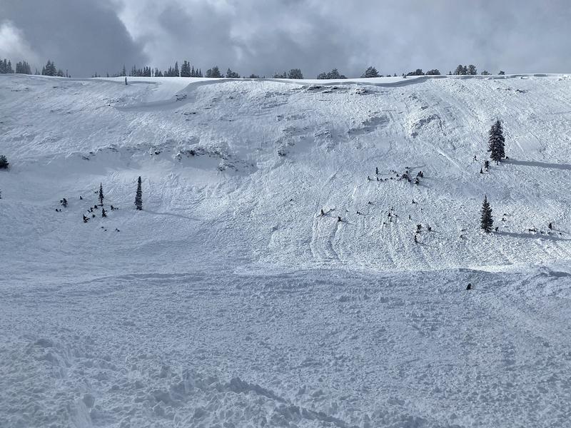
We went up to Wood Camp yesterday afternoon to check out a huge natural avalanche that was reported yesterday morning.
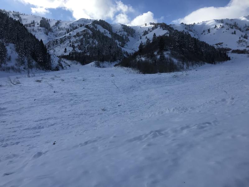
On Sunday we checked out a large remotely triggered avalanche in Bunch Grass Canyon...
It will be partly sunny in the mountains today, with pretty good visibility for viewing the recent widespread natural avalanche activity. High temperatures at 8500' today will be around 16°F, with moderate west winds and wind chill values as low as -9°F. Another decent shot of winter storminess is expected, stating tonight and lasting through Friday into Saturday, with a foot or more of accumulation likely to accumulate at upper elevations in the Logan Zone.
Recent Avalanches
Clearing yesterday revealed a significant natural cycle occurred across the Logan Zone, with many huge avalanches having occurred late in the storm, (Tuesday night----early Wednesday morning). Very large natural HS avalanches were widespread, with reports of big avalanches in the Wellsville Mountain and Mount Naomi Wildernesses, in Wood Camp, and the Bloomington Lake Area above Bear Lake. The list of recent natural activity is sure to grow today.

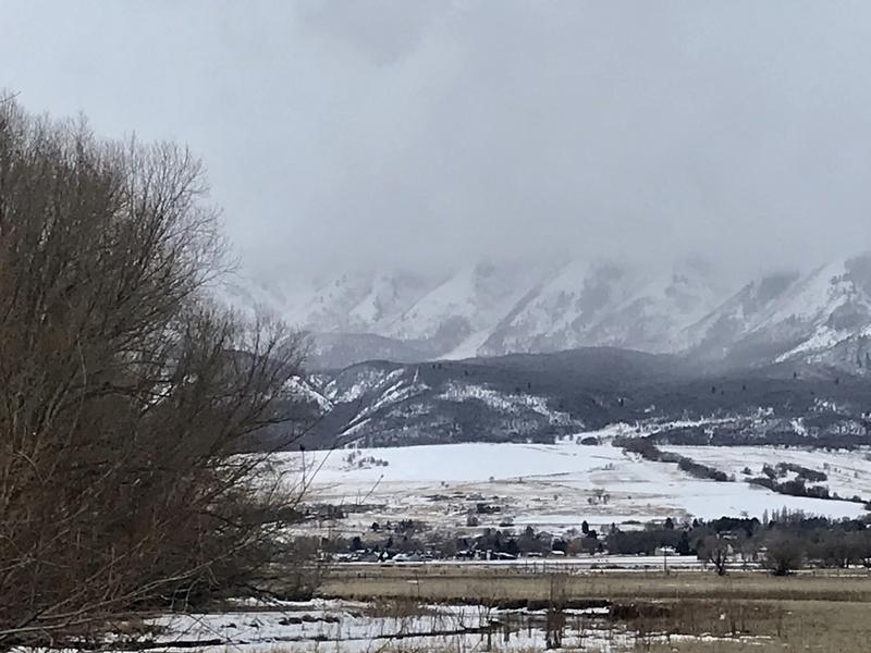
Tuesda, we could see evidence of large and long running natural avalanches in the Wellsville Range above Mendon. Some of these appear to have run at least 2500 vertical feet. A stand out in Old Logway Canyon hit Maple Bench, depositing a multi-acre debris pile that is visible from across Cache Valley.

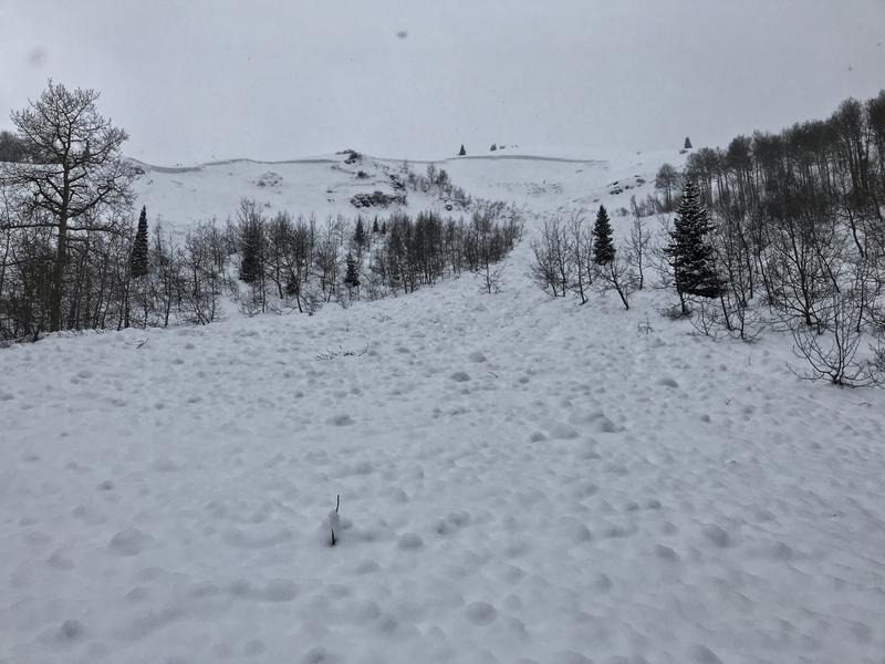
Saturday (2-13-2021), a party of local backcountry skiers remotely triggered a large avalanche in "the Gut" of White Pine Knob above the yurt in the popular Bunch Grass Canyon. The 4' deep and about 500' wide avalanche occurred on a southeast facing slope at around 8900' in elevation. The slope angle at the crown was in the lower 30° range, but the slope rolls to 40 degrees in the Gut itself, and the hard slab was well connected, pulling out even on the lower angled slope above and on each side of the steep section.
Ad
Avalanche Problem #1
Persistent Weak Layer
Type
Location
Likelihood
Size
Description
Heavy snowfall and westerly winds added significant weight to slopes that were already near the tipping point. Buried persistent weak layers consisting of sugary faceted snow are widespread across the Logan Zone, and the threat of large and deadly avalanches failing on weak snow near the ground is quite real. Avalanches are likely where a slab of more cohesive wind drifted snow formed on top of the weak snow.
  • Avalanches failing on a buried persistent weak layer might be triggered remotely, from a distance, or worse from below!
  • Cracking and collapsing of the snow are a red flag, indicating unstable snow conditions.
Avalanche Problem #2
Wind Drifted Snow
Type
Location
Likelihood
Size
Description
Avoid travel on or below all steep drifted slopes... Avalanches of wind drifted snow are likely where drifts formed on slopes with buried persistent weak layers.
Avalanche Problem #3
Wet Snow
Type
Location
Likelihood
Size
Description
Large natural slab and loose wet avalanches are possible as the sun rapidly warms slopes with significant accumulations of storm snow. Avoid travel on or under steep slopes with moist or saturated fresh surface snow.
Additional Information
Do you have the essential avalanche rescue gear (transceiver, probe, and shovel) and do you know how to use them? Watch this video to see how the three pieces of equipment work together. HERE
Please keep practicing with the Beacon Training Park at the Franklin Basin Trailhead. Test yourself and your riding partners. It is free, fun, and easy to use.
General Announcements
Thanks to the generous support of our local resorts, Ski Utah, and Backcountry, discount lift tickets are now available. Support the UAC while you ski at the resorts this season. Tickets are available here.
Visit this website with information about Responsible Winter Recreation by the Utah Office of Outdoor Recreation.
EMAIL ADVISORY. If you would like to get the daily advisory by email you subscribe HERE.
Remember your information can save lives. If you see anything we should know about, please help us out by submitting snow and avalanche observations....HERE. You can also call us at 801-524-5304, email by clicking HERE, or include #utavy in your tweet or Instagram.
I will update this forecast by around 7:30 tomorrow morning.
This forecast is from the USDA Forest Service, which is solely responsible for its content. The forecast describes general avalanche conditions and local variations always occur.