Join us for the 17th Annual Professional Snow and Avalanche Workshop (PROSAW) on November 4 - Purchase tickets here!

Forecast for the Logan Area Mountains

Toby Weed
Issued by Toby Weed on
Friday morning, December 29, 2023
The snow is stable in the backcountry, and the avalanche danger is LOW.
As usual, active situational awareness and normal caution are recommended for wintertime mountain travel.
Low
Moderate
Considerable
High
Extreme
Learn how to read the forecast here
Special Announcements
To fulfill our mission, the UAC relies on our amazing backcountry community. Your support helps pay for the daily avalanche forecast, free awareness presentations across the state, and new tools like the new Avalanche and Observation Explorer. As the end of the year approaches, please consider
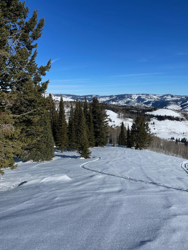
 donating to the UAC.
Weather and Snow
If you venture into the backcountry today, you will enjoy nice sunny weather and easy traveling conditions with stable, generally supportable snow. The surface consists of crusty snow in sunny terrain, wind-jacked snow in high exposed terrain, and shallow, fast, recrystallized "loud powder" and glistening feathers of surface hoar on select sheltered slopes facing the northern half of the compass.
The Tony Grove Snotel at 8400' reports 33° F and 41” of total snow. Light winds are blowing from the west-southwest (around 10 mph) at the 9700' CSI Logan Peak weather station.

Dry conditions, with haze in the valleys and nice, mild, and mostly sunny weather in the mountains will continue through the remainder of 2023 and into the new year. There is no sign of a significant winter storm in sight for at least the first several days of 2024.
Read the most updated forecast discussion from our partners at the National Weather Service for Southern Idaho HERE, and for Northern Utah HERE.
Recent Avalanches
Other than Tuesday's report of a previous small natural avalanche near Millville Peak, no other avalanches were reported recently in the Logan Zone.
Check out all local observations and avalanches HERE.
Ad
Avalanche Problem #1
Normal Caution
Type
Location
Likelihood
Size
Description
You may find small avalanches in isolated areas where it might be possible to trigger wind-drifted snow close to ridgelines; or dry loose avalanches on steep shady aspects as the snow surface weakens.
Up high on slopes facing west, north, and east, triggering a dangerous avalanche failing on a persistent weak layer is unlikely. Still, the potential is not to be forgotten if you venture into isolated, steep, rocky terrain with shallow snow and poor snow structure where a thick slab of heavy snow from early December overlies weak, sugary snow from November. If you sink through soft, sugary snow to the ground when you get off your sled or if you can stick your ski pole to the bottom, you should avoid slopes steeper than 30°.

Even though the avalanche danger is LOW, always follow safe backcountry travel protocols when traveling on or under slopes steeper than 30°
  • Be sure everyone in your party has working avalanche rescue equipment, including a transceiver, probe, and shovel. Practice with this equipment regularly, and include and instruct new partners
  • Cross avalanche paths and runout zones one person at a time, with the rest of the party watching from a safe place
  • Reevaluate and be willing to change your plans if you encounter any signs of instability, like recent avalanches, audible collapses (whumpfs), or cracking in drifted snow.
Additional Information
In many areas, the snow on and just under the surface is quite weak, consisting of sugary, near-surface facets, and in many places, it's capped by feathers of surface hoar. If this weak snow was buried today, it would become a problem persistent weak layer, but no new snow snow is in sight, and warm temperatures and wind have a good chance of destroying it before it's buried.
Dave Kelly found easy traveling in a few inches of sugary snow and surface hoar capping supportable snow in the Central Bear River Range on Wednesday.

Two new weather stations are found in the Logan Zone this season. The Paris Peak Weather Station (available HERE) and the Card Canyon Weather Station (available HERE)
General Announcements
  • For all questions on forecasts, education, KBYG, events, online purchases, or fundraising: call 801-365-5522.
  • To report an avalanche or submit an observation from the backcountry: go HERE
  • Read Mark's blog about electromagnetic interference of avalanche transceivers HERE.
    We will update this forecast tomorrow before 7:30 AM.

    This forecast is from the U.S.D.A. Forest Service, which is solely responsible for its content. This forecast describes general avalanche conditions, and local variations always occur.