Join us for the 17th Annual Professional Snow and Avalanche Workshop (PROSAW) on November 4 - Purchase tickets here!

Forecast for the Logan Area Mountains

Dave Kelly
Issued by Dave Kelly on
Monday morning, December 25, 2023
The avalanche danger is LOW at all elevations and aspects where human triggered avalanches are unlikely. Look for and avoid isolated areas of wind-drifted snow near ridgetops in the highest elevation terrain.
Low
Moderate
Considerable
High
Extreme
Learn how to read the forecast here
Special Announcements
To fulfill our mission, the UAC relies on our amazing backcountry community. Your support helps pay for the daily avalanche forecast, free awareness presentations across the state, and new tools like the new Avalanche and Observation Explorer. As the end of the year approaches, please consider donating to the UAC.
Weather and Snow
Merry Christmas, while Santa didn't deliver any new snow overnight, he has brought cold temperatures and clear skies.

Currently, the Tony Grove Snotel at 8400' has 43" of total snow, with overnight temperatures in the single digits °F. The CSI Logan Peak weather station at 9700' had overnight temperatures in the low teens ° F and winds blowing from the west-northwest 24 MPH with gusts up to 33 MPH. The temperature is 5°F at the new Card Canyon weather station, with 33.9" of total snow on the ground. The new Paris Peak weather station in Southern Idaho is reporting overnight temperatures in the teens °F with winds blowing from the north 26 gusting to 29 MPH. Wind chills throughout the region are well below 0 °F and Peter Sinks is holding steady at -40°F/C (the temperature where Celsius and Fahrenheit are the same).

For today, winds will blow from the west-northwest 15-20MPH gusting to 25MPH at the highest ridgelines. Wind speeds are forecast to decrease throughout the day. Skies will be clear with temperatures 15-22°F. No new snow is expected today.

Earlier this week we found stable and variable snow conditions near Garden City Bowls and in the Bunchgrass Area. Even with warm temperatures and high pressure, we found surface hoar and sugary surface snow (consisting of near-surface facets) on shaded east-facing terrain. Dig down below the new snow to see if these crystals are under the newest snow as they are a sensitive weak layer when buried.
Recent Avalanches
No recent avalanches were reported in the Logan Zone. In the mountains south of Logan, backcountry travelers reported natural shallow wind-drifted snow avalanches running in steep terrain above treeline and I would expect the same could be found in the Logan area mountains.
  • Local observations are available HERE.
  • Visit our avalanche page to check out this season’s activity across Utah.
Ad
Avalanche Problem #1
Wind Drifted Snow
Type
Location
Likelihood
Size
Description
You may see small wind-drifted snow avalanches isolated to ridgetops above treeline, to avoid this problem look for and avoid pillowy round wind deposited snow near ridgetops and in gullies. These wind-drifted avalanches could be up to 6-12" deep.
Avalanche Problem #2
Normal Caution
Type
Location
Likelihood
Size
Description
We have an older December Persistent Weak Layer (PWL) that is buried 4-8" off the ground and while it has been a while since we have seen natural avalanche activity on this layer the very nature of this PWL is that any additional weight could be enough to tip the scales. While I don't think that the most recent 2-3" of new snow and wind is enough to trigger this now dormant weak layer, I don't trust it and the best advice I can give is to follow good backcountry protocols when traveling on terrain where this PWL is buried. Greg and Nikki had a forecaster discussion about this buried PWL layer the other day that applies to the Logan Zone. Check it out HERE.
  • Always follow safe backcountry travel protocols when traveling on or under slopes steeper than about 30°
  • Be sure everyone in your party has working avalanche rescue equipment, including a transceiver, probe, and shovel. Practice with this equipment regularly, and include and instruct new partners
  • Cross avalanche paths and runout zones one person at a time, with the rest of the party watching from a safe place
  • Reevaluate and be willing to change your plans if you encounter apparent signs of instability
  • Up high on slopes facing west, north, and east, triggering a dangerous avalanche failing on a persistent weak layer is unlikely but remains possible in isolated outlying terrain where a thick hard slab of heavy snow from early December overlies weak, sugary snow from November
Additional Information

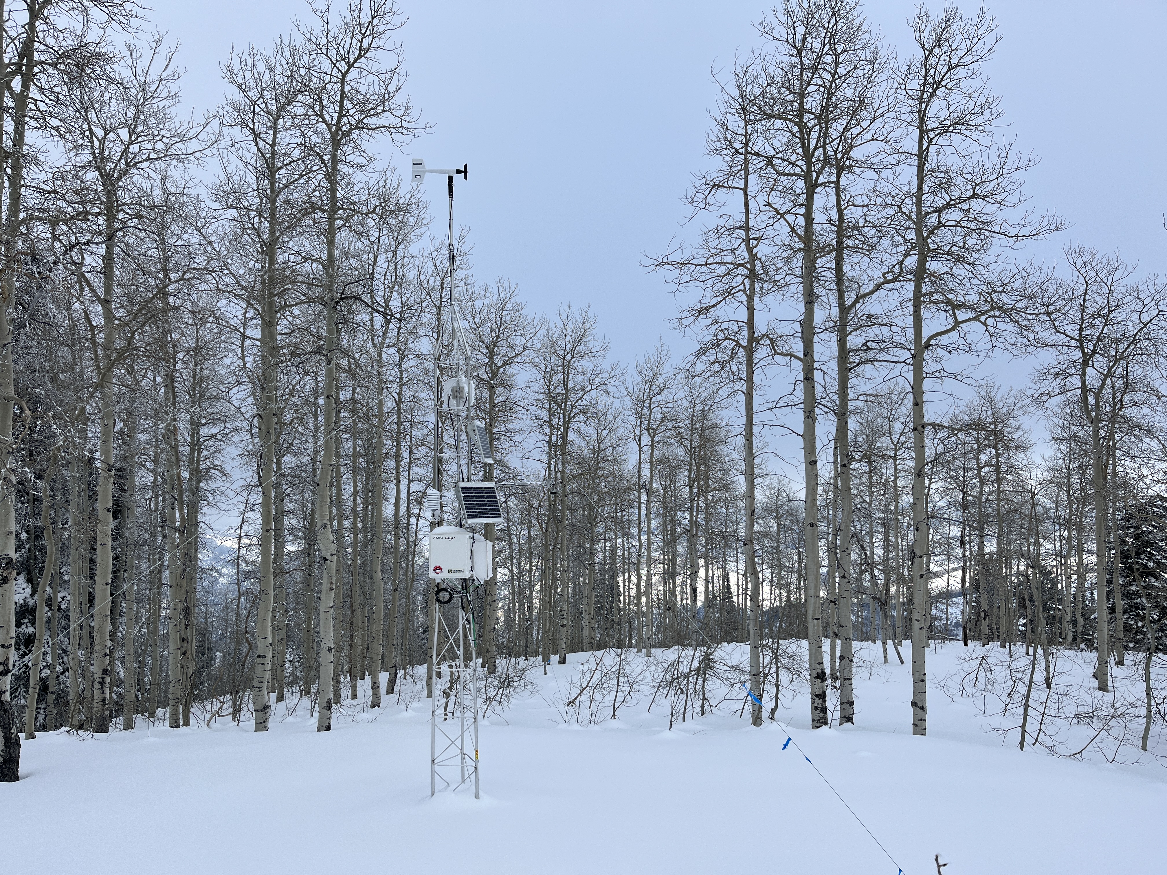
This fall, we installed two new weather stations in the Logan Zone. The Paris Peak Weather Station (available HERE) and the Card Canyon Weather Station (available HERE)
The Card Canyon weather station at 8700' on Red Pine Ridge.
General Announcements
  • Taking time to check your companion rescue gear and practice with your transceiver is essential. Watch a short video here.
  • IMPORTANT: Read Mark's blog about electromagnetic interference of avalanche transceivers HERE.
  • We will update this forecast tomorrow morning before 7:30 AM.
This forecast is from the U.S.D.A. Forest Service, which is solely responsible for its content. This forecast describes general avalanche conditions, and local variations always occur.