Forecast for the Logan Area Mountains

Toby Weed
Issued by Toby Weed for
Monday, December 10, 2018
MODERATE: Heightened avalanche conditions exist on shady upper elevation slopes with deeply buried weak sugary or faceted snow. Dangerous human triggered avalanches failing on a persistent weak layer near the ground remain possible. Drifting from southwest winds will create heightened wind slab avalanche conditions in exposed terrain. Elsewhere the snow is much more stable, the avalanche danger LOW, and you can find nice snow and good coverage.
  • Evaluate snow and terrain carefully, use safe travel protocols.
I will update this advisory on Wednesday morning.
Low
Moderate
Considerable
High
Extreme
Learn how to read the forecast here
Special Announcements
Check out the new free online avalanche course series developed by the Utah Avalanche Center. This is a great way to refresh your skills or prepare you for a Backcountry 101 or Level 1 class. HERE
Weather and Snow
You can find nice snow and good coverage for this time of year in the Logan Zone, but heightened avalanche conditions remain on upper elevation slopes with poor snow structure. Although becoming less likely with time, dangerous human triggered avalanches 1 to 3 feet deep remain possible. High pressure weather conditions are bad for future stability and weak layers are developing within and on the surface of the shallow snow currently on the ground.
At midnight the Tony Grove Snotel at 8400' reported 25º F and 32"of total snow, containing 102% of average SWE for the date. A southwest wind is blowing 15 to 20 mph this morning on James Peak
Southwesterly winds will increase in the mountains today ahead of a weak storm system which will cross the area late tonight into tomorrow morning. A stronger and colder storm system will impact the area Wednesday. Expect partly sunny conditions in the mountains today, with high temperatures at 8500' around 33º F and 10 to 15 mph southwest wind. Tonight will be mostly cloudy with a chance for some snow and low temperature around 14º F and 9 to 14 mph south-southwest wind, veering from the west after midnight. Some snow is possible in the morning, but it'll become partly sunny tomorrow, with a high temperature around 26º F and 11 to 13 mph west wind. Wednesday's system has cold air and good dynamics with it, but it will be moving through rapidly, which will keep snow amounts from being too great. 2 to 4 inches of accumulation is possible during the day.
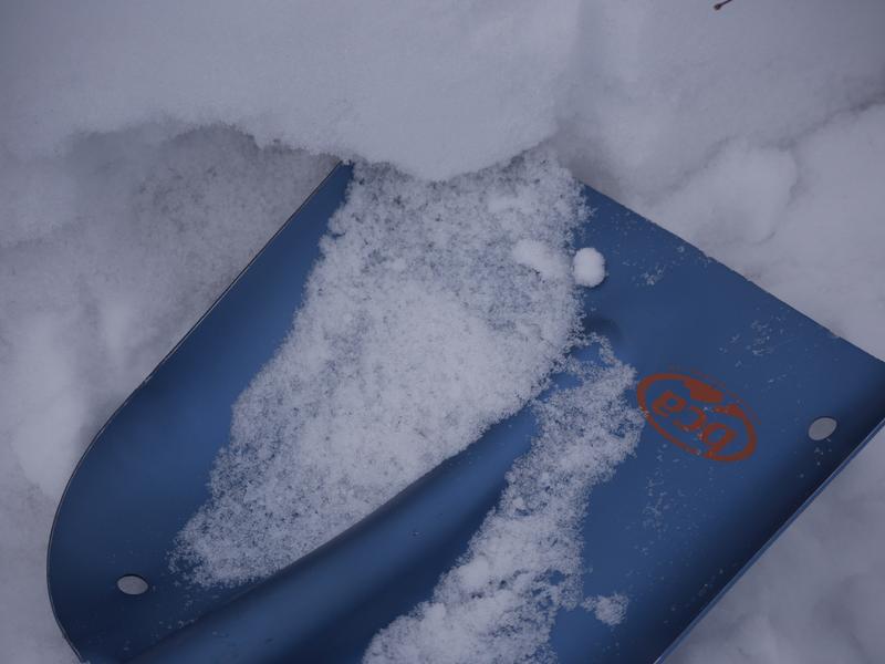
Powder Mountain's snow safety team found well developed surface hoar feathers or frost crystals on the snow surface yesterday. Surface hoar can become a tricky persistent weak layer if buried intact.
Recent Avalanches
  • Whumpfs or audible collapses at upper elevations continue to be reported by observers, but no new avalanches have occurred in the Logan Zone recently.
  • A skier was caught, carried, and injured in an avalanche Saturday in Porter Fork in the central Wasatch Range in the mountains above Salt Lake City. Report is HERE
Ad
Avalanche Problem #1
Persistent Weak Layer
Type
Location
Likelihood
Size
Description
Dangerous avalanches failing on a deeply buried persistent weak layer are becoming less likely to trigger, but they remain possible.
  • The sugary weak snow near the ground is fairly shallow in the Logan Zone, so potential avalanches will probably be on smooth upper elevation slopes or in pockets between rocky anchors and terrain features.
  • Collapsing and cracking indicate that the snow is unstable.
Shallow but loose and weak faceted snow lurks under the Thanksgiving slab. (Bedground Bowl 12/6/18)
Avalanche Problem #2
Wind Drifted Snow
Type
Location
Likelihood
Size
Description
Increasing southwest winds today could drift snow into steep lee slopes and you could trigger shallow wind slab avalanches on exposed upper elevation slopes.
  • Even small avalanches can be very dangerous with shallow, early season snow cover. You could get dragged through rocks or deadfall if you get caught and carried.
  • As always, avoid recently drifted snow in steep terrain.
General Announcements
Remember, before it opens on December 12, Beaver Mountain is backcountry. Hikers and dogs are welcome, but please no motorized use...
Now is a great time to practice companion rescue techniques with your backcountry partners. Here is our practice video.
If you would like to get the daily advisory by email you subscribe HERE.
Support the UAC through your daily shopping. When you shop at Smith's, or online at REI, Backcountry.com, Patagonia, NRS, Amazon, eBay by clicking on these links, they donate a portion of your purchase to the UAC. If you sell on eBay, you can have your See our Donate Page for more details on how you can support the UAC when you shop.
Benefit the Utah Avalanche Center when you buy or sell on ebay - set the Utah Avalanche Center as a favorite non-profit in your ebay account HERE and click on ebay gives when you buy or sell. You can choose to have your seller fees donated to the UAC, which doesn't cost you a penny.
Remember your information can save lives. If you see anything we should know about, please help us out by submitting snow and avalanche observations. HERE You can call us at 801-524-5304, email by clicking HERE, or include #utavy in your Instagram.
This advisory is from the U.S.D.A. Forest Service, which is solely responsible for its content. This advisory describes general avalanche conditions and local variations always occur.